August 12 - 16, 2019
I had to wait a couple of weeks for the weather forecast to turn favorable, so was happy to finally hit the highway on Monday morning. My intention was to return to some of my favorite SW Colorado mountains to get aerial photos and videos, especially those interesting old mine structures on Red Mountain. I will include the photos here, but the video will come later.
Part 1: Silverton Area
Remember you can click any image to see a larger version.
For spherical panoramas: click to activate (if necessary), click and drag mouse to change orientation, click the full-screen icon at upper right for the best experience.
Monday, August 12th.
Durango
A few miles outside of Durango, on the ridge west of the highway was evidence of the
large forest fire that ravaged the area last year. I don't know how far it reached to the west, but they kept it away from the highway for the most part. Also, the fire was stopped before it reached Purgatory Ski Resort. I'm sure the wildfire was devastating for many locals, but very little issue for those of us just passing through.
Silverton
I had researched the times the Durango Silverton Railroad would arrive/depart its northern terminus. I'd also spied a likely vantage on Google Maps where I could fly and get video. I got to the spot with only a few minutes to spare, so was a bit rushed to get the Mavic 2 Pro set up, in the air, and the microSD card formatted. I felt I got some great footage. [However, once home to review the video I discovered I had not properly started recording and thus missed the oncoming train. The only video I got was after I thought I'd stopped recording - the caboose disappearing and me landing. Sigh.]
I did get this aerial photo of town:
 |
| Silverton, Colorado and the Animas River |
South Mineral Creek
This beautiful valley has gotten more and more crowded through the years, but I was hopeful that early on a Monday afternoon I'd be able to find a campsite. You are permitted to camp either at the National Forest campground at the end of the gravel road, or one of the designated camping areas, or at a wide spot in the road (not good for a camper like mine, but several allow access to gorgeous tent sites away from the dusty road.)
Official USFS South Mineral website.
 |
| South Mineral Creek - looking downstream toward Silverton. |
I found a nice site in the trees in the Golden Horn dispersed camping area which is about 2/3rds of the way to the end of the gravel road. There were already a couple large motorhomes, a good sized trailer, and a few tent campers set up. But on my last visit the camping area was filled to the gills.
There seemed to be lots of bugs at my chosen site, so walked around the area talking to a few other campers. I met an interesting couple who had been full-timing in a 1984 VW Westphalia. They were parked in a prime spot not far from the creek. We spoke for quite a while and their site didn't seem to have many flying bugs, so I asked if they'd mind if I moved down near their site - I'd only stay overnight. They happily agreed.
 |
| My campsite |
Made a rude discovery once I set up camp. The water in my camper tank had gone funky. I'd checked the function of the water pump before leaving home and didn't detect anything wrong, but the water coming out now was stinky. This is the first time in the 7 seasons I've been camping to have this problem. I normally bring along separate gallon jugs of drinking water as the well water I have at home, and use in the tank, is not the sweetest. So this wasn't an emergency. This time I'd also brought a gallon of tap water "just in case". I guess this was the "in case." Silverton is only two miles from the highway junction, so I'd head to town tomorrow and buy some bleach to add to my camper tank.
Tuesday, August 13th
South Mineral Creek (continued)
Had coffee with my neighbors and enjoyed the morning views. Other campers were out walking along the river and stopping to say hello.
 |
| A realistic view of many of the campers in the Golden Horn camping area, and the gorgeous scenery. |
Clear Lake
I wanted to take the jeep trail up to Clear Lake and get some aerial views up there. I had driven up once before when returning from my
Solar Eclipse trip in 2017.
The views from the road as it climbs the mountain side are breath taking.
 |
| View from the road of the valley from which South Mineral Creek originates. |
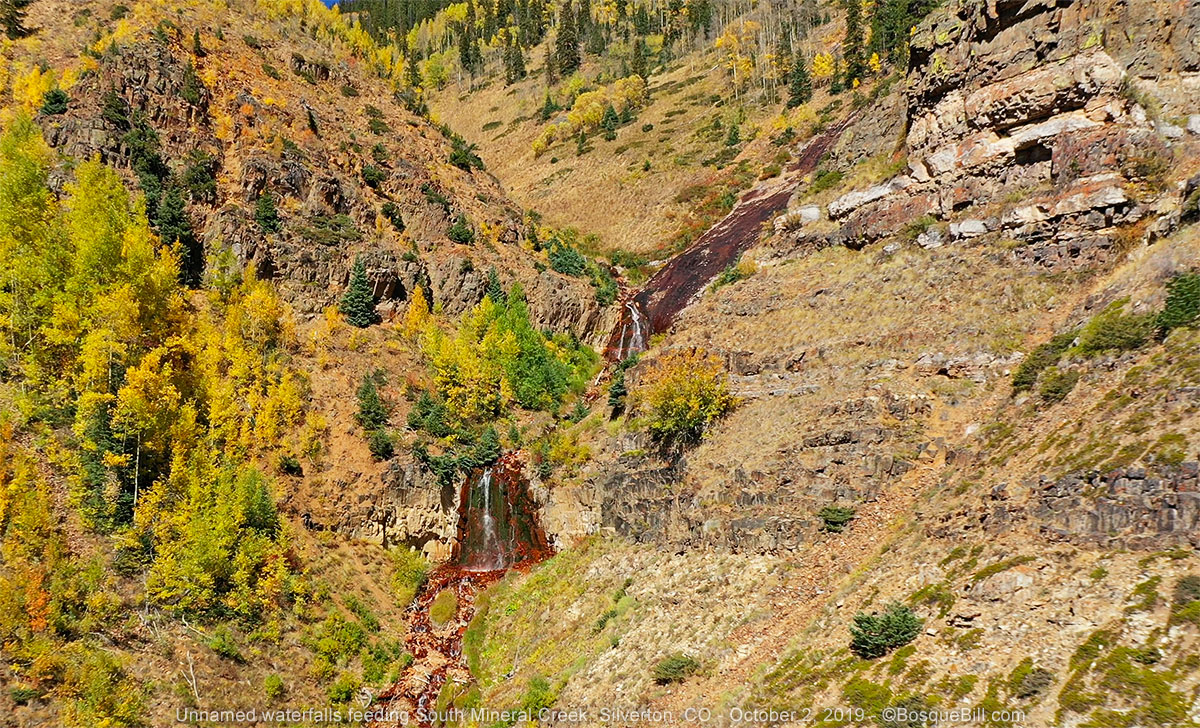
I stopped at the waterfall where I'd gotten photos last time. There was noticeably more water flowing this season.
 |
| Nice little waterfall at a switchback before the steep climb |
The road near the top seemed much rougher than my one previous visit. There were a couple switchbacks that still had snow banks in the middle of August! One was particularly challenging - I had to back around to get a favorable angle and even in 4 wheel low barely made it up with my wheels slipping.
 |
| Clear Creek near the top. (Not the same waterfall as the above photo.) |
 |
This is a small pond below Clear Lake (Clear Pond? LOL) and the road to the lake. See the snow?
This was actually taken on my way out, looking toward the valley. |
 |
| I saw a marmot last time, too, along Clear Creek. |
The view was worth it! And the road didn't seem to stop the many Jeeps and pickups that also made it up. I got some nice video and photos.
 |
| Aerial view of Clear Lake and surrounding peaks. |
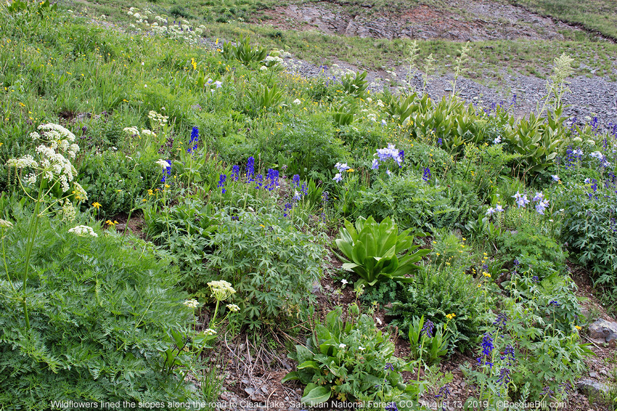
On the way back down I paused to photograph just a few of the many wildflowers that were blooming on the slopes beside the road.
South Mineral Creek Redux
After descending I stopped to fly along South Mineral Creek to capture the beautiful scenes. Clouds were starting to build.
 |
| Looking toward the west up South Mineral Creek. |
Silverton Redux
I drove into and through Silverton. I stopped at the town park at the far end of town to get some aerial shots, then found the market.
 |
| Aerial view of Silverton from above the park at the eastern side of town. |
I bought a bottle of laundry bleach and added about a cup to my water tank. I'd let that slosh around for the rest of the trip to disinfect the tank. [The funky smell was gone by the time I camped; instead a strong chlorine smell, not surprisingly. I have flushed the tank twice now I'm home and it's ready for the next trip.]
Before leaving town I checked my watch and noticed I had time to get to the location where I'd taken video of the scenic railroad train the day before. It was starting to sprinkle a little from a dark cloud overhead by the time the trail came by, so used my phone to get video instead of putting up the drone. I did get a good recording this time, though from a terrestrial perspective. Here is a screen shot for your pleasure.
 |
| Screen capture of iPhone video of Silverton-Durango train leaving Silverton. |
I'd noticed an old mine building farther down the road when I was reconnoitering the best spot for train photos. I drove back there. The "rain" had stopped, so I flew around the old mine to get some aerials.
 |
| Champion Mine near the Animas River just west & south of Silverton. |
Red Mountain
I headed back north on US-550. Before the ascent to the pass stands some sort of mine building in very good condition. It's apparently in the highway right-of-way and there is a No Trespassing sign citing it is "Property of the Colorado Department of Transportation." There is what could be mine detritus behind it. I got aerials of it and the surrounding scenery. Research once home indicates this area was the site of the Chattanooga mine and town.
 |
| Mine structure near the Chattanooga mining town site. |
 |
| Aerial view of Mill Creek canyon as US-550 begins its ascent up to Red Mountain Pass. |
 |
| From same location as above, a view back along the highway to Silverton. |
In 2013 I'd explored the old mines on Red Mountain using the route in my Funtreks Colorado 4WD Trails book. Naturally I forgot to bring the book along on this trip.
I felt I mostly remembered how to get to the Red Mountain Mining District and navigate to the mines. I was mostly right ;-) I ended up in an area below the Yankee Girl mine, but that was OK as I can fly! I then wandered the dirt roads until I got up to the mine level.
From there I drove up to the Genessee Mine for more aerials.
The road that I was sure would lead to those mines farther south along the mountain was cordoned off with orange traffic cones. I'm guessing the road was closed due to a slide or some such. Oh well, I'd just head back to the highway where I'd entered. I was confident I could then find where the south end of the road joined US-550 as I'd come out that way previously. I would drive in from that junction and complete my mine tour.
 |
| Looking west from Genessee toward the working Idarado Mine and US-550 |
On the way out I took the road I should have on the way in and thus discovered the Cora Bell Mine.
At the highway I turned south (one of the many backtracks I'd take during this trip.) I found the correct junction and headed back into the mining district. As I'd remembered there was a well preserved mine not far off the highway. I stopped and got aerials of the Longfellow Mine.
 |
| Longfellow Mine. |
If memory served, the next mine would be mostly tailings. I didn't remember seeing much in the way of buildings last time I was there. In fact looking back at my published photos I didn't even include that site. As I drove north along this backroad I kept my eye open for possible campsites. As long as I avoided the areas immediately next to the mines, most of the remaining land was national forest where it would be legal to camp.
After driving a few miles along this increasingly deteriorating road, I gave up finding the next mine and turned around to find a campsite instead. I found a very nice site off a spur. There were actually two sites there, a shady spot among the trees that wasn't very level and a level spot for the camper a bit higher and with a better view (and fewer mosquitos). I set up camp, then retired to my chair to enjoy that view.
 |
| Aerial view of my campsite. The mountains to the west were my view from the site, but the sun was not favorable for photos. |
Wednesday, August 14th
Red Mountain (continued)
On the way out I stopped again at the Longfellow Mine to capture the scene in the beautiful morning light.
 |
| Longfellow Mine still has the hoist engine on site. |
I had also decided to further backtrack to South Mineral Creek to see if I could get better photos as the afternoon light the day before hadn't been ideal and the clouds had shadowed some of the mountain sides.
South Mineral Creek Redux
Of course by the time I got there about 10:30 clouds were beginning to form. Still I was able to get images of the red-sided mountain I was most interested in free from shadows.
 |
| South Mineral Creek and the mountain with the red cliffs I like so much. I'm sure it has a name, but not that I've found on any maps even though the USGS too puts the peak at over 12,500 ft. |
 |
| Same view from in the sky. Note also the Gold Bar dispersed camping area. |
Ouray
Once again north on US-550, but the scenery is so gorgeous I didn't mind seeing it multiple times. Every time I'd driven into Ouray I'd noticed the sign for the
USFS Amphitheater Campground. This time I stopped to check it out.
It's a pretty, little campground with 35 sites mostly for small vehicles or tents. Reservations are available, but there are also some sites set aside for "first come." At noon this day, there were sites available.
After checking it out, I returned to the day-use picnic area just before the campground where I had lunch and took a few photos of the town and surrounding peaks.
 |
| Ouray and surrounding peaks as seen from the picnic area near the Amphitheater Campground. |
I then drove through Ouray to Ridgway where I filled my gas tank. On the way to Telluride I took the road that leads to the Last Dollar Road. I didn't intend to drive through, but wanted more photos of the glorious fields of wildflowers with the mountain peaks in the background. Though there had been plenty of flowers blooming at higher elevations, they were all gone-by here. I returned to the highway and kept on truckin'.
Continued in
Part 2