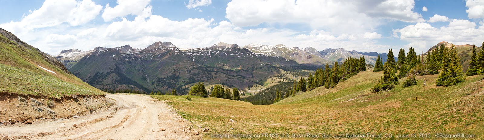
This is the first of five posts covering my trip to the San Juan Mountains of June 11 - 16, 2013. I figured smaller chunks would be more digestible.
I was looking forward to a return trip to southwestern Colorado after my brief taste on my last trip at the end of May. Since my last trip, and based upon my experience of just how rocky some of the backroads could be, I replaced my OEM tires with the highly recommended BF Goodrich All-Terrain, E-rated tires. This time I would be ready!
June 11, 2013
I joined US-550 just north of Albuquerque and followed it through northwest New Mexico to Durango, then toward the high country. First stop would be the area around Silverton. From there I planned to visit some old mines, then continue on the highway to Ouray in order to come over and around to the "top" of the Last Dollar Road. Now that I had good tires I'd traverse that road to the Telluride area and then explore that area before heading home in about a week.
 |
| US-550 between Durango and Silverton, CO |
From Durango, this highway is part of the
San Juan Scenic Skyway. Some of the best views were in sections where there was a steep drop-off down to the Animas River and no place to pull over, so I can't show you photos of that.
 |
| 180 degree panorama of Molas Pass. Click here for larger image. |
Back in 1973 I'd travelled this way in my '68 VW Campmobile. I remembered camping along a river just north of Silverton and how beautiful it was. I found the area, South Mineral Road, on Google Maps and wanted to see if I could find my exact campsite, plus explore farther up this valley.
Surprisingly enough, I did find the exact spot I'd camped all those years ago. I also remembered that it did not get much sun and the morning was very cold even in summer. Even though my new rig has a great furnace, I thought I'd explore up the road as it was still plenty early and see if I could find another campsite.
Turns out there are quite a few dispersed camping areas all along South Mineral Creek, in case anyone is interested. At the end of the maintained section of the road is the South Mineral Campground, run by the NFS. It is very nice, but so are the other sites and they're free. In fact in some of the dispersed camping areas near the river the forest service has provided very nice vault toilets.
I decided I try heading even farther up the road and check out the Bandora Mine. This route is part of a trail in the Colorado Backroads guide by Wells and Peterson.
 |
| Just past the South Mineral Campground on the way to Bandora Mine. |
After passing the campground, the road enters the deep woods and passes this little waterfall.
 |
| Ice Lake Creek. Ice Lake is a popular hiking destination. |
But very soon the road emerges from the forest and hangs onto the side of the canyon.
 |
| The road & creek had been going west, but then both turn south. |
And then the road gets very rocky. I stopped to reconnoiter. It appeared easily passible, just very, very bumpy.
 |
| Rocky road. |
From here I drove through a minor brook and saw the mine. The road cuts through the mine tailings then down close to the creek where I looked back to take the photo below.
 |
| Bandora Mine. Like most in this area, long abandoned. |
The road continued on, fording the creek a couple more times. There are supposed to be nice camp sites not much farther where the road ends, but I chose instead to drive back down the road and look for a camp site in one of the pretty areas along the river that I'd seen on my drive in.
There were many sites to chose from. I ended up here.
 |
| First night's camp site with a wonderful view. |
June 12, 2013
The next morning after coffee and breakfast I took a nice walk up the creek. There were lots of flowers, butterflies, and great views. With one exception I'm not including my flower photos in this posting as I took better ones later which I'll include in future installments. I found this macro photo interesting...
 |
| When I took this photo of a small cinquefoil flower I did know that there was an ant in the picture. It wasn't until I was post-processing the image that I realized the ant was eating another ant! Look closely. |
 |
| Reflection in a beaver pond. |
I'd been keeping an eye out for dragonflies and damselflies, but had seen none on my walk up the river. On my way back to camp I walked along the road and found this one guy on the shoulder. The only Odonate I saw the entire trip.
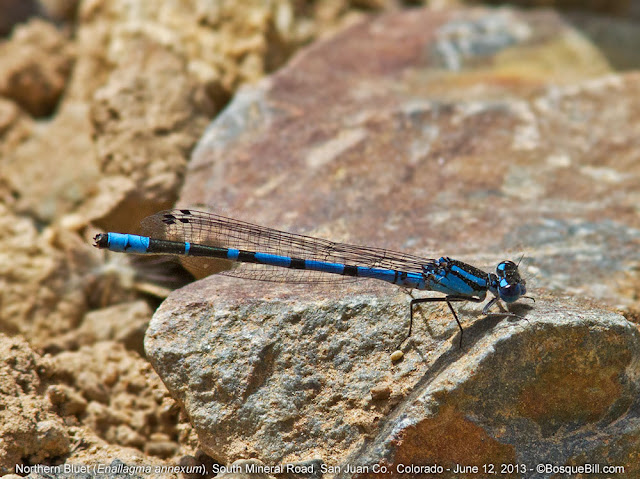 |
| A Northern Bluet damselfly. |
 |
South Mineral Creek, which I keep referring to as a river, because I'm from New Mexico.
The road runs parallel and along the river though the valley. |
There were lots of butterflies all along the river.
 |
| Common Alpine butterfly |
 |
| Field Crescent butterfly |
 |
| A Greenish Blue butterfly - that's the common name, not just a description. |
When I'd stopped at the federal lands information center in Durango the previous day, the helpful lady highly recommended that I visit the old mining town of
Animas Forks. What was left of the town has been "stabilized" by volunteers to preserve as much of the history as possible. To get there one drives through Silverton.
 |
| Silverton, CO. View from US-550 south. |
Silverton is a tourist destination and the terminus of the
Durango and Silverton Narrow Gauge Railroad. It is not as polished or as pretty as Telluride. It is a smaller town which gives off more of a working-class vibe. There is no popular ski resort here and though the area is lovely, it is not as spectacular as around Telluride. Consequently, there are not the crowds of tourists either, which some may appreciate.
When I stopped at the Silverton Tourist Bureau for info, the excursion train backed into a siding nearby for maintenance after dropping its passengers at the station in town. I took many photos, but it was not a scenic spot for really nice photographs. The two photos I include here of the engine, I converted to B/W to provide a bit of historical flavor.
To get to Animas Forks you take the road past the Mayflower Mine, up along the Animas River.
Above the old Eureka Mine site the road is recommended only for high-clearance, 4WD vehicles, though I soon discovered that Colorado folk are not afraid to take their passenger cars up roads that give me pause.
 |
| An old mine above Eureka. |
I was surprised just how many other folks were headed up this same road. As I was a slow poke, I kept pulling over to let the Jeeps and SUVs go past. Then arrived at the ghost town.
 |
| Two houses in Animas Forks |
 |
| The foundation of an old mine workers' bunkhouse with the mine itself in the background. |
 |
| Another of the stabilized houses. |
 |
I wonder if the miners had time to admire the view? Probably not.
Perhaps whoever owned this fine house had time to look out the window. |
 |
| There was a small flock of Gray Jays in the woods behind the town. |
 |
| Took this out of my window on my drive back down the mountain. |
After returning down the mountain, I stopped in Silverton for an early dinner on my way back to find a camping spot again along South Mineral Creek.
 |
| Camping along South Mineral Creek. |
There were sites in the trees with grass if one wanted to pitch a tent, but with the camper I chose to get closer to the river. I enjoyed sitting there admiring the mountain peaks in the evening light and listening to the river lullaby when I went to bed.
 |
| Here you can see my camp chair and the lovely view. |
This concludes the first post covering my first two days in Colorado. Thanks for reading.
My next post will cover the old mines of Red Mountain and an extremely scenic drive along a high ridge overlooking the Million Dollar Highway. I've already processed the photos for all the following posts, so hopefully I will get them written very soon.