Bears Ears National Monument in Two Parts
Friday, April 29th (continued)
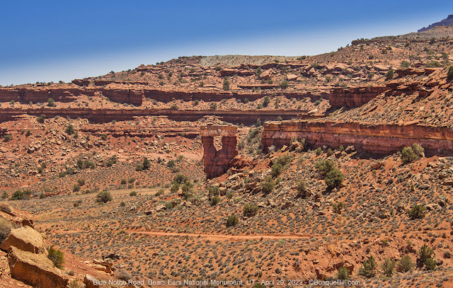
UT-95 and not quite the Blue Notch
Leaving White Canyon North Road I turned left, southeast, when I reached the pavement of the highway. Some maps show White Canyon South Road continuing on and it looks like it once reached Lake Powell. From the satellite images it seems to slowly deteriorate, though it does pass along some interesting looking canyon scenery. I may check that out another time.
In that same "another time" spirit, a friend mentioned Blue Notch Road. She had driven it years ago all the way to Lake Powell. I actually found the unmarked road. I wound myself up the first set of switchbacks which were narrow and steep, but not particularly difficult. Not particularly photogenic either, so no photo. At the top I got my first look at the Blue Notch. Wow, that is one gigantic blue hill. I knew the road twisted and turned for miles beyond the pass and I was eager to continue to my planned destination, so I told myself, "another time."
 |
| Sandstone window on Blue Notch Road |
There was a place to turn off the road where I could reverse direction. I was going to walk back to the high point for a photo of the Blue Notch. Just then I was amazed to see a white pickup pulling a bass boat come up the switchbacks and pass me. Either the road does still reach the lake or there was going to be one disappointed fisherman. At that moment I forgot to get a photo of the pass—-sorry no photo of the Blue Notch. On my way back to the highway there came another pickup and bass boat headed for the lake. Hmmm.
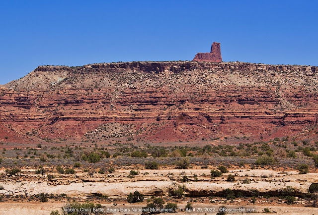 |
| Jacob's Chair Butte as seen from UT-95 |
Fry Canyon
Back at the highway I turned south. Now, shortly before (or after depending upon your travel direction) there is a small dirt road off the north side of the highway (actually east) with a small sign, Fry Canyon Road. I blew past as I was on my way to what I used to call Fry Canyon Road which I now know is actually Radium King Road. But became curious later. I looked it up at home and Google Maps has labelled it Fry Canyon Ruins Road. Turns out there are Cedar Mesa style ruins in the canyon at the end of that short dirt road. A brief internet search shows they are under an overhang and can just be seen from the rim. Looks like there may be a way down into the canyon, but I don't know how difficult that is. If anyone checks it out, please let me know.
Radium King Road
As you might imagine with the name Radium King, the area the road passes through contained many uranium mines, as do many areas in UT and Navajo lands. From what I've read, peak production here was during the late 1950s though some continued to operate into the '60s and a few into the '70s.
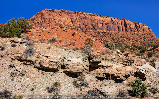
The turn off for Radium King Road is easy to find if you look for the (now closed) Fry Canyon Store & RV Park. There is a brown road sign with an arrow pointing to Fry Canyon. As you drive down the gravel road you can see the top of Moss Back Butte ahead, but the Tables of the Sun Buttes, which will dominate the sky soon, are as yet not visible. The gravel gives way to dirt, but the surface is smooth.
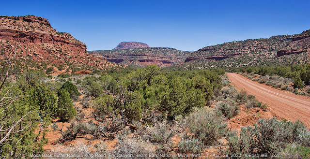 |
| Driving southeast into Fry Canyon with a view of Moss Back Butte. |
At the head of the canyon the road climbs with mild switchbacks. I took a couple of photos looking back down the canyon. I apparently wasn't paying enough attention as I had a difficult time determining exactly which butte is centered in the image (and you know me, I am compelled to identify landmarks or species.) Looking at maps from home, by process of elimination, it has to be Jacob's Chair Butte from an unexpected angle. Right?
 |
| Looking back down Fry Canyon to Jacob's Chair Butte (?) |
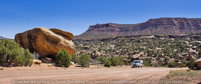
One of the maps I consulted before my trip showed the legend "arch" near the top of the road. I asked John about that and he replied "you can't miss it." When I hear that, it usually means "I'll never find it." In this case, however, you really can't miss it as it's right before your eyes as the road climbs. (If you were driving down, you might miss it.) It is a window, not an arch, and is in white sandstone, so not your typical Utah arch in red.
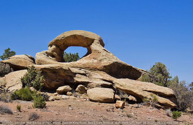 |
| Window near the top of the road. |
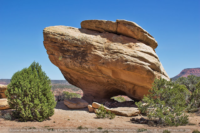 |
| Boulder with feet across the road from the window. |
 |
| Tacoma with camper for scale. |
There are a few, limited sites to disperse camp on the Fry Canyon side of Tables of the Sun Buttes, if needed, but you will miss the amazing views available from the SW side.
Also note, the restored Bears Ears National Monument border follows the ridgeline SW of UT-95 all the way down to UT-276 where it follows the ridgeline north of that highway until roughly Glen Canyon NRA. Mancos Mesa is an "island" of Bears Ears to the west. For more info on Bears Ears NM visit the Bears Ears Education Center, a service of the Friends of Cedar Mesa. This means all lands that drain into Red Canyon are not in Bears Ears; most of it is BLM, however. There are private in-holdings throughout the area.
Moss Back Road
After driving across the pass (and exiting Bears Ears NM) I was on the lookout for Moss Back Road, my objective, on the left. The road was named for the Moss Back member of the Chinle Geological Formation. John cautioned me that Radium King, Moss Back, and Red Canyon South Roads were the only ones maintained by the county and considered passible (in dry weather only) by standard vehicles. It was a happy discovery that, where exposed, the sandstone surface of Moss Back Road had been smoothed by carbide tipped drum-mill or other machinery.
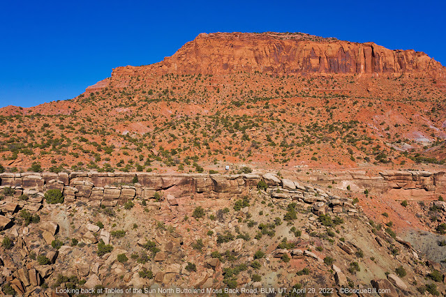
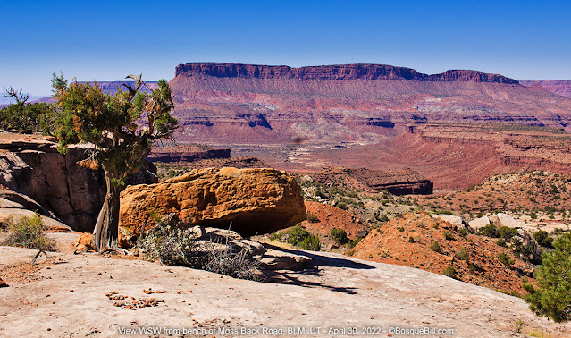
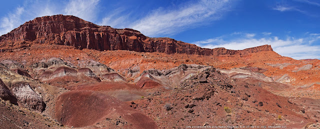
Within a quarter mile after turning onto Moss Back Road I was treated to an extraordinary view off across the broad Red Canyon valley with the red cliffs, buttes, canyons, and hills of colorful bentonite all around. The road travels over a bench supported by white sandstone. Not only that, but the Tables of the Sun North towered on the west more than 1000' above the road; the drop off the bench varied between 100' and 200'; then the low point east across the valley was nearly 1000' feet below the road. Wow!
 |
Aerial photo taken the next day, but appropriate to the narrative to put it here.
You will want to view this panorama as wide as possible. |
I very soon saw a great campsite on a flat slab of sandstone with a superb view. I marked it in my mind, but I wanted to drive the length of the bench to look around before setting up camp. Who knows, there might be even better campsites ahead.
Turns out there are many dispersed sites with amazing views for camping on Moss Back Road. There were interesting rock formations and rocks, boulders, and soils of various compositions, textures, & colors. Wow. I probably drove a little too far. Once you see a good size hill of bentonite on the left, it's best to turn around unless you're in a jeep or ATV. The road farther on wasn't bad, exactly, but narrow, twisty, & steep and there were no more campsites that I could see. I had a dickens of a time finding a place where I could turn around.
As I drove back on Moss Back Road, I gave consideration to possible campsites. Not unexpectedly with this exposure, the wind was a major factor. As I sampled wind speed at each location (by opening both cab windows) I discovered the site I'd originally spotted had significantly less wind than the others. So I backed in and set up.
 |
| Tables of the Sun North Butte as seen from my campsite. |
There were a number hours of sunlight left in the day. I sat in my camp chair and enjoyed the view for a while. The wind dropped and I was able to get my camera drone in the air for a few photos and video.
 |
Aerial view from out over the canyon back toward the bench and butte.
Can you see the little white dot that is my camper just above the rim? |
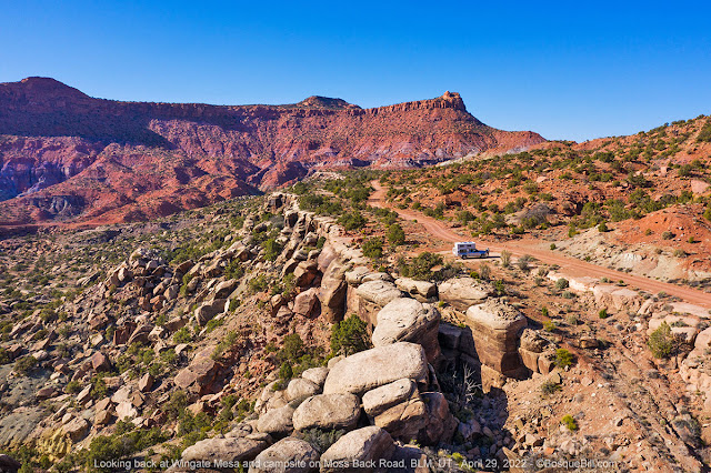 |
| My campsite along Moss Back Road with Wingate Mesa in the background. |
As the sun moved low in the sky I took a walk back toward Radium King Road with my camera. The golden hour was beautiful on the cliffs to the east.
 |
| A small spire up the slope from my campsite. |
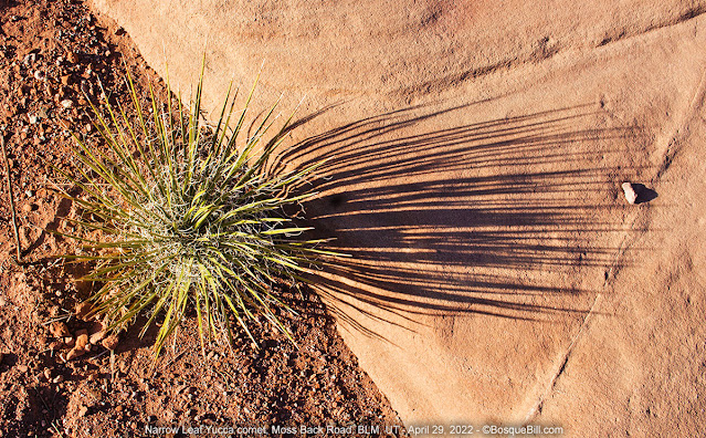 |
| The low sun angle reveals a yucca "comet." |
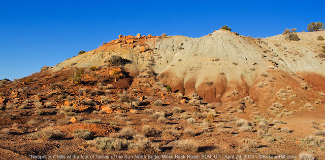 |
| Colorful clay hills. |
There was a bit of a sunset, but I had to tweak it in photoshop to get something to show.
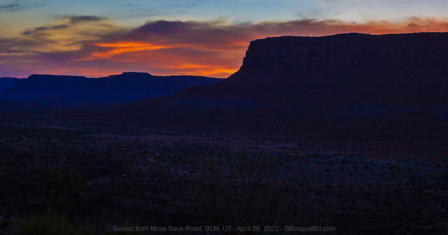 |
| Sunset. |
I was just about drifting off to sleep when the wind kicked up...
Saturday, April 30th
Moss Back Road (continued)
...OMG, the wind, comparable to that I experienced the one time I camped near Muley Point. It slammed into my camper, tin-canning the roof for hours. It finally waned about 2:30am and I was finally able to fall asleep. I had originally intended to camp here another night, but decided my nerves couldn't take another night like that one.
If I wasn't going to camp here tonight, I'd make the best of the day before moving on to tackle the rest of Radium King Road and perhaps I'd find a new site out of the wind down along Red Canyon Road.
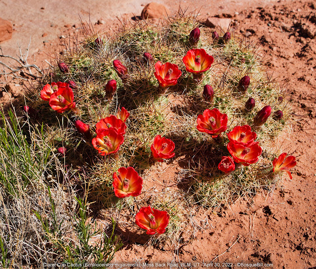 |
| Claret Cub Cactus in bloom. |
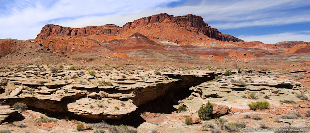
I took a three hour walk/hike south along the road and canyon rim. As I ambled along I took photos of all the interesting rocks, plants, and vistas. Looking at them now, most do not come even close to conveying the experience of seeing these spectacular vistas in person. I did get a few beautiful photos and one extraordinary panorama, though. I recommend you view this full screen. If your browser has a problem displaying the panorama, such as the Full-Screen icon not working, click this link to view on the Kuula site.
 |
| A view of the mesas across the northern branch of Red Canyon. |
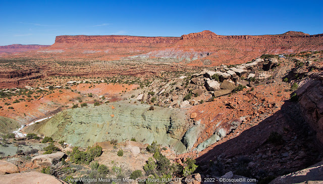 |
| Colorful clays and sandstones with Wingate Mesa in the background. |
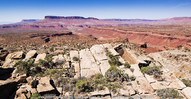 |
| Another view across the canyon with an emphasis on the canyon rim. |
 |
| Desert Paintbrush |
Around noon the wind had let up enough for me to get my drone in the air. This spherical panorama provides a bit of the feel of this amazing scenery. I strongly recommend you click the full-screen icon. If your browser has a problem displaying the panorama, such as the Full-Screen icon not working, click this link to view on the Kuula site.
If you were to look at a USGS map, you would see my campsite is at the junction of two roads. Let this be a caution to those who use those maps. Here's a photo of my camper sitting at the top of the old mining road which led to the Maybe Uranium Mine. As you can see the road has been derelict for 50 years, but looks just as viable as Moss Back road does on the map.
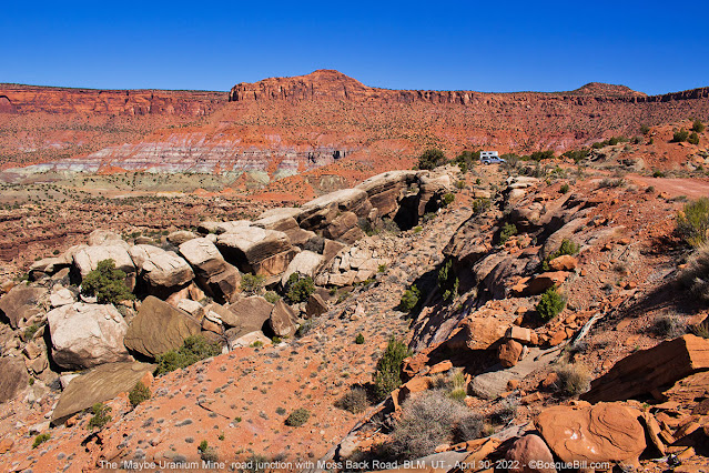 |
| The derelict road leading to the Maybe Uranium Mine. |
When I returned to my campsite I enjoyed the view with my lunch. I then broke camp in preparation to continue my journey.
Radium King Road
I turned left, westerly, on the road I drove up on. It continues at the same elevation for about a half a mile then dives down below the bench. Here is a photo looking back at the canyon rim near where my campsite was located.
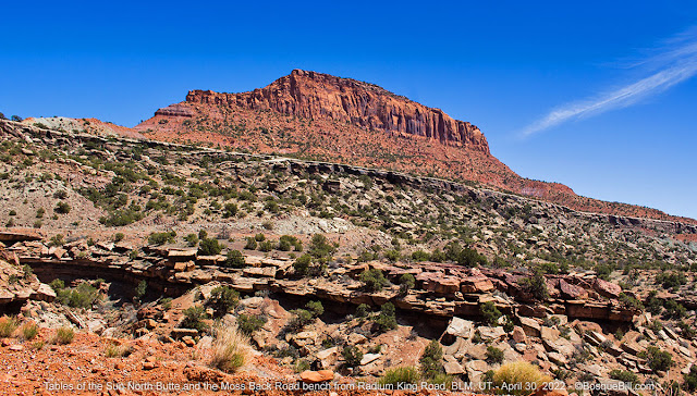 |
| Looking back toward Tables of the Sun North Butte. |
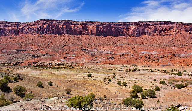 |
| The road runs parallel with Wingate Mesa for a few miles. |
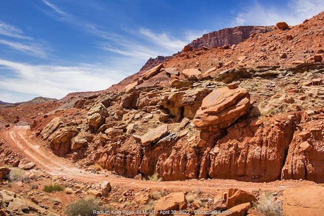
Radium King Road was in very good condition, especially considering how remote it is. There were plenty of tracks in the road, presumably from ATVs, but I saw none. The road would periodically pass through areas of bentonite, then a long stretch of relatively mild grades. There is a junction at the first gully the road crosses. My understanding is that the spur leads to the last working mine in the area. This crossing and two more were the only places where high clearance was useful.
 |
| Radium King Road |
This is some of the most rugged and most beautiful southwestern country I've ever passed through. I took lots of photos, but looking at them now they just don't convey the magnitude of the features, the colors & textures, the feelings of traveling through miles and miles of spectacular, raw terrain. There is no camera lens that can capture the experience of being one small human in the midst of this gigantic, geologic treasure house. Nonetheless, I will post a few attempts.
 |
| View off the side of the road. |
The road continued in very good condition and smooth for the most part. There were a few short stretches that were very narrow and steep toward the western end. 4WD was not needed, though I engaged it a couple times just for more secure traction on the steepest climbs.
 |
| Looks like it wouldn't take much to topple this rock onto the road—just sayin'. |
It had been well over 24 hours since I'd seen a single person or vehicle. I stopped at a saddle in the road for photos and spied a white rectangle that must surely be a parked vehicle far in the distance and about 500' lower in elevation. Some time later after a winding descent I saw a large white pickup with Utah plates and camper shell parked in the middle of the road. There was a man wearing a sun hood with a backpack wandering along the base of some bentonite hills. Looked like he was searching the ground for something that washed down; perhaps pieces of petrified wood that is found throughout the area.
 |
| Multi-image panorama. View as large as possible. |
In any case I was very lucky. Just after I passed his truck there was a gate in a barbed-wire fence—-the type where the strands of wire are attached to a pole and the pole fits into a wire loop at the bottom of the fence post, and you drop another loop over the top of the pole to close the gate. I could no more lift the top loop off the pole due to the tension in the wire than I could sprout wings and fly. The man saw me walking back toward him and came to meet me with words acknowledging how difficult that gate was to open. I asked for his help and this much younger man was able to open the gate and closed it after I drove through. I thanked him, but neglected to ask what he was searching for along the ground.
 |
| Multi-image panorama. View as large as possible. |
A few miles farther along I can across this monument to broken dreams. From there it was only half a mile to where the road crosses the main drainage of Red Canyon. Should there be enough rain to produce flow, it would drain NNW toward Lake Powell, supplemented by the many canyons south of UT-95.
Note: for some reason many maps do not show Radium King Road connecting to Red Canyon Road. Let me assure you that they not only connect, but the road is easily passible (in dry weather.)
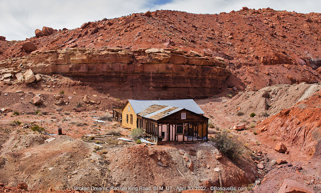 |
| This modern ruin is near the end of Radium King Road. |
Red Canyon Road
Once up the other side the road 'T's into Red Canyon Road. John advised that although the route northwest looks like a good road it quickly deteriorates. I turned southeast toward UT-276.
FYI, it took approximately a half hour to drive Radium King Road from UT-95 to Moss Back Road; by rough estimate it took 2 hours plus to drive from Moss Back Road to Red Canyon Road.
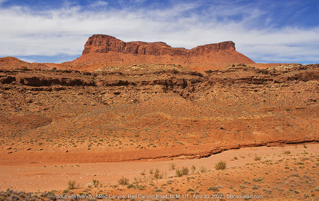 |
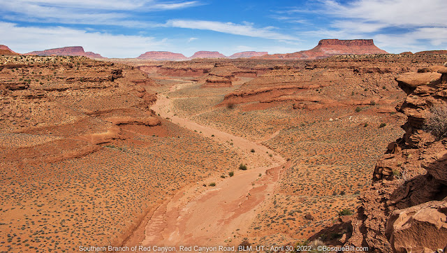
| Southern branch of Red Canyon. |
Red Canyon Road was in good condition, though there were a few very sandy areas where you should keep your momentum. I'm going to guess it would take an hour to reach the highway, but I tried a couple side roads looking for potential campsites, so don't have a reliable estimate.
The road basically parallels the southern branch of Red Canyon. It rides on deposits that have washed down or slumped from the red sandstone cliffs to the south. The scenery is not as dramatic as along Radium King Road, but there are wonderful vistas of the buttes and mesas off to the north. The terrain becomes less interesting as you approach the highway.
 |
| Southern branch of Red Canyon. |
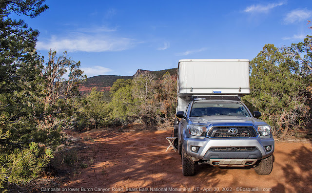
I had hoped to find a dispersed campsite along here somewhere that would be out of the worst of the wind. Although there were several sites with attractive views, I found none that were sufficiently out of the wind. It became clear I'd have to try somewhere else, but where? I hatched the idea to head back to Burch Canyon Road where there were many dispersed campsites and many are within piñon/juniper woodlands that might afford shelter from the wind.
I turned left, northeast, on UT-276 which lead back to the "main" highway, UT-95. From there it was only a few miles east to the turn-off to Natural Bridges, then Burch Canyon Road.
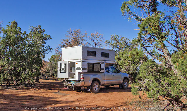
Burch Canyon Road Redux
When I drove up lower Burch Canyon Road earlier in the week around mid-day, there were very few campsites open. Surprisingly, on Saturday evening there were many sites available. I'd seen a couple of interesting sites a few miles along that I wanted to check out. When I was nearly there I stopped to chat with a gentleman who was out walking along the road.
It turns out we had more in common than our ages. We both had pop-up campers, both from the outskirts of Albuquerque, both an interest in photography, and I later learned we were both retired engineers. I said I was going to look at sites a bit farther along the road. The gentleman said if they were taken there was a spur just this side of his camp I should check. If I camped there he invited me to walk over to his site and visit. Turns out the sites I'd seen earlier were taken, so I returned to where my new friend had suggested.
 |
| My campsite out of the wind. |
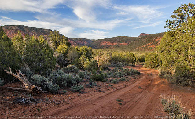 |
| The spur off the road that lead to my campsite. |
After setting up I took my camp chair and walked over to visit. Ralph and I had a very enjoyable evening sitting next to the (non-burning) campfire and swapping stories about travel destinations, camping, and photography.
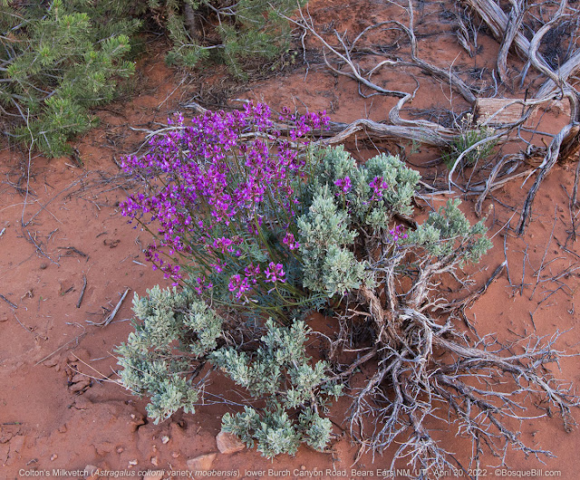 |
| Colton's Milkvetch looks very similar to Locoweed. |
Sunday, May 1st
Burch Canyon Road (continued)
 |
| My campsite in the morning sun. |
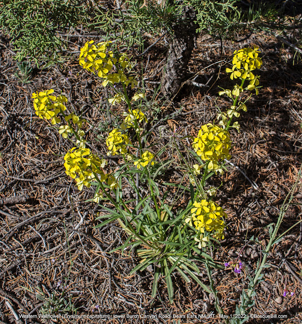 |
| Western Wallflower beneath the junipers. |
I slept well as the campsite was indeed sheltered from the wind. I debated my options as I was not quite ready to return to civilization, but I needed to keep in mind that my gasoline was limited. Driving the relatively short distance across the top of Cedar Mesa to Arch Canyon Road seemed like a good option, especially as most of that distance was toward the gas stations on US-191.
Dog Tanks Springs
My favorite site at North Mule Canyon was occupied so I drove a couple miles farther up the road to the site I stayed at once before, Dog Tanks Springs. This was probably a better site under the conditions. It is located down in a small dell and thus sheltered from the wind. The view is not quite as scenic as North Mule Canyon, but very pleasant. There are a few mature cottonwood trees next to the spring, though only one was showing spring leaves and the scrub oaks had not begun to bud.
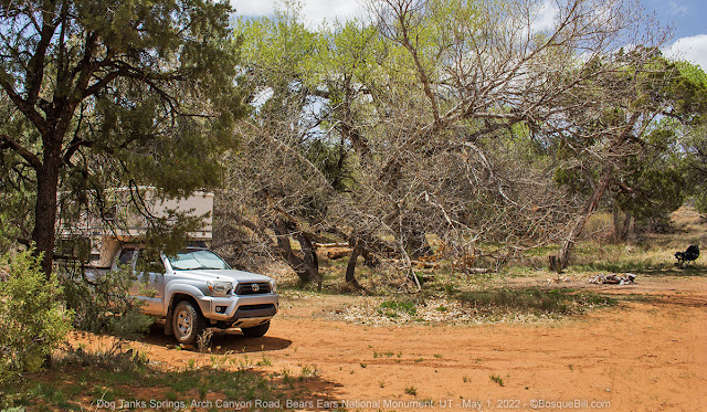 |
| My campsite along Dog Tank Springs. |
I sat under the trees and read, listened to the birds and tried to get photos of those feathered friends who stopped by. I got a good one of an Ash-throated Flycatcher, which I will share here. I got a poor one of a Plumbeous Vireo which I will not share, but allowed me to ID the song I'd heard also at Lost Canyon.
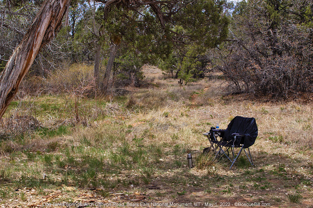 |
| Lounge chair near the spring. |
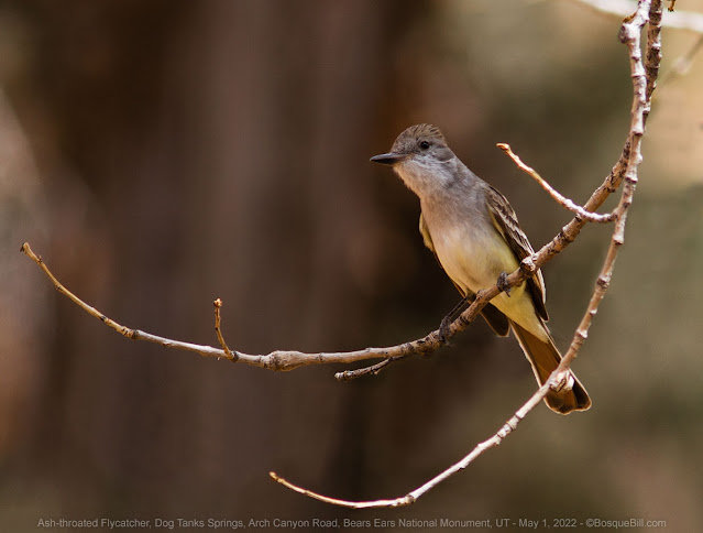 |
| Ash-throated Flycatcher. |
I'd camped here once before, while waiting for the campsite at the Arch Canyon Overlook to be passed along to me. At that time I sent my drone up to look around. When I got home and viewed the video on my desktop I realized that Arch Canyon was really close to this campsite. When I looked on a topo map, the canyon was only about a quarter mile away, as the flycatcher flies.
Arch Canyon
I couldn't find a trail from the campsite so bushwhacked my way over. I hiked just under half a mile to get to the canyon rim. By that time in the afternoon clouds had moved in unfortunately, so the light wasn't the best for photography. If you missed my Arch Canyon photos from previous posts, check them out. I enjoyed the spectacular views, nonetheless. I apparently wasn't paying enough attention earlier, so wandered a bit on my way back to camp, but with the help of my inReach device I did find a slightly longer route. I think that longer route was much easier and I'll share below the photos.
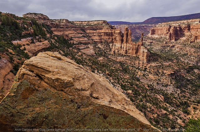 |
| Looking NW up Arch Canyon. |
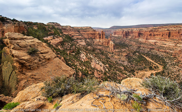 |
| A slightly different and wider perspective. |
In case you ever camp here and want to walk to the canyon, I suggest: walk almost 400' back down the road (SE) until you come to a wash with a sandstone bottom; walk east along the wash bottom; just past another large section of sandstone look for a little wash that heads NNE (about 700' from the road); the wash doesn't go very far, but keep heading NNE and you will get to the canyon in about another 600'. That's an easy walk.
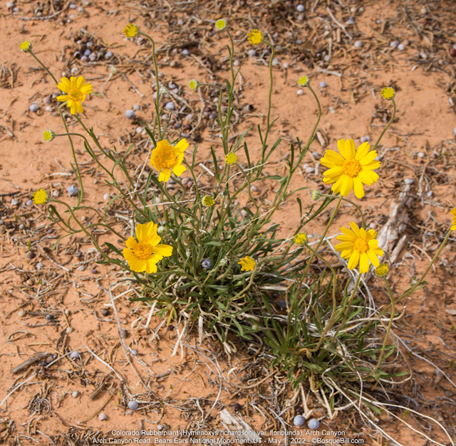 |
| Colorado Rubberplant |
Monday, May 2nd
Dog Tank Springs (continued)
After a pleasant night, shielded from the wind, I packed up and started out for home. No photos from camp or from the road as it was hazy and/or smokey this morning. I made it to White Mesa with gas to spare, then aimed the truck at New Mexico.
On the way home
I stopped at my favorite place in Shiprock to grab a bite to eat, the locally owned "That's A Burger" just north of the junction of US-64. In addition to all the burgers and things you'd expect, they have a Navajo menu, too. I decided to try their green chile stew. It surprised me as I'm used to the green chile stew in Albuquerque being made with diced potatoes, but this Navajo style was made with posolé... it was so delicious! They served a generous portion, too. I ate half at an outside table, then put the rest in my fridge to enjoy at home.
The drive home was uneventful, which is good. It was warm, but not too bad.
Summing up: this was a wonderful trip—-one of my favorites (but as was pointed out to me, I say that frequently.) It was especially sweet as I spent most of my journey exploring new places, and those new places were so beautiful and even spectacular!


