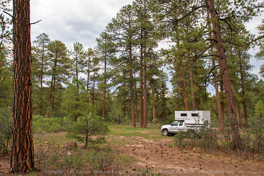
Northern New Mexico
September 25 - 26, 2023
The Rio Grande del Norte National Monument, proclaimed about 10 years ago, is located primarily in the Taos Plateau in far northern New Mexico. It is comprised of rugged, wide open plains at an average elevation of 7,000 feet, dotted by volcanic cones, and cut by steep canyons. The Rio Grande carves an 800 foot deep gorge through layers of volcanic basalt flows and ash. Among the volcanic cones in the Monument, Ute Mountain is the highest, reaching to 10,093 feet.
I'd driven by the signs and often gazed out into the vastness whenever I drove up US-285 on my way to the Colorado or far northern New Mexico mountains. The region can also be seen from the eastern side, though I go up that way less frequently. I'd wondered what might be in the area, but it looked desolate and forbidding. I needed a spark.
Near the end of August one of my fellow New Mexicans posted a photo on Mastodon of his visit to the monument which captured my imagination. I reached out with questions and received recommendations in return. From this start I gathered what information I could online, there isn't much, and began to plan a visit. I will add detailed observations here for those who might wish to visit the monument themselves. It wasn't a lengthy visit, but I will include photos that I hope are representative of this area. Hopefully this will encourage you to visit, as well. I plan to return.
[This trip included three more nights in the Carson National Forest at Cabresto Lake and Rio Chiquito in the Taos Mountains, but that portion will be a separate post.]
Monday, September 25
Monday morning I drove north on the Interstate, by-passed Santa Fe, got gasoline and tacos in Española, and navigated the construction on the road to Taos. My plan was to go through Taos and take the old John Dunn bridge across the Rio Grande. I'd previously crossed the "high bridge" at the Gorge and at the old Taos Junction bridge, so this would be a new sight.

|
| Looking downstream at the Rio Grande from a pull-out along NM-68 on the way north. |
Visitor Center
I stopped at the BLM Visitor Center at Pilar off the east side of the highway, adjacent to the Orilla Verde section of the Rio Grande del Norte National Monument. I hoped to get maps and info. Good thing I did. The nice lady at the desk told me the the section of road from the John Dunn bridge up to the plateau was closed. "A big rock fell on it or something", she said. OK, change of plan.
Orilla Verde
With a couple new maps in hand I crossed the highway and drove up NM-570 through this lower section along the Rio Grande which I'd done way back in 2014. One could argue this stretch is where the Rio Grande Gorge really begins (ends?) with its high basalt lava cliffs.

|
| Basalt lava cliffs portend the Rio Grande Gorge. |

|
| Rafting along a calm river. |
Taos Junction Bridge

|
| The Rio Grande |

|
| The Taos Junction Bridge |

|
| This is the view of the gorge when climbing the road up from the bridge. |
High Bridge
I turned right and drove to the rest/parking area on the west side. What a circus! About half the non-handicapped parking is taken up by vendors of sundry goods of questionable provenance, i.e., junk. All the other parking spaces were full, due in part to a weirdly painted old school bus with some sort of "patriotic" theme. What a poor impression for visitors to be subjected to when they want to stop to see a scenic wonder. Sigh.
John Donn Bridge Road
I left the mêlée without stopping and drove northwest on the highway. The turn-off I wanted is about 6 miles from the junction of West Rim Road. The lady at the visitor center said there was a BLM sign there. I almost missed it as I was expecting one of the nice new Rio Grande del Norte National Monument signs. Instead, a little ways off the highway, was a plain brown sign indicating access to the Taos Plateau. Google Maps calls this Montoso Road; my Garmin GPS calls it John Donn Bridge Road (being the west end of the road that normally crosses that bridge.) You follow this dirt road about a mile then turn east. After about three miles is the junction with Cerro Montoso Road that Google Maps calls "Cam Delovato" until they don't. There was another brown BLM sign which gave milage to US-285 and to the Colorado Border, so at least I knew I was on the right road.
Cerro Montoso Road - TP-130
There are a few widely spaced homes along the first few miles of the road into the national monument. Must be very inconvenient when you can't get across the nearby bridge. A few of these homes were nice though not mansions; a few could be called tiny homes, if one were to be extremely generous. All had solar panels and all looked lived in, not vacation homes. I passed one red pickup truck here. That was the last vehicle I saw my entire time in Rio Grande del Norte National Monument.

|
| Cerro Montosa Road headed north |
There are a few private "inholdings" within the national monument. In fact most of the land until you are almost past Cerro Montoso to the west is private and you will see a few ranch road junctions, but I don't think anyone actually lives out there. The terrain is typical northern New Mexico plateau with sagebrush and native grasses and a sprinkling of junipers. In low areas where runoff collects are gardens of chamisa which were in full bloom at this time of year.

|
| Beautiful vista east toward the Taos Mountains |
The unmaintained dirt road was generally in good condition. There are rocky places where basalt veins reached the surface where you need to go slowly. In those aforementioned low areas the road can get very muddy, though the deep ruts were hard as rock when I drove through. Nowhere did I need 4WD, but high clearance is strongly recommended lest one high-center in any number of places.

|
| Cerro Chiflo looks less like a volcano than the others in the area |
Speaking of junctions and routes, if you get the official Rio Grande del Norte NM map from BLM you will see the roads designated TP-XXX, where TP stands for Taos Plateau since the name came long before the monument was born. You can get the paper map from one of the two visitor centers or the same map in PDF form from the BLM website. Those route numbers, however, are essentially useless as nearly all the route signs you will come across (and there are very few) have lost any legibility to weathering. And no one else, it seems, observes the BLM road designations. My Garmin GPS and Google have named the main north/south road Cerro Montosa Road in the south, and after the junction leading to US-285, it's called Comino de Lovato to the north. The BLM map will give you a general idea as to the primary roads through the monument, but actually location should be taken with a gain of salt.
Also, there are countless side roads throughout the national monument. Most are little more than tracks, some have seen some traffic, but it's not hard to follow the "main" route. These side roads may be fun to explore, if you are so inclined.
Unnamed Dirt Road West, aka TP-150
My Mastodon friend mentioned a road that took off to the west, south of Bushy Mountain. This would lead to the south side of Cerro de la Olla where there were dispersed camping areas. I was cautioned that these campsites might be occupied during hunting season, so I planned my trip to be just before elk and deer season. I was using the Earthmate app, which syncs with my inReach Satellite Communicator, to find my position on their topo map. I would strongly recommend some sort of GPS enabled maps for anyone visiting this area, though this is primarily for your convenience as you can always determine roughly where you are as the isolated volcanic cones are always visible to orient you.

|
| The southwestern flank of Bushy Mountain reveals a cliff of volcanic ash. |

|
| Looking back east from the location of the photo above. |
The road that BLM designates as TP-150 looked like it goes between the two hills of Bushy Mountain, but I found a "well travelled" road south of the smaller hill and took that route. I'm calling it TP-150(ALT). It was a good choice, though little more than a double-track, and after passing an interesting hill of volcanic ash (which shows up brightly on a satellite view), it joined the an east/west road "already in prgress." Looking at Google Maps, now I'm home, they have these roads and junctions properly placed—at least as far as the turn-off south of Bushy Mountain.
Cerro de la Olla
The BLM map showed one road, TP-185 heading north into the foothills of Cerro de la Olla. When I came upon a side road headed north I didn't know if it was the one or not, but using my GPS enabled topo I decided this was not the right road. I could see another on the topo map farther along, which did turn out to be the designated route. TP-185 is about 4 miles from Cerro Montosa Rd.
 |
| For reference, this is TP-185 that heads up into the SW foothills of the mountain. If you've clicked the photo for a larger view, you can see a typical route marker sans paint. |
 |
| Looking farther west along TP-150 from the same spot as the above photo. |
This side road was much rougher than those I'd been on, but not technical, just slow going. With the increase in elevation the junipers gave way to a piñon forest. I came across a clearing where someone had camped previously (and campers can be seen in the current Google satellite image), but it wasn't particularly level. The road became a bit more rocky and rutted, but soon opened up at a fork in the road. This area had been used for dispersed camping in the past with several potential sites. I took a spur left up onto a knoll.

|
|
The view back (east) as I start up Cerro de la Olla. You can see the Bushy Mountains and their ash flank in front of the Taos Mountains |
I'm always looking for the holy grail of a level site, a spectacular view, and a wind break. I walked around the area and settled for two out of three. I ended up camping right on the "road" as I didn't want to crush any of the vegetation or soft soils off to the side. I had a pretty view of the mountainside and a grove of piñon trees blocked the wind. A very short walk took me to a view of the Taos Mountains and walking the other direction a view across the plains. Interestingly, I had good cell service up here. I spotted a tower in clear sight to the east near Taos. At home with a map I determined it was only abut 12 miles away, though it felt I was much more isolated than that.

|
| The view east from next to my campsite. |

|
| The view across the plains toward the southwest |
I sent my drone up for a spherical panorama. Hold your mouse button and drag to look around. I recommend clicking the full-screen icon or open the pano in a new tab.

|
| A 180º panorama from above my campsite looking east toward Taos |
I was outside in my chair having dinner when I realized the sun was casting a gorgeous red light, but by the time I got my camera and walked down the hill to take a photo of the mountains, I'd missed the peak. Still a pretty picture, as is the one a few minutes later.

|
| I just missed the peak red light on the mountains |

|
| A few moments later in the gloaming |
I think this is the quietest place I've ever been. I've been in some isolated places, as you know, but in those places there were always a few commercial airliners crossing overhead trailing a rumbling noise. Not here.
Tuesday, September 26
Cerro de la Olla (continued)

|
| Oops, almost forgot to take the required photo of my camper set up in my campsite! |
 |
| I couldn't take enough photos of the blooming chamisa, also known as rabbitbush. |
Brushy Mountain
Apparently Brushy Mountain is made of volcanic ash with only a thin layer of soil on top. The ash was exposed here at the southwest corner. I parked not far from an abandon well house and walked up the hill via a double-track. The ash was surprisingly firm and previous visitors had driven up the hill and around the top. A few daredevils had even driven down the other side. Seemed like it was firm enough for a full size vehicle, but I didn't test it.
 |
| A view from the top of the hill of volcanic ash, looking west. This photo is deceptive. The white top of the hill is about 20-30 higher than my truck. |
When I sent up the drone for a panorama I took a look at where the the road went next. It looked sketchy.
If you wish to view the panorama full screen, either click the icon in the upper right or visit the website.
I backtracked and recommend that if you come this way you take the road that skirts below the southern hill. I followed the road I'd come in on for a ways, then kept to the northeast when I came upon the spur that I'd come in on. This brought me back to the main north/south road where I turned north.
Cerro Montosa Road - TP-130
 |
| A view of Cerro Chiflo, left, with the Taos Mountains in the background and Guadalupe Mountain just in front of them—both are on the far side of the Rio Grande Gorge. |
 |
| Looking north along the road. |
After passing between the peaks, the through road turns northeast. After about 3 miles the road turns back north and quickly comes to a junction. I wasn't sure at the time, as there was no sign or marker, but if you go west at the junction you will come out at US-285 north of San Antonio Mountain. The road also passes the old McGreggor Place, but I have no information on that. BLM designates this road as TP-120. I think I'll go this way on my next visit.
Comino de Lovato
I proceeded (continued) north as my goal was Colorado and the bridge across the Rio Grande up there which I'd never seen. This section of road appears much less travelled and in many places is double-track only. Also the land appears much dryer with only range grass and no juniper or large shrubs. The road here is named Comino de Lovato, though still designated TP-130 on the BLM map. After several miles I crossed a cattle guard and for the first time there were isolated herds of cattle grazing. Twice I had to wait for one them to stand up and get off the road.
 |
| Aerial view from above Camino de Lovato looking back at Cerro de la Olla. |
There are some very rocky sections from the junction to the state line where ancient lava flows have become exposed on the surface of the landscape. It's necessary to drive very slowly through those. There are still low areas where water accumulates, however here the ruts have been flattened by cattle hooves. None of the road is technical and high clearance is strongly recommended.
 |
| I was lucky to spot this little tarantula skittering across the road. I just barely had enough time to pull over and stick my camera out the window. One second more and the spider had disappeared. |
A hazard to look out for are the cattle guards. My theory is the ground is too rocky to dig the pit over which the metal rails would sit. Instead it appears they sit a pre-cast concrete vault, with rails pre-installed, on top of the road and pile dirt up against it as a ramp on both sides. Over time the dirt has eroded away leaving the concrete sticking up 2+ inches above the dirt ramp. It's like driving up and over a short curb. There may be a half-dozen of these along Camino de Lovato.
 |
| If you click for the larger photo you might be able to see the concrete curb I described. |
After one such cattle guard I backed into a rancher's side road to have lunch. I took the opportunity to send the drone up for a spherical panorama.
Continuing along the road Ute Mountain to the northeast is a constant companion.
 |
| Ute Mountain to the northeast |
 |
| Clouds were building over San Antonio Mountain to the west. The mountain, though geologically related to the volcanic field in the national monument, is located in Carson National Forest and is administered by the USFS. |
Since entering the national monument there had been hundreds of small grassland birds taking flight before me as I drove along. I tried time and again to stop and hope they would alight where I could get a photo, but no joy. My luck changed when a much larger bird flew up and landed at the side of the road ahead. I was able to stop, and using my open door as a blind take a number of photos. I wasn't sure at first what the bird was, but got out my binoculars and discovered it was a Burrowing Owl. Very cool! It then flew off the road where I was able to get a better photo.
 |
| The Burrowing Owl is sure I'm up to no good. |
 |
| Here the road is passing through a sandy area. The South Piñon Hills to the north are in Colorado. |
 |
| At this point Ute Mountain is almost due east. |
Also, this entire afternoon, I'd been observing a thunderstorm build over San Antonio Mountain. Later this would move east.
 |
| San Antonio Mountain is obscured by the heavy thunderstorm. |
South Piñon Hills, Colorado
I crossed the state line without fanfare. There was one old-style "Welcome to New Mexico - Taos Plateau" sign on the road facing north. That's it.
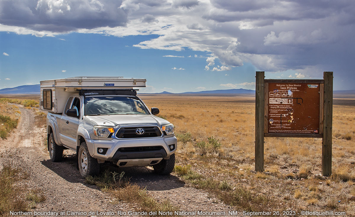 |
| Hello, Good-bye |
 |
| South Piñon Hills in Colorado |
The road winds through a few small flat-topped hills, crosses a basin, then into a larger group of hills which the maps call South Piñon Hills. The road turns west and after a little over 4 miles ends at County Road G, though it is unmarked here. I turned right, east, toward the Rio Grande. The road here is wide gravel and smooth. I noticed one of the new BLM signs here for "San Luis Hills" which apparently refers to the entire range that includes the Piñon Hills. The clouds from earlier had already moved into these hills and the wind was picking up.
Lobatos Bridge
 |
| Lobatos Bridge across the Rio Grande |
 |
| Looking downstream. |
 |
| I would argue the bridge marks the start of the Rio Grande Gorge. |
Ute Mountain
 |
| Welcome sign with Ute Mountain in the background. |
 |
| Driving west, north of the mountain |
 |
| West slopes of Ute Mountain (and my last photo of chamisa, I promise.) |
The Gorge
I could see that the road was getting closer to the Rio Grande Gorge. I'd noticed on a satellite view during my planning that there appeared to be a side road leading to a dispersed campsite (or two) next to the gorge. When I saw what looked like an appropriate turn, I took it. Sure enough, I found a campsite right near the edge. I marked it on my GPS and also took photos and sent the drone up for a spherical panorama.
 |
| The Rio Grande from next to the dispersed campsite. |
 |
| You can see the gorge cutting north across the plains in this aerial view. |
Click the full-screen icon in the upper right or open in a new tab.
I drove back to where I'd made my original turn to continue on and noticed a yellow Dead End sign attached to a road marker. It looked fairly new, too. I had to go a ways before I could turn around, but have confirmed from home that road does indeed end about half a mile farther along. I was a bit puzzled. I had seen a road cross the spur I took to the gorge campsite; maybe that was now the "main" road though it didn't look well used.
I don't know exactly how far I drove. I know two different people who said it was possible to drive all the way around Ute Mountain on the west side and that it was a rough, bumpy road. Nonetheless, the road seemed to be getting worse and I wasn't convinced I was on the through road, so I called it quits, turned around, and headed back the way I'd come in. In looking at the satellite view now, I believe I was on the through road and there appears to be several cleared areas farther along where you could camp. I just wanted to clear out in front of the weather. I decided to head south to the BLM's Wild Rivers area. I had read the roads were paved and that seemed a good idea with the storm coming.
I back-tracked along my route. As I was driving north on the exit road I was treated to a pronghorn crossing in front of me. I had hoped to see pronghorn on my drive north, but had not. Once out of the monument getting to the state highway was a challenge. My Garmin GPS would have had me go straight east, but there was a fence and a field in the way. I again needed my Earthmate app to find my way to the highway, NM-522. Sheesh.
Wild Rivers Recreation Area (a more domesticated portion of Rio Grande del Norte)
This is another area I'd seen on maps and never visited. It features paved roads and developed campgrounds, though no hook-ups. Naturally, by the time I got here the storm had dissipated and it was very warm. I turned off of NM-522 on Post Office Road in Cerro (a shortcut if coming from the north) onto NM-378 which goes into the recreation area. The highway curves around to the west side of Guadalupe Mountain. I stopped for a photo of the gorge at the Sheep Crossing Overlook just inside the park boundary.*
 |
| Here at the overlook you can see the gorge is getting deeper. |
There are a number of trails into Guadalupe Mountain and a few day-use, pull-offs on the gorge side. Once in the main fee area you enter a one-way loop road that goes by the Wild Rivers Visitor Center. Then you come to the El Aguaje Campground (which I somehow missed seeing on my way around the loop) on the Red River side. At the southern end of the loop is the La Junta Campground which is dedicated to walk-in, tent camping. No one was there.
There are four small camping areas with gravel roads for vehicle camping. Looks like each site has a ramada for shade. Every space was taken on a Tuesday afternoon. I gather one of the big attractions of this area is that there are trails from the campgrounds down to the Rio Grande for those who are willing to hike for some water sports.
I decided not to try to find a site in the campground I'd missed on the other side of the loop away from the gorge. Even if I found a site it would be too warm for comfort and being away from the Rio Grande seemed like giving up. I've learned later this was a good decision, too, as there is no shade in that particular campground. The Red River is below the canyon rim, but a long way below.
I didn't get any photos of Wild Rivers beyond the one at the overlook. Basically it contains shrubs and wild grass with piñons and juniper woods, typical of northern New Mexico.
There was plenty of light left, so I accelerated my plans and drove back out to the highway and turned south. The remainder of this trip will be documented in a separate post.
*Additional Dispersed Campsites
I noticed what looked like an RV on the rim of the gorge far to the north when I was at Sheep Crossing Overlook. In looking at satellite views from home I can see there appears to be clearings for dispersed camping along the rim just north of the Wild Rivers Recreation Area. Where the highway starts to curve to the south, take the dirt road west toward, then past, the transfer station. Drive north along the rim. This BLM land is within the national monument, so camping is legal and free here.
Also, the lady at the BLM Visitor Center had circled an area south of Wild Rivers on one of the xerox maps she gave me and said there was dispersed camping in that area, too. There was no detail on that map, so I looked it up while writing this post. It seems Carson National Forest extends all the way to the Rio Grande south of Red River (and thus south of Wild Rivers). The map shows a gravel road, FS-9, from NM-522 (across from Rio Grande Stables) leading to a primitive campground near the rim of the gorge on Cebolla Mesa. Looking at the satellite view, there appears to be a vault toilet in a central camping area and a small network of side roads leading to other dispersed sites.
Thanks for reading.
I hope this glimpse of Rio Grande del Norte National Monument was entertaining and informative. If you have questions, feel free to drop me an email—find my address in the menu up top under Get Email Notifications.