Part 2 of 2; continued from Part 1
Part 2: Telluride Area
Remember you can click any image to see a larger version.
For spherical panoramas: click to activate (if necessary), click and drag mouse to change orientation, click the full-screen icon at upper right for the best experience.
Wednesday, August 14th (continued)
Telluride
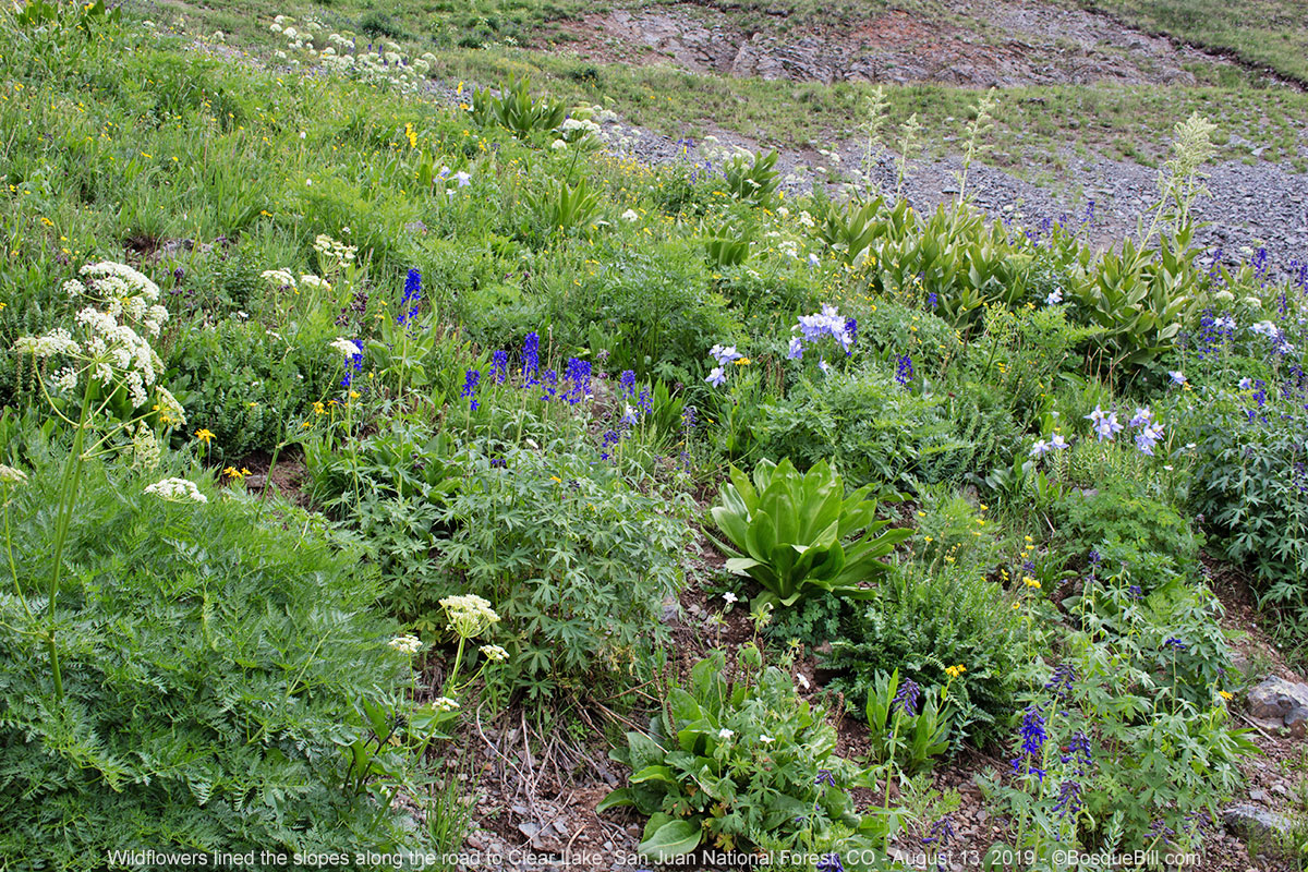
I drove through the town of Telluride. Traffic in this tourist destination was heavy, but moving. On a previous trip I'd stopped at the parking area past the Pandora mine at the head of the box canyon and photographed Bridal Veil Falls from there with my long lens. My pre-trip research lead me to believe I could drive up a number of the switchbacks to get closer to not only Bridal Veil, but also Ingram Falls where I could get aerial photos and videos. At some point near the top, the road is supposedly one-way to the west from Black Bear Pass, I didn't know if I would come across a Do Not Enter sign, but I didn't.
The switchbacks were steep and rocky. There were lots of vehicles of all strips driving up and down. There were also lots of hikers on the road. I slowly climbed the road trying to match my memory of the satellite view I saw at home with what I was seeing now.
I stopped at one switchback and took to the air. I was quite a ways below the main Ingram Falls at the top of the canyon, but was able to see another switchback with cars parked about half-way up, so headed for there to get photos and video.
 |
| Looking back toward Telluride. |
Three aerial photos, rising up the mountain side, of Ingram Falls:


I'm a bit foggy on the sequence of things now, I think I drove up the road to the next switchback on the other side where there was a great view of Bridal Veil Falls. This also had a reasonably sized parking area and level spot to fly from. I took lots of video and some photos of the falls and a perspective of the power house not many folks can see.


On the way down I stopped and parked at the switchback close to the bottom of Bridal Veil Falls. This was the destination for most of the hikers (and there was a portable toilet, too.) The cool mists billowing off the bottom of the falls provided welcome cooling on a very warm day.
 |
| Foot of the falls. |
I returned to the valley floor, made my way through town, and headed south on CO-145.
Trout Lake Area
On Trout Lake Road, past the lake, there is a trestle across the stream that feeds the lake. This was used by the Galloping Goose Railcars that served mountain towns in the area. I'd photographed it previously, but hoped an aerial view would be more interesting. Official USFS Trestle website
 |
| Trout Lake Trestle used by the Galloping Goose. |
 |
| Water tank from back when there were steam locomotives. |
I had hoped to camp at a dispersed site up Hope Lake Trail Road, FS-627, just past the lake where I'd camped previously - it had a fabulous view of the surrounding mountains. As fate would have it that site was occupied, there were a number of other dispersed sites up that road, but only a swampy few were untaken.
I drove back down and looked at the dispersed camping area near Priest Lake, but didn't find any to my satisfaction. I spoke with a fellow there who suggested I return to Trout Lake Road. There are sites along the south side past the trestle he said.
Since I was close to the highway I elected to take the pavement to the southern terminus of FS-626. There is a large meadow with dispersed camping at that junction. Nice views, but too many neighbors for my taste. I headed east on the gravel road. There were a few sites with views, taken. I tried an unoccupied site on the south side of the road, but it was full of mosquitos.
I continued down the road, passing a few campers parked on the grassy verge with tents or small trailers. I left the lake environs for the deep forest, then spotted a dirt spur leading up into the trees. It was a very nice spot at the end of a small loop - far enough from the road to be private (though not one vehicle came by that night) and relatively free from flying bugs. There wasn't a view from the level spot where I set up camp, but I was able to carry my chair about 20' down the loop for a small view of some mountain tops.
 |
| My campsite about 75 feet off FS-626. |
It was a pleasant evening and I was exhausted.
Thursday, August 15th
I kicked myself Thursday morning when I realized I'd missed a chance to photograph the mountains east of the lake in the previous evenings rosy glow. I love that mountain range. I'd just been too tired the night before and it never occurred to me. So I decided that I would hang around the general area and drive over Dunton Road to the West Dolores River. I'd then return to Trout Lake for some evening light on the mountain range.
Sunshine Mountain Overlook
I headed back toward Telluride intending to go only as far as the Sunshine Mountain Overlook. When I'd driven by that view the day before the sun was behind the mountains. It should be in a position to illuminate the view in the morning.
On the way I stopped at a pull-out to get a photo of the valley of the San Miguel River South Fork.
 |
| Looking down into the valley of the South Fork of the San Miguel River. |
I then drove to the official highway overlook. There I took to the air for photos and video.
 |
| Aerial view from above the overlook. |
 |
| Informational sign at the overlook. |
South Fork Preserve
From the overlook, I headed back south and took the Illium turnoff down South Fork Road, FS-625. It follows the South Fork of the San Miguel River. I'd driven down there on a previous trip and remembered it was very pretty. It was nice, though warm. I stopped at the Sheep Corrals day-use area and walked down to the South Fork of the San Miguel River. I hoped to find dragonflies, but didn't see any.
 |
| South Fork of the San Miguel River at the Sheep Corrals day-use area. |
I continued down (north) along the road. I stopped at the Illium trailhead, crossed the footbridge and walked a short ways down the trail. It was too warm to go far, but I did take a few photos.
 |
| View looking toward the north. |
Mary E Campground
Just before you get to where the road is paved I found a small campground that I didn't know was there. This is a no-fee, first-come, primitive campground run by the forest service. It was pretty dusty and hot, but might be a treasure for those who want free camping close to Telluride.
I turned around at the main highway and drove back up South Fork Road to where I had entered. From there I turned south.
Dunton Road
Several years ago I had explored up the West Dolores River, taking hikes and spending a couple of nights. I'd followed Dunton Road, FS-535, up and over the ridge and then down the switchbacks to CO-145. This time I'd go up those switchbacks, spend the afternoon wandering, then head back to Trout Lake for the evening.
The switchbacks were even narrower than I remembered and there were a surprising number of vehicles coming down on a Wednesday afternoon. The road is is in good condition and suitable for low slung passenger cars.
West Dolores River
I followed the road nearly all the way to Dunton, which is little more than a (not particularly) wide spot in the road - let me know if I'm wrong. There are a couple of very nice dispersed sites right next to the river just a short ways north of the junction with FS-611. They'd been occupied on my previous trip, but were empty now, perhaps due to the large mud puddles in the access road.
I turned around there and pulled into the USFS Burro Bridge Campground to check it out. It is next to the river and a very nice little campground with a super friendly "hostess with the mostest", as she herself pronounced.
I returned to the road, then pulled off at the modern Burro Bridge across the West Dolores for a photo opp.
 |
| West Dolores River at the new Burro Bridge. |
 |
| Cool moth on flowers alongside the river. |
Mount Wilson
I hoped to get photos of the southern flank of Mount Wilson as it is a dramatic vista seen across a wide, green meadow. The clouds that had come up in the afternoon were casting shadows that I didn't like, so I explored a short ways up Eagle Creek Road, FS-471. I didn't actually drive very far, but did pass several good dispersed sites only a short ways south of Dunton Road. A couple of those even had great mountain views. There's a vault toilet at the Calico National Recreation Trail head, in case anyone needs to stop.
 |
| My lunch site where I hung out and waited to get the photo below. |
The clouds had dissipated a bit by then. I pulled off Dunton Road along the crest. Much of "The Meadows" is private land and posted, so I stayed on the right-of-way. I set my chair in the shade of my camper and had lunch. I hung my camera nearby and took an occasional photo, hoping to get a nice one. I think I did, you tell me.
 |
| "The Meadows" with Mount Wilson in the background. |
I headed back on Dunton Road, pausing to get a photo of Flat Top Mountain before descending the switchbacks.
 |
| Flattop Mountain is across on the other side of the Dolores River. |
Lizard Head
On my way back toward Trout Lake I happened to look over to my left and was amazed to see a granite tower up against the skyline. This was Lizard Head Peak and for all the times I'd driven this road I'd never noticed it before. Perhaps because the peak was in the sun and the forest in the foreground was shaded by clouds. I pulled into the parking area for the Cross Mountain Trail and took a number of photos and aerials.
 |
| Mount Wilson and Lizard Head peak. This was from a few hundred feet in the air; don't expect this view from the parking area. |
 |
| A closer look at Lizard Head (135mm lens equivalent.) It's a very cool tower, but personally I don't see a lizard's head here. Perhaps it looks more like a lizard from another location. |
Trout Lake Redux
I thought I'd take a chance and drive the couple miles up Hope Lake Trail Road to see if my favorite spot had opened up, but no joy. I decided to return to the campsite I'd had the night before and if it was unoccupied, I'd claim it. It wasn't, so I did. After relaxing a while and waiting for evening light to set it, I marked the site as "occupied" and drove over to Trout Lake. I parked at the picnic area at the northwest corner of the lake.
 |
| Fisherman, earlier in the day, near the picnic area. Sheep Mountain in the background. |
Over the course of the evening I took a number of photos and made several sorties out above the lake for video and aerial photos of the dramatic mountain range to the east. It was a bit of a balancing act as I'd hoped for that rosy glow on the rocky mountains as the sun sank, but at the same time the shadows of Mount Wilson and neighboring peaks were creeping up the slopes behind the lake.
Here is a panorama created using three RAW files from the M2P, lightly processed in ACR and stitched by Photoshop. The secret for successful PS stitching is to make sure there is plenty of overlap in your images.
 |
| This link should allow you to see a full-size image - I recommend you then maximize your browser window. |
 |
| This informational sign was located at the Lizard Head Interpretive Site, so the perspective is different from the photo above, but may give you some idea of the mountain names and certainly a description of their formation. |
I returned to my campsite for the evening.
Friday, August 16th
I had achieved all my objectives for the trip so broke camp and headed south on the highway. I thought about maybe another night in the mountains before heading home, but for the first time this week week clouds were building in the morning and there were high clouds moving in. I decided I'll call the trip a success and head home before the weekend.
Rico
As I came into the old mining town of Rico, which has had something of a modern renaissance, I noticed an old mine structure. So I had to stop and get images and video.
 |
| Atlantic Cable Mine in Rico. |
 |
| Informational sign at the mine. |
Dolores
The previous day I'd met a gentleman from Mancos, on a Goldwing Trike, at the Lizard Head Interpretive Site. He asked if I'd seen "the rock"? When I said not, he told me of two giant rocks that had broken off a cliff and rolled down onto the highway just this side of Dolores. One landed right on the highway. It was too large to move, so they had to dynamite it. The other was far enough off the highway that they simply build a railing to cordon it off when they repaired the highway.
 |
| The remaining of the two "rocks" that broke off the cliff and rolled down to the highway. |
And home again.
Thanks for joining me on this journey. I hope to return to Colorado mining country again soon to acquire more footage to complete a historic mine video.