
White Rim Trail Pop-up Camper Expedition - Day 3 of 5
April 4, 2017
For an introduction to this trip and an explanation of the White Rim Trail, see Day 1.
Click any photo for a larger version!
Day 3 began with glorious sunshine and a descent of the Murphy Hogback.
 |
| Our camp in the morning sun. |
 |
| My shadow at the top of the descent. |
 |
| The way down and a view. |
 |
| As we drive down, Bob suddenly disappears. |
 |
| There he is, down below. |
 |
| Dan sneaks by some enormous rocks. |
 |
| Bob took this photo as I was starting down a rough section. |
 |
| Down, but not out. |
 |
| Looking back at Murphy Hogback. See the road cut down from the top? |
 |
| Looking ahead with Soda Springs Basin between here and the mesa top. |
 |
| A little tilt to this curve. |
The road on this side was a little rougher and longer than the stretch we drove up, but not too bad. Bob stopped at the bottom and chatted with some of the cyclists as he waited for Dan and I to catch up.
 |
| Beautiful morning for a bike ride. |
 |
| Dan lets the last bike by. |
 |
| Lots of sand as we cross Soda Springs Basin. That's Candlestick Tower on the left and the Green River Overlook, up on Island in the Sky mesa middle right. |
 |
| I took this photo the day before we began our trip from the Green River Overlook on top. You can see the WRT wind around the canyon rim, and Turk's Head in the meander of the Green River. |
 |
| And we are back on the White Rim Sandstone. |
We had let the bikes go ahead, but soon caught up with them where we all stopped to view the Black Crack. This quarter-mile fracture can be jumped across, but is so deep and dark that one cannot see the bottom.
 |
| Rush hour - trucks and bikes. Candlestick Tower, too. |
 |
| John provides scale to the photo. |
 |
| Turning around, you can see the crack keeps going. |
There is a wide view of a gooseneck of the Green River with Turk's Head rising from the middle.
 |
| A single exposure taken with my widest lens. |
The structure of the White Rim Sandstone here lends itself to numerous holes that capture rain water.
 |
| I tried to catch a reflection of Candlestick Tower. |
 |
| The guys head back toward the vehicles. |
 |
| One more look as I jump across the crack. |
 |
| Interesting colors to the rocks, here. |
Only a few miles farther along we again caught up with the bikes when we all stopped at Holman Slot Canyon. Bob had hopes to walk the length of this small, short slot. I thought I might be able to go a little way even with my bum knee. I was able to climb down, but not able to go far at all as I came to a drop off that was more than my knee agreed to take. Bob went a bit farther, but even he was stymied by drop-offs before long.
 |
| Holman Slot Canyon seen from the road. |
 |
| Here's Bob coming back up. As you can see, it's just a little slot canyon. |
We drove on admiring the canyons and cliffs.
 |
| Looking back across another canyon. I believe that's Candlestick Tower in the background. |
 |
| More beautiful buttes. |
In about 5 miles the road afforded great views of the Green River. We stopped for photos and to chat with a friendly South African bloke on his trail bike. There were folks in canoes on the river.
 |
| This chap was on his own, but most motorcycle riders were in small groups. |
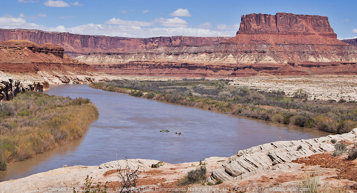 |
| Lovely day for a canoe paddle, too. |
 |
| WRT runs along side the Green River here. |
It wasn't much farther until we came to our camp at Potato Bottom. Unfortunately, the salt cedar formed too thick a bramble to be able to reach the river. But it was a nice spot and, as always, with amazing views.
 |
| Here's our camp. Photo's a bit faded as the lens is in the sun. |
 |
| From as close as I got to the river, looking back at camp and Bighorn Mesa. |
 |
| The trees were just starting to leaf out. |
 |
| Discussion group by our table rock. Photo by Bob. |
Bob and I took a nice walk up the wash into Potato Bottom Basin that evening.
 |
| Looking up into Potato Bottom Basin. |
 |
| Don't know what kind of plant this is, but I liked the shape. |
 |
| This sandstone was forming leaves of a different order. |
 |
| Greetings from Potato Bottom Basin. |
 |
| Bob as Spiderman. |
 |
| As we walked back to camp, the sun sank behind this formation. |
This concludes Day 3. The story continues on Day 4 & 5.


