Showing posts with label Blue Crossing CG. Show all posts

Monday, November 8, 2021

Season Finale, NM & AZ - October 2021: Part 3

Part 3 of 3 - Driving out of NM into AZ

Begin this trip from Part 1

Continued from Part 2

October 22nd (continued)


Highway 180

When I got off the mountain and drove through the village of Gila, I pulled off the highway before entering US-180. I had to decide if I was going to turn right (north) or left toward Silver City and maybe the City of Rocks Campground. I'll spare you my internal debate of all the options. 

I decided to go north, then take NM-78 west to US-191 in Arizona where I'd go north up through the Apache National Forest. I have been wanting to camp at a cute, little campground I'd found on an earlier trip along the Blue River. Maybe this was a good time.

As I got close to the junction I realized I'd be driving west and south across more dry hills and plateaus with sparse piñon and juniper, much like the last several days. At the last minute I changed my mind and kept going north. This would take me up into the mountains, then I would cut west on Pueblo Park Rd, FS-232, though the San Francisco Mountains to Blue, AZ.

I stopped again at the Leopold Picnic area for... a picnic (and to use the toilet.) I proceeded on after lunch, stopping again in Glenwood to top off my tank. A ways north of there the highway begins to climb up into the mountains. About 5 miles before the junction with NM-12 was the sign for the Pueblo Park Campground where I turned toward the west. 


Pueblo Park Road

This was County Route CO-13 or FS-232. The dirt road had been very recently graded and was as smooth with no washboard. You could still see the tread marks from the grader in the soft dirt. The road snaked though a ponderosa forest. Once again, in retrospect, I should have taken a photo.


Pueblo Park Campground

In six miles I came to the campground. It was pleasant enough, though not remarkable. It is situated in old growth ponderosa. If you were traveling on US-180 and needed a place to spend the night, even dragging a medium to small trailer, you would find it convenient. There is a corral if you have horses with you and want to ride.

After my reconnaissance I turned toward Blue, AZ. The road continued smooth only about a mile farther. It begins climbing though rocky terrain. Then becomes very rough as it skirts around Saddle Mountain. The view off to the south would have been amazing except for the haze that day, made worse by the sun being in the southern sky.

Saddle Mountain

Progress was very slow and this is even after having a road crew pass though. I could see where they'd filled in a couple of wash-outs, but I also found one or two that they had missed. My recommendation is to NOT access Pueblo Park Campground from the west. It took quite a while to get past this rocky section.

Just before the state line is the junction with FS-209 that winds north and eventually comes out at US-180. I have no idea about the condition of the road. The USFS map shows it as gravel suitable for passenger cars, but they have also marked the rough road I barely made it through the same. The usual rules apply.

Once I crossed into Arizona the road was no longer freshly graded, but it was also in good condition. There was evidence of previous low-intensity wildfires in places, perhaps prescription burns. The dirt road descends for several miles down to the community of Blue on the Blue River. I turned north on the Blue River Road and soon came to the junction with Red Hill Road. I turned left onto Red Hill, drove through a shallow water crossing of the small river. Immediately thereafter is the access road to the campground on the north side.


Blue Crossing Campground

I first found Blue Crossing Campground on my 2015 spring shakedown. It is named Blue Crossing I believe as the road crosses the Blue River at this location.

I wrote:

As the road reached the bottom there was the Blue River and a green, riparian area.... There is a tiny campground there called Blue Crossing - a gem hidden in a thick grove of narrow-leaf cottonwoods. I will want to camp there on a return trip. I did stop for about an hour to walk about, try to take photos of the many birds I could hear in the trees and brush, look for dragonflies (none) and have lunch.

I had been hoping since then that my travels and timing would align so I could get here to camp. This was the time. As I drove in on the narrow access road I became concerned. First, there had been no sign announcing the campground. Secondly, there were large piles of logs and slash on either side of the road. As I got close enough that I could see a USFS bulletin board I could also see a large, three-railed barricade with a Road Closed sign. Oh, dear. I drove on to learn my fate and hoped if all else there was a place to turn around.

I discovered the closed road was placed across an old trail that ran between the campground and the river. Why they placed a highway barricade there to close it off instead of simply rolling a big log or a few large rocks on the side road, I don't know. It had given me a scare and I bet it's driven off many a visitor.

The entry to the campground was open and inviting. It was like moving into another world of calm and beauty. Trees in their autumn colors closed in from all sides with their branches forming a cathedral ceiling overhead. The ground and road were dusted with fallen leaves of all colors. 

Blue Crossing Campground

The bulletin board said to camp only in designated sites. The first two small campsites, beside the road, had Adirondack style shelters, picnic tables, and a fire ring. The third drive-in site was perfect for a small camper and a tent, also with a table and fire ring. There were only 3 sites in this hobbit sized campground, thought the USFS webpage says 4. There is also a very clean vault toilet with men's and women's sides.

Perfect. Even more charming than I'd remembered. How often is that the case? The compact campground was lovingly maintained. I could see where they had removed side limbs from a mature ponderosa rather than risk them falling on a camper. There was ample vegetation to provide the sites privacy, but not so much that it felt overgrown.

My cozy campsite.

After I set up in the third site, I grabbed my camera to go explore. At the end of the campground was an interesting looking gate. On the gate was a sign I wasn't expecting here. It warned not to "destroy any historic or prehistoric objects, ruins, or sites." I looked up and there was an exposed rock face. Could there be...? Sure enough, there were petroglyphs! 

The petroglyph rocks are fenced off to encourage visitors to behave themselves.

Wow, I had totally missed seeing those last time. They were beautiful and I could see no defacement which was a boon. According to the placard these petroglyphs were likely created between 700 and 900 years ago by the Mogollon Culture.

One of the petroglyph rocks

There are two sections of petroglyphs in this photo.

In another location I noticed an unusual set of rock steps. There was an information sign nearby explaining they were a stile/bench made by the CCC when the campground was built in the mid-1930s. The rock was hand fashioned using the feathers & wedges technique. The stone steps were once the main entrance to the campground. I also learned the lean-to shelters in the other campsites were restorations of the original shelters built by the CCC.

Stone steps hand made by CCC stoneworkers.

The Blue River flows just to the east of the campground.

Colorful foliage in the campground.

Campsites 1& 2 have these log shelters.

A grove just to the north of the campground.

What a delightful place that I had all to myself. There wasn't a sunset, per se, but I did see some color in the clouds though the weave of the bare tree branches -  almost like an aurora borealis.

Red sky at night; camper's delight.

The only negative was that Red Hill Road climbed past close by. Many small, loud trucks pulling cattle trailers rattled down the road perhaps on their way to the corrals I'd seen beside Blue River Road. The saving grace was the trucks stopped once it got dark.


Saturday, October 23

Blue Crossing (continued)

It was cold in the morning, 31º as I recall. Consequently, I didn't get outside until after 10am. I took a short walk up the valley. It was still chilly, but warming quickly. Many of the deciduous trees had already lost their leaves or were well on their way. There were some ponderosa and piñon. Almost all the flowers were gone by, though a few chamisa still had some blossoms that the few butterflies were visiting.

My campsite in morning light... well, late morning light.

A dry wash along my amble north of the campground.


A Sulphur butterfly on Chamisa near the river.


Red Hill Road

I broke camp and turned right going up Red Hill Road. I stopped and took a photo looking down on the campground. You can't see the sites for the trees, but you can see the rocks where the petroglyphs are located. I understood why the trucks yesterday sounded so loud.

Looking down at the petroglyph rocks from the road.

I noticed a few side roads as I drove northwest. One was marked as a trailhead. Others may lead to dispersed campsites. I stopped again for photos of some rock formations.


I had remembered from my previous trip that there were interesting and prominent, red sandstone formations on the road. Last time the light had not been good so I crossed my fingers. I was lucky this time that the largest formation was in excellent light.

Aerial view of the red sandstone formation.

I pulled off the road to launch my drone. I captured a still image of the formation, above, then took a spherical panorama. This turned out well and was also useful once home. At the time I thought the formation was Red Hill, but according to the map it is to the left on the west side of the canyon. Panning left in the panorama you can see Red Hill, though it doesn't appear particularly red as it is covered with vegetation. "Turn around" and far to the south is the Blue Range Primitive Area.

I continued up the the road and noticed an old corral with an excellent view of the red sandstone formation. I pulled into the circular road at the corral to take a photo. Not only was the view great, but the shape of the clouds almost made it seem like the formation was a benign volcano. For the purists, I apologize as I could not stop myself from over saturating the image in postprocessing.

Another view of the red formation.

The road continues to wind up the valley, then climbs up onto a plateau. At a hairpin turn almost to the top is a vista point. You will see the Blue Mountains in the background. The hills in the foreground appear to be covered in dead trees. At least that is what I thought until I looked at my old blog post photos and saw the trees were bright green - probably oaks or other fast growing deciduous trees that had turned brown.

View looking back from the top of the climb.

At the top I turned right onto FS-58. The elevation gain at this point is enough to cause a transition from piñon/juniper forest to ponderosa pine. In fact the large, mature ponderosas were quite majestic. Once again I've failed you by not taking a photo. By the time I thought of it I was into newer growth (and I seem to have a strong predilection to never backtrack for a photo - maybe I should work on that.) There were dispersed campsites all though here.

Ponderosa pine in Apache National Forest

The road came out onto US-191 where I turned right, north. Along much of this section is scaring from the enormous Wallow wildfire of 2011.


Alpine, AZ

The highway drops down into the town of Alpine. At the junction with US-180 there was a NM pickup truck with signs offering tamales for sale. As I drove past an impulse caused me to pull off. I was hoping he had ready-to-eat food like you will often find at junctions in northern New Mexico cooked by the nearby tribes. Unfortunately (or not) he was selling frozen dozen-lots of homemade pork or beef tamales and batter or cornmeal chile rellenos. I bought a dozen pork tamales, being a traditionalist. I put 8 into my freezer and four into the fridge so they would slowly defrost to eat at home. (And OMG were they ever delicious!)

I got back on the highway headed north though the foothills toward Springerville where I'd turn right to head back to New Mexico on US-60. Of course now I was getting hungry so tried to find a place to eat the light lunch I'd prepared before breaking camp this morning. I finally found a gravel road marked as Wildlife Viewing. I've subsequently learned this road leads to the White Mountains Wildlife Area. I didn't drive that far, but pulled off at a close-by parking area to have lunch. 

As I was stretching my legs I noticed a flat-topped mountain way off across the grasslands. It was so far away that it wouldn't have attracted my interest on its own, but the cloud formation seemed to frame it. I've now learned that this is Escudilla Mountain, a wilderness area north of Alpine.

Escudilla Mountain framed by the clouds.


Highway 60

At Springerville I connected up with US-60 East. Nothing but NM plains for 50 miles until Quemado where I turned north on NM-36 as the first leg of the back way to I-40. From there north on NM-117 that leads through El Malpais National Monument. The stark and magnificent landscape was a joy to behold, but I was too focused on getting home to stop for photos. Sorry. But then, again, I have covered the scene in two previous blog posts that you can find here.


I-40 to Home

On the freeway, with all the big rigs speeding along, a tailwind let me keep up with the traffic and even pass some. There was construction near Laguna that slowed everyone down, queuing up to get into a single lane. Perhaps because it was Saturday, it wasn't as bad as I had feared.

Coming into Albuquerque I glanced over to my left and got my first look at Amazon's new fulfillment center, which is scheduled to finish and be in service by the end of the year. OMG - that's the largest building I've ever seen. I think it would rival many professional football stadiums for shear volume. I'm hoping that once it gets going my 2-day Prime deliveries will actually get to me in two days rather than the 3 to 4 that it takes now.


Home Sweet Home

I made it safely home with just enough time to unload the truck and camper before dark. This was a fantastic season finale and I'm glad you came along via my blog. In the time it took to publish I have stored my camper in the garage for the winter. I hope you will come along next season, as well.


Thursday, June 11, 2015

Spring Shakedown 2015 - Part 2

Important Note: I am organizing this trip report into separate sections to both make it easier to read and to organize the geographical areas for your future trip planning.


  • Part I comprises part of Wednesday and part of Saturday covering El Malpais National Monument. This breaks the timeline, but puts all of El Malpais in one section.
  • This section, Part II covers the rest of Wednesday, Thursday, Friday, and Saturday morning in the Apache and Gila National Forests.
  • Part III covers El Morro National Monument from Saturday evening through Sunday afternoon.
  • Part IV is a photo gallery of the inscriptions of El Morro National Monument. I separated this out as they will be of only limited historical interest for most folks.


II. Apache and Gila National Forests

Wednesday, May 20th (continued)


Quemado Ranger District, Gila National Forest


Leaving El Malpais via highway 117, I took SR-36 to Quemado [kee-MOD-oh] where I stopped at the Apache NF District Ranger Station for advice. The nice lady there explained my options and gave me a report of good road conditions for Apache National Forest. 

I took SR-32 south from Quemado, then turned east on SR-103 which changed from pavement to gravel just before Quemado Lake. The lake was extremely low as this area of the state has been exceptionally dry. There were still a number of folks fishing and campgrounds were nice enough. The one closest to the lake, Juniper, had lots of RVs all in one small area as it offers full hookups. There were several more campgrounds and there were very few people in those. The El Caso campground is farther from the lake and has several small units in a riparian area and there is no fee. However, I drove on as it was only 4pm and I wasn't ready to stop. Though I wish I'd taken a photo or two of this area.

The forest road 13 was in great condition and I thought I'd check out the Mangas Look Out. By the time I got there it was 5:30. The ranger said the tower cabin was closed until 8am, but I could climb the stairs if I wanted. I did climb the very steep stairs. The view was wide, as you might imagine, but the atmosphere was hazy.

Mangas Mountain Lookout tower

Northerly view from upper step of the tower.

Looking southwest from the tower. Note the light colored clearing in the center; I'll refer to it later.

Curiously, I saw two groups of very weathered backpackers walking in this area (more worn looking than your typical Rocky Mountain backpackers with which I'm more familiar). They were hiking along the road intent on going somewhere, but I couldn't figure out where as there didn't seem to be any specific attractions in the direction they were going. Later I realized I'd been driving back and forth along the continental divide. Looking at my maps I discovered the Continental Divide National Scenic Trail runs through the area I was exploring. I bet that explains the hikers.

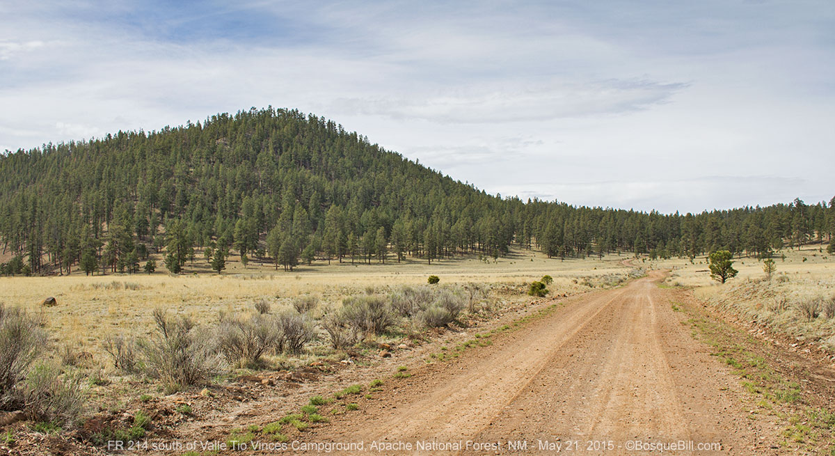
I drove back down the 4 miles to the valley and found a nice level spot in the Valle Tio Vinces Campground, that the lady at the ranger station recommended. It is "partially developed," i.e., there is a vault toilet. I settled in all by my lonesome, had dinner, then about dusk a pickup truck came in, parked across the road and unloaded wood, I thought, and built a small fire. Turns out the other campers were three brothers from Magdalena, NM who were up in the mountains hunting for elk antlers. We conversed for a few minutes and I wished them good night and good luck in their gathering. I wasn't until the next day that I suddenly wondered what they were going to do with the antlers - I guess I was a but slow on the uptake. (The next day I saw a general store in Reserve with a big banner: We Buy Antlers. So maybe that is the simple answer.)

I went to bed and realized it was very, very quiet. The brothers made no noise and this area must not be under any flight path. Before I drifted off, though, a distant pack of coyotes sang me a lullaby.

Thursday, May 21st


It was 26º when I awoke in the morning, but the furnace kept me warm.

After breakfast I took a nice walk up the hill to the south of the campground. It was very pleasant to stretch my legs and attempt to photograph some birds.

View of my campsite as I walk up the hill.

Yellow Groundsel, I'm not positive I identified the species correctly.

Mistletoe can weaken trees, but it is an eye-catching red and there was not much of it around, fortunately.

The ground was vey rocky at the top.

There were a number of flycatchers working the woods. This drab bird is a common species.

This chickadee appeared to be molting. It was bug hunting in scrub oak.

Another view of the Ponderosa Pines around Valle Tio Vinces.

I broke camp and drove down forest road 214 to HWY 12, turning right toward Reserve, NM where there was a district ranger station for Gila [HEE-lah] National Forest.

The road south, leading to SR-12, cuts through this large clearing that was visible from the Mangas L.O., remember?

Reserve Ranger District, Gila National Forest


On the way to Reserve I checked out Apache Springs Campground, in the woods off the highway. It was nice, but there is no access to the creek. I checked the creek for dragonflies at the bridge, even though it was cool and cloudy. I saw a blue darner, but that was all. I also spotted a hawk land at the tippy-top of an evergreen tree.

Red-tail lighted briefly atop this tree; can you ID the species from its cones?

I found the Reserve District Ranger Station just west of town on SR-12. There I solicited advice on where to explore from here and for a recommendation for where to have lunch. Yolanda gave an enthusiastic review of Carmen's back at the highway junction and added that as it was Thursday, the special would be tacos for a dollar each. Turns out they also had rolled, cheese enchiladas for $1.50 each. I ordered two tacos and two enchiladas. She also recommended the red chile sauce, so I made that selection for the enchiladas. Wow. Delicious! The tacos didn't need any extra salsa, as the ground beef was specially seasoned and the lettuce & tomato had a light dressing, too. If you're ever in the neighborhood, stop there for breakfast, lunch or dinner. And yes, the red chile was outstanding.

I filled my tank which was half empty by this time at $3.36 per gallon, quite a bit higher than the $2.49 at Costco near my house. But I did get a free weather report... cloudy, cool, sprinkles and maybe a bit of rain. Not the clear & sunny report I read before starting my trip. Oh, well.

As the "highway" climbed up from Reserve, there was a pretty view of distant mountains to the west.
I believe this is the Blue Range, that I'll drive through later in the trip.

Sure enough as I drove south from Reserve on SR-435, I ran into a few sprinkles, then a bit of rain. I headed toward Snow Lake, which I'd been told was a lovely area. The road is "paved" for the first several miles, then gravel actually in better condition. The forest along the way was a patchwork of slight wildfire damage and no damage.

FR-28 cut through this large grassland, home of the T-Bar Ranch.

Once on top of the mesa, following 28 south, the devastation was much more severe. I turned off on 142 toward Snow Lake amid further fire damage. A few miles in I saw what I thought was a coyote run across the road, then a second one ran across right in front of my truck. My casual impression was that it was a sturdy looking coyote, holding a very bushy tail strait out behind as it loped across the road and up the hillside, but didn't think any more about it at that time.

Snow Lake

Snow Lake is nice, and not as low as Quemado Lake. It is in a grassy valley surrounded by unburned forest. There is a campground situated above the lake and there is a loop of sites, suitable for tents or campers, with a nice view of the lake, but without trees it would be vulnerable to winds.

I decided instead to backtrack a bit, then continue south on 28 to the Ben Lilly Campground along Willow Creek. Yolanda at the ranger station said it was a small campground with only 5 sites, but her very favorite in the area.

Ben Lilly and Willow Creek


The campground was lovely and I had my pick of sites next to Willow Creek. As I sit here in my camper, typing this report on my iPad, I'm the only one in this tiny campground. (Note: if you use an iPad for writing, I can recommend the new Logitech Ultrathin Magnetic clip-on keyboard cover. However, I had problems on this trip as the batteries were low. It takes 2 common coin batteries.)  I found my spot about 3pm, took a short walk up the creek and on my way back it started raining lightly. I sat in the cab until it let up, then raised the camper roof. It is now 4:30 and it has been sprinkling or raining on and off. I can hear the creek and a few birds singing.

My campsite. Willow Creek is between my camper and those fir trees.

The sun came out for a while about 5pm allowing me to walk around a bit before the sky darkened again. I saw a notice posted that endangered Mexican Wolves have been released this area of the Gila. Hmm, that got me thinking about those two unusual coyotes I saw earlier in the day. For more information on the release of these wolves, click here.

Here is a view of Willow Creek where it ran past my campsite.

Friday, May 22nd


It was 26º again this morning. After breakfast it had warmed up enough for me to take a walk farther up the road. The map showed ended at private property about a little ways along. As I was leaving the campground I wished good morning to my neighbors, a couple who had pulled into the campground just as it was getting dark and set up a small tent. This friendly couple, Mark and Maria, had planned to backpack, but didn't realize their route was in a burned out area, so they stopped here instead. They were wondering where to go to continue their trip. I said if they were going to the southern part of the Gila that I strongly recommended the Gila Cliff Dwelling National Monument. They hadn't been there before and were happy for the recommendation.

I had a very nice walk up the road and back.

I find it interesting this species of cactus thrives both in the hot lava fields and cool mountains.

This junco perched cooperatively for my camera.

It was more of a challenge capturing an image of this warbler.

On my return the Forest Ranger pulled in to the campground for a routine check. I was able to get an update on road conditions from Ranger Tory and ask her if maybe the coyotes I saw had actually been Mexican Wolves that have been released into the area. From my description, she believed I had indeed seen wolves. Cool!

I thought I'd have to backtrack to Reserve, as a sign south of town stated that State Highway 159 was closed between Willow Creek and Mogollon. Tory, however, said it was indeed open and in fact she'd driven in on it this very morning. She said it was a bit rocky in places, but no 4WD was needed. Very good. She also encouraged me to drive into Arizona and explore the national forest there, and not be discouraged by the big wildfire of 2011.

Glenwood Ranger District, Gila National Forest


I broke camp and got on "highway" 159, aka Bursum Road. Once I climbed up out of the canyon, the wildfire damage from the Whitewater-Baldy Fire Complex was extensive all along the ridge.

Looking across the fire damage toward the north.

From the same spot as the previous photo, but looking south up the mountain.

More information on the Whitewater-Baldy Fire Complex

Once I crossed the divide and descended into the canyon, it was much less severe. But all along the canyon bottom was evidence of flooding in the form of cobble size rocks covering everything along the bottom. I should have taken a photo, but for some reason didn't.

I spotted this butterfly next to Silver Creek along the canyon bottom.

The road continued into the old mining town Mogollon [muggy-own] which was probably a quaint little village before the flood. They've had time to make some repairs. And this Memorial Day weekend was to be the official re-opening of the historical mining town (though I was a day early, so even the one cafe was still closed.)

Northwest of Mogollon was this old mine - I believe it is the historic Fanny Hill mine.

Alpine Ranger District, Apache-Sitgreaves National Forest


SR-159 led to US-180 which I took north into Apache NF, crossed some lovely scenery into Arizona, and drove into the town of Alpine. I stopped at the district ranger station there which is officially the Apache-Sitgreaves National Forest. Andrea helped me with my enquires and she was very knowledgeable, interesting and informative. She confirmed that the Wallow fire of 2011, though very damaging to some areas, only lightly touched others that were already recovering, and that there were many other areas that escaped the fire all together.

She helped me put together an itinerary that would take me through some scenic areas and provided advice on campground and dispersed camping. She suggested I drive along the East Fork of the Black River where there were a series of small campgrounds. From there I should cut back east, cross US-191 and continue on forest roads through an area where Big Horn Sheep were regularly seen (though she didn't know what time of day they usually appeared.) From there return north to Alpine, then up another forest road where there had been lots of elk sightings.

I took her suggestions heading west on highway 249 just north of Alpine, then south on forest road 276 and into the valley of the East Fork of the Black River. This was indeed a nice area along the small river. There were many open campsites, though many were already taken for the holiday weekend, too. The problem from my perspective was the gusty winds were kicking up dust from the road and carrying it into the campsites. The best site I found felt like it was in the middle of a wind tunnel, so instead of camping, I turned left on FR-24 to look for a dispersed campsite out of the wind.

This TV was sitting on the shoulder of the road next to the East Fork of the Black river.
When I drove up it flew onto this limb to pose for its photograph.

A short distance along 24 I turned north on the unimproved road 405, where there were a few RVs dry-camped in the meadows. I continued on and took a left fork onto 405C that was too rough and narrow for big trailers and found a pretty little glen shielded from the wind by a nice hill and some trees.

My secluded and sheltered campsite.

Saturday, May 23rd


It was a chilly 25º this morning and instead of my usual after breakfast hike, I drove back to 24 headed south through the forest to turn onto eastbound road 26. This was a lovely area of Ponderosa pines, rolling hills and meadows either untouched by the fire or only lightly touched, though the ridges and hill-tops enclosing the broad valley had been throughly scorched.

Close-up of a Wild Iris along a side road.

Looking up from the iris bed, one can see the fire came through here only
enough to blacken the tree bark and not hot enough to kill the grasses.

There were numerous side roads one could take for dispersed campsite, though there were no running creeks or views to enhance one's site. The area north of the last half of the road before you get to the US highway is closed for part of the year to allow the elk a quiet area to raise their calves.

The Blue Range


I crossed US-191 and continued east, now on 567, named Red Hill Road. Within a couple of miles the terrain changed dramatically. Where I had been driving through verdant, forested hills, now the land dropped away into a large, rugged and much dryer canyon land. Where before one could only see a short ways into a meadow or wood, here the vista was across many miles of deep, ridged valleys. There were the red hills off to the right, after which the road is named, and a very dramatic, red sandstone formation next to the road on the left.

The vista a few miles east of US-191.

The Blue Range in the distance.
I was intrigued by the red sandstone formations, so took many photos.

An early glimpse of the formations.

Another photo as I drive closer.

This Wooly Paintbrush was perched on the high side of the road cut.

A close view of the formations.

Looking back at the red sandstone formations.
The road continues to wind its way down through this scenic area that reminded me of the southern Arizona mountains such as the Chiricahua. South and west of the road is the Blue Range Primitive Area.  Even though without official "wilderness" designation, motorized transport is still prohibited except along a narrow corridor. The Blue Range is the last primitive area in the national forest system.

As the road reached the bottom there was the Blue River and a green, riparian area very similar to that found in the Chiricahua Mountains. There is a tiny campground there called Blue Crossing - a gem hidden in a thick grove of narrow-leaf cottonwoods. I will want to camp there on a return trip. I did stop for about an hour to walk about, try to take photos of the many birds I could hear in the trees and brush, look for dragonflies (none) and have lunch.

The first resident of the campground that I saw, in a dry wash.

Though Flickers generally feed on the ground, this one was in a tree (to get away from me, I guess.)

This is one of the heavily shaded campsites where I stopped for lunch. No one else was around.
The creek is about 20 yards off to the left.

On my way out of the campground I paused to photograph this quail.

From the crossing I proceeded north on County Road 67004 which follows the Blue River for about the first half of its length. This is a dry area, lightly forested, with interesting sandstone formations. There is also some private land along the road.

One of many formations along the lower portion of the road.

This long-eared fellow scampered across the road and paused in this tree to pose for me.

I returned to Alpine via US-180 and thought I'd try the road where Andrea said there'd been a large herd of elk. She'd suggested going to Nutrioso, then south on CR-2269; I decided to simply start at the south end of that road where it is forest road 81. As I started up the road I realized why she'd suggested starting from the north - the first several miles were though an area that had been badly devastated by the Wallow fire. The road was OK, though narrow and there were run-off bars placed across the road frequently.

I was actually glad I came this way as it was instructive to see the damage and note the aspen returning. Andrea had said the Forest Service planted grass seed by air after the fire and the grasses were healthy. Andrea also said they'd planted wheat and barley in this area as high energy, quick growing fodder for the elk. They don't expect the grains to survive over the years, but to fill the gap until the native grasses are restored. I didn't see any elk at all, however.

Fire damage northwest of Alpine.

Looking south, back up the road from where I took the previous photo.

I continued up US-180/191 to Springerville where I filled my gas tank and my stomach. I then drove east on US-60 toward Quemado. I hadn't initially intended to backtrack my route home, but by wandering around the way I ended up doing, that was the only logical route unless I wanted to add many miles through less interesting territory.

US-60 a few miles after crossing back into New Mexico. Rain on the horizon, but I never ran into it.

Note: the timeline of the trip actually jumps back to Part I at this point in the narrative. 

The next published post, however, will cover the time after that at El Morro National Monument.