Saturday, June 29, 2013

Bryce Canyon Photo Gallery

Finally, I present a few of the hundreds of photos I took at Bryce Canyon National Park in southern Utah while camping there on May 21 and 22, 2013. The main blog post, which includes two photos of Bryce Canyon not in this gallery can be found here.

The first afternoon, after claiming my camping spot, I drove to the end of the road and started viewing from each of the overlooks as I worked my way back. Unfortunately, the sky was not great for photos, covered with high clouds, and a forest fire to the west created a haze in the atmosphere. Consequently, I didn't include any of those photos. Those overlooks do not have the density of hoodoos as "the Amphitheater," as it is called, but do afford grand vistas. I did include three photos from late that evening, which I placed at the very end of the gallery - organizing by time, though not by date.

The second morning I met my friend Kevin, who works as an interpretive Ranger at Bryce, and we rode the shuttle bus to Bryce Point. The gallery begins there. We walked the trail to Inspiration Point. I highly recommend this easy hike. It is mostly level and affords spectacular views of Bryce Canyon. Beforehand, I thought the scenery might be a bit repetitive, as one walks around the rim of the same canyon complex, but was I ever wrong. Every turn of the trail revealed new, fascinating perspectives.

Remember, you may click on any photo to view them all in a light-table format or slide-show.

Panorama from Bryce Point. I recommend the slightly larger version.

Iconic Hoodoos

I like the alternating pink and white of this formation.

A single white Hoodoo and colorful soils.
There were flowers and birds aplenty along the trail, if you could tear your eyes from the canyon views.
I did enjoy the flowers, but apparently didn't take very many photos.

White cliff and red Hoodoos with a vista.

Red, white and blue... and green.

The view from Inspiration Point, the terminus of our delightful walk. The slightly larger version.

These pretty flowers adorned my campsite.

After a nice afternoon nap, I set off to walk down the trail to the Queens Garden - a "must see" according to my photog buddy Chris, who used to haunt southern Utah, and now I agree completely.

A view from near the top of the trail in the general direction of the Queens Garden.

Along the trail there are tall Ponderosa pines.

Interesting formations as I look up toward the canyon rim.

A Ponderosa that has withstood the tests of time and a hint of the modern
world that I chose not to photoshop out of the image.

A cute little chipmunk who wasn't particularly afraid of all the humans walking the trail.
As proof, this photo was taken with my wide-angle lens.

Here the Queens Garden Trail winds through one of several man-made tunnels.

Looking through a tunnel opening. They were tall enough for me to stand upright.

At the end of the trail, this informative plaque was erected.

The Queen, herself, atop the left pinnacle. 

On the way back up, I caught this juxtaposition. Not sure why I like this so much, but I do.

Another tree perspective.

An open area of trail affording a wider view.

More dead trees framed by the rock - this time a tunnel.

Nothing left of this tree but its roots providing an organic contrast to the geology.

Now for the photographs from my first evening:

Moonrise

The layered soils from which Hoodoos spring and the evening sun lighting the horizon.

The last rays of the sun illuminate this bluff on the north end of the park.

Thank you for looking at my photos. I hope they either bring back fond memories of your earlier visit or encourage you to go to this amazing natural wonder for yourself!

Tuesday, June 18, 2013

Brief Foray into Colorado

I'm falling behind. As I write this post I've already completed another trip to southwestern Colorado and I haven't even worked through the Bryce Canyon photos from this trip, yet. So much to do; so little time.

This post covers my last stop on my way home from Overland Expo 2013 in Flagstaff. In the last post I was leaving Utah on my way to Colorado. I took US-491 from Monticello, UT to Cortez, CO. Another area where I had no idea there was so much agriculture. Apparently beans are a major crop in this area, and cattle ranching. In Colorado on the way to Cortez I saw genuine cowboys herding cattle from horseback.

Since I hadn't planned on coming to Colorado this trip I hadn't yet purchased the Benchmark map atlas of Colorado and since it was a week-end the forest service information stations were closed. No matter, I refueled in Cortez and I'd wing it. Other than a quick trip up to Colorado Springs and Denver last fall when I drove my sedan up to check out the Four Wheel Campers in person, this would be my first return to the state since the mid 1970s.

I headed north on Colorado Highway 145, a.k.a. Railroad Avenue, which runs alongside the Dolores River toward Telluride. Once I got to the town of Dolores the countryside changed from open piñon and juniper to forests and mountains. Unfortunately, I was so busy admiring the view I forgot to take a picture.

As I made my way up the canyon into the San Juan Mountains a big smile crept across my face. This was looking like the Colorado I remembered and loved to visit back when I was a young man with a VW Campmobile! Nothing as beautiful as the west slope with the towering, snow-capped mountain peaks.

View along the highway, part of the "San Juan Skyway" scenic highway route.

I took a few photos of the mountains from the highway, but they just don't convey the beauty of the area. As I got closer to Telluride the peaks got higher and even more beautiful. I wasn't sure if I'd visited Telluride all those years ago. I remembered Durango, Silverton, Ouray, Gunnison, and Aspen, but as soon as I saw Telluride with the sheer mountain face and the long, narrow waterfall behind it, I remembered that view for sure. Breath-taking!

Telluride, Colorado

I drove into town just to see it, not really to stop and visit. Good thing, as it was crowded. I got a map at the tourist bureau and asked if the Last Dollar Road was open. The nice lady replied that the guys who ran the jeep tours business next door had just told her that it was indeed open. I hadn't planned to do that road this trip, but I did have my Colorado Backroads guide book which had directions and a map.

I left town and the turn-off to Last Dollar Road was well marked. I drove past the very small airport and marveled at the number of fancy jets on the apron and limousines in the parking lot. Yes, lots of money up in this neck of the woods. The road was graded at that point with private drives to both modest cabins and top-tier estates.

A bit farther up the road and another cowboy rode into view leading about a dozen horses. Gotta love Colorado.

Moving the horses to fresh pasture.

The road climbed and climbed and the views were spectacular.

You should view this photo in a larger size.

The road moved up into an Aspen grove and saw this warning sign - looked like they meant business.

CAUTION
Very slick mud when wet next 8 miles
4-wheel Drive
Good Tires Only

The road narrowed, crossed a talus field, and got quite rocky. I was remembering what the Land Rover drivers had emphasized "go as slow as possible; as fast as necessary."

Talus Slope (this photo was actually taken on my way back down the mountain.)

I came to a wide spot in the road with the ruins of an abandoned cabin in a turn-out, so I stopped there to evaluate if I wanted to proceed. I could see a water crossing down the hill and could make out the road clinging to the side of the next mountain, climbing steeply.

I saw an older model, high-clearance 4WD truck of some type come up the hill toward me. I waved and they stopped. I asked them how the road was ahead. They replied with a name I didn't recognize and I quickly realized they didn't speak English. Chagrined that I'd grown up in New Mexico and didn't speak Spanish, I nonetheless asked, "¿Via esta bueno?" As pathetic as my attempt to communicate was, they understood what I was asking. The driver shook his head and the passenger waggled his hand in the universal gesture of "not so much." As I only had street tires on my truck, I decided not to push my luck and turned around to head back down the mountain. (There is a hidden irony here which I will share in an upcoming post from my next trip to Colorado.)

On my drive up earlier in the day I had noticed some possible dispersed campsites along the highway below the village of Rico, so drove down to check them out. I'd also seen a side road next to a creek in the same area on my way up. I came to it first and turned east to check it out. It was an old wagon road following Scotch Creek that connected Rico to the Animas Valley back in the 1870s. The informational sign indicated it was only suitable for 4WD vehicles, but I was game for a try.


It was very rocky and again I was concerned for my OEM tires and walked part of the road to make sure I had clearance before driving up. I only had to go about a quarter of a mile to find a wonderful campsite right next to to the creek (which was larger than some rivers in New Mexico.) After setting up the camper, I walked around the immediate area admiring the trees, canyon walls, butterflies, flowers and always the roaring creek. Late that evening I saw my first Marmot making its way across a talus slope near my campsite. It was delightful that night falling asleep to the water's song.

This photo shows how close I was to the wonderfully musical creek.

My campsite. Didn't realize until later how the tree leaned over me.

The next morning I walked up the canyon about a mile or so, watching the birds and admiring the beauty of the canyon. At the upper end of my walk I got my macro lens out of the bag and enjoyed photographing some of the tiny flowers around my feet. Here are some photos from that morning.

Typical of the canyon walls with rock cliffs and talus slopes; fir and aspen.

Butterflies were flitting from flower to flower.

A pretty blue violet hiding in the grasses in a shady area of the forest floor. Macro photograph.

The road winds up the canyon.

A colorful Western Tanager briefly out in the open.

Teeny, tiny white flowers. Macro photograph.

The road is uncharacteristically smooth in this spot.

Many of the butterflies were also lapping up minerals where the ground was wet.

There were lots of Juncos foraging along the ground.

This individual looks worn, but not as much as others of this species that I saw.

The columbine flowers in the canyon had not quite opened. Macro photograph. 

After my walk, I had a spot of lunch and began packing for my return to civilization. This unplanned stop in Colorado had been the perfect end of a fabulous trip that had begun with Overland Expo, a run up the Great Western Trail in Arizona and an interesting journey across southern Utah (covered in previous posts.) All in all, a roaring success in my trusty Tacoma and camper!

Thanks for reading along.

Sunday, June 9, 2013

Across Southern Utah

In the last installment I'd just crossed into Utah following the Great Western Trail, which placed me on US-89 just east of Kanab. My goal for the day was to drive to Bryce Canyon National Park in time to get a campsite at this very popular destination. Lots of folks told me I should have gone to Zion National Park, but I decided to save that for another trip.

Driving north from Kanab the highway winds through and up an interesting canyon with large, vertical rock slabs as its sides. These red rocks look like they've been scoured by a giant grinder, but I supposed it was only the wind. I don't have photos, perhaps because I didn't see a good place to pull off the highway, or perhaps I was too focused on getting up the highway. It has been difficult for me to judge drive times in these areas that I've never visited before.

Bryce Canyon is really a plateau into which a number of canyons have cut. These canyons are filled with the park's iconic Hoodoos. I took nearly 400 digital photos of Bryce which I've yet to process. I'll save those for a later photo gallery post. In the meantime I'll include the requisite campsite shot and a photo of an interesting tree.

There are excellent sites for small campers in the tent area of the campground.

Along the Queen's Garden trail.
Bryce was gorgeous and amazing; a place everyone should visit. The plateau is at 6000 to 8000 feet in elevation, so is much cooler than the other Utah parks, such as Canyonlands and Arches. I had the added benefit of personally knowing one of the interpretive Rangers and we had a great hike the next morning between Bryce Point and Inspiration Point. Gorgeous! I stayed two nights in the park.

From Bryce Canyon I drove east on Highway 12, which is part of the state recognized scenic loop highway. It was interesting and I hadn't realized how much agriculture there is in southern Utah. I stopped at the Federal Interagency Information Station in Escalante to pick up maps and brochures for a future trip - a nice facility with helpful people. I picked up info on the Dixie National Forest and Escalante-Grand Staircase National Monument.

Continuing east from Escalante the scenery at first seemed rather plain, then you drop off the edge!

Looking back west from whence I came. Can you follow the highway all the way to the top?

Soon  you come to the canyon containing the Escalante River.

Highway 12 overlook above the Escalante River.

From there you wind up a canyon and the next thing you know you're on a "hogback" with a steep drop-offs on either side. By the time I found a place to pull off the narrow highway for a photo it wasn't quite as spectacular.

Looking south along a hogback on Highway 12.
Soon thereafter the highway turns and starts heading up into the mountains. There are large stands of Aspen. It is distressing, however, to see many colonies totally dead. My first in person experience with Sudden Aspen Decline. See also this short Smithsonian article: What's Killing the Aspen?

The highway climbs quite high up and around Bluebell Knoll, which is actually a very large mountain, and it got very chilly! Lots of recreation opportunities up here, but quite far from most places, and no specific, spectacular attractions as one comes to expect in this region.

The highway drops thousands of feet within a few miles on the north side and soon you find yourself back in the desert. Here Highway 12 goes north and joins Hwy 24. I turned southeast.

It was hot and very windy as I entered Capitol Reef National Park where I had intended to camp. Unfortunately, even though I got there around noon, hundreds of other folks got there sooner and all the spots in the lovely campground were full to overflowing. The campground doesn't take reservations, but people must have headed out early for Memorial Day.

Looks like an interesting place to return. The campground and valley are noted for the historical orchard and community of Fruita.

I didn't stop for photos, but keep going down the road past more intriguing rock formations, which I also didn't stop to photograph.

I finally stopped for a late lunch in Hanksville near the junction with Hwy 95 where I'd turn south. I stopped at a cafe that was part of an RV park not expecting too much with the name of Duke's Slickrock Grill, but needed a break from driving. Turned out it was a very nice stop, clean and cool inside, with good food - I had a full meal with vegetables, salad, and everything. They also had wireless Internet and was able to check my email after my meal.

Heading down 95 was a long, boring stretch which got slightly more interesting as the highway started down into this branch of Glenn Canyon, but it was still hot and windy.

No sign of a lake at the crossing, only a trickle of river, and I didn't bother taking the turn-off to Hite.

I did stop at Natural Bridges National Monument, the first national park in Utah, created by Teddy Roosevelt. It was getting on toward 4pm and I didn't expect to camp at the small campground here. The ranger gave me half a sheet of paper they'd prepared to assist folks in finding a nearby dispersed camp on BLM land.

I drove the loop road, stopping at each of the three overlooks. To get a good look at the rock bridges would actually take a little time to walk down the steep trail to the canyon bottom, which I elected to do on another occasion.


I did find a good camp spot on Deer Flat Road with a large juniper to help shield me from the winds.

Campsite along the road, sheltered by the junipers.

After I setup I watched the full moon rise over the red hills.

Moonrise over my campsite.

The next morning I returned to the highway and soon thereafter turned south on Utah 291. I had been wanting to visit Muley Point for some years since seeing a wonderful photograph of Monument Valley viewed from there. I had originally planned to camp along the canyon edge, but it had been just too windy for such an exposed location the night before and this morning I felt like there were just too many places to go in my journey to pause there for a whole day.

On my way down 291 I stopped at the BLM Kane Gulch Ranger Station to learn what I could about the area. Turns out this particular patch is fairly interesting. The nearby finger canyon coming up from Glenn Canyon is called Grand Gulch. There are a number of hiking trails and archeological sites to explore. Site visitation requires a permit as the number of visitors is limited each day to mitigate the impact of visitation on these fragile sites. Permits are required for all hiking here, so plan to stop at the station. Another area for a return visit, perhaps in early spring or late fall.

Muley Point lived up to my expectations. You turn west just where the pavement ends (or begins depending upon which direction you're driving) and take a very good dirt road to the point. All except the last 50 yards is suitable for a 2WD sedan. I didn't actually follow the road all the way to the official point as the initial overlook is so spectacular. I'm looking forward to a return visit with camping. I'm sure the dusk and dawn looking over the canyon is inspiring. My photos don't really give you even a hit at how amazing the canyon view is from here; you'll have to see it for yourself.

A gigantic rock perched at the canyon edge.

Monument Valley in the distance.

The drive down Moki Dugway was super scenic and fun. The road is dug into the cliff as it drops hundreds of feet just about straight down.

View from partway down Moki Dugway.
I didn't know what exactly to expect from Utah's Valley of the Gods. People said it was worth a visit; said it was like a miniature Monument Valley; but frankly it didn't look like much when I made the turn onto the unmarked road near the bottom of Moki Dugway.

A short ways in there was an informational board from the BLM to reassure me I was in the right place. The first part of the drive was fun, the road looks wicked, but is actually pretty tame, though I did drag my steps in a couple of places. I was thinking it was a charming area and pulled off in one of the dispersed camping spots for a spot of lunch with a view.

Having lunch at a turn-out along the Valley of the Gods road.

A little farther on the road and the scenery took a turn for the more spectacular. No, not as grand as Monument Valley, but wonderful nonetheless and there are lots and lots of free dispersed camping spots with fabulous views of the rock formations. This will be a great place to come back on a moonless night to try star trail photography with the interesting rock formations creating a foreground to contrast against the sky... though not when the wind is strong, as you are totally in the open.

Valley of the Gods, BLM, Utah
A fellow voyager from Albuquerque, who I meet at Muley Point, recommended a coffee house just as you arrive at the town of Bluff. I forgot the name (Bluebird Cafe?), but it is on the north side of Main Street, US 191. I had a non-coffee, iced drink with an unpronounceable name. It had chocolate, mint, and creme and was super delicious! They serve hot breakfasts in the morning and sandwiches for lunch.

I didn't know if I should bail on my trip and head for home or what. My preconceived schedule had been shot and I had planned to head home from here, but by not stopping at Capitol Reef I was a day ahead of my plans. I decided to instead head north from Bluff. I saw on the map that there was a national forest just west of Monticello, UT, then the next morning I thought I'd poke my head into Colorado with my "extra" day, maybe head toward Telluride.

I stopped for directions at the Forest Service office in Monticello. There's only one road out of town west toward the mountain, but it is not well marked. Lots of dispersed camping spots, mostly taken by folks with trailers or tent colonies and ATVs. I found an isolated spot and crossed my fingers.

My verdant campsite. A closeup of the mountain and valley in the following photo.

The La Sal Mountains east of Moab and Canyonlands as seen from my campsite.

Turns out I was't bothered by ATVs and the lovely little meadow had a great view of the La Sal Mountains to the northeast with interesting canyon formations in the middle distance. It got cold that night.

The next morning fortunately I was up early enough that I wasn't awakened by baying hounds. Apparently this area is a popular spot for running hunting hounds. The three trucks driven by rustic Americans had special kennels in back and were driven around with the hounds perched on top of the kennels, baying at the wind. I packed up and hit the road eastward.

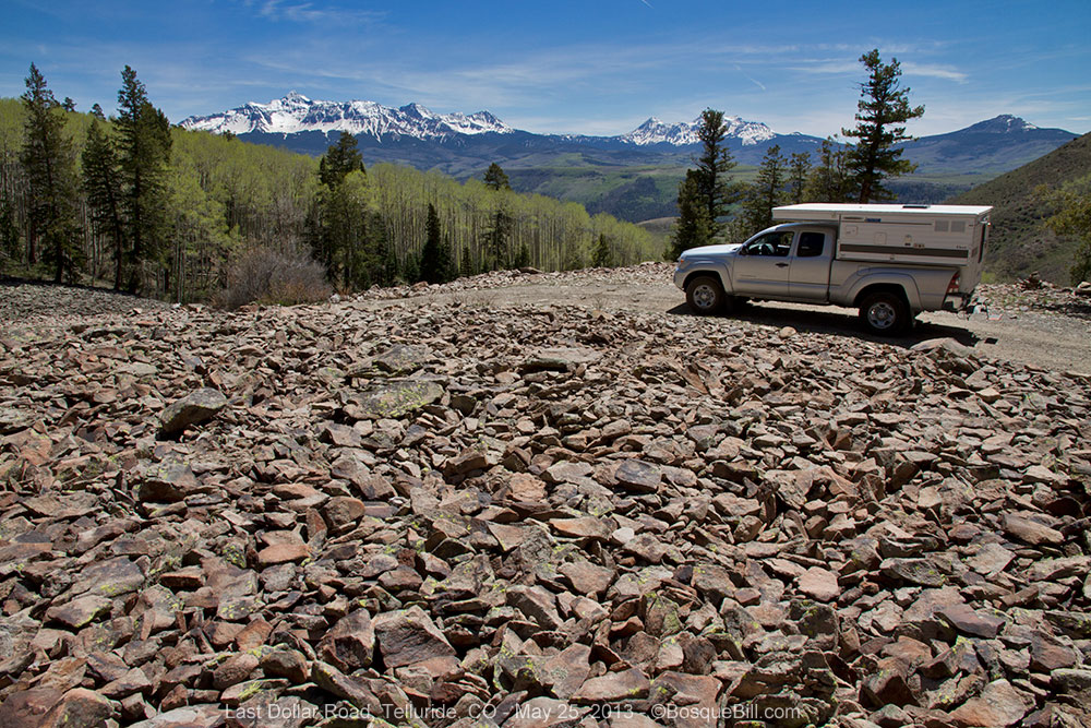
My next, much shorter post will cover my brief trip into Colorado.

Thanks for visiting!