Bears Ears National Monument in Two Parts
April 26 - May 2, 2022
Preface
A year ago I asked my readers if anyone knew what was down Fry Canyon off UT-95, between Natural Bridges and the Colorado River. The road is about 12 miles west of the junction with UT-276. John from Arizona kindly replied that is was a very interesting place which he'd visited a number of times. We exchanged several emails. He described Radium King & Moss Back Roads and the interesting terrain & geology. I navigated to the area in Google Earth, looked around at ground level, and got quite excited by the potential.
I wanted to go last fall, but John warned all the bentonite clay soils made the roads impassible when wet, and the forecast was chancy. I hoped this spring would be my opportunity as the forecast was dry, dry, dry. I shouldn't need to remind regular blog visitors that there is very little shade in these mid-elevation Utah landscapes. The piñon and juniper trees are just not tall enough as you can see from my photos. Spring and Fall are the times to visit and camp. Winter is chancy as at 6000 to 7000 feet elevation it will be cold indeed during the night, and snow is not unheard of.
He had also mentioned Burch Canyon Road as interesting. I saw that there were backroads beyond Burch Canyon that ran northwest roughly parallel to UT-95 though BLM lands along ridges and canyons that looked worth exploring. I knew no one who had been that way, but the roads looked OK in the satellite images, so I was determined find out. I'd do that loop first as it was higher in elevation and the weather forecast had the warmer temperatures early in the week. When it cooled off I'd explore lower down.
Part 1 of 2
Click photos to view larger versions in a view screen where you may use the arrow keys to move.
Tuesday, April 26th
Angel Peak Scenic Area
I again chose to only drive as far as BLM's Angel Peak Recreation Area in northern New Mexico the first day. This spot is a few miles off US-550, south of Bloomfield. It is situated on the edge of a plateau and overlooks the eponymous Angel Peak and the banded colors of the badlands below. My previous blog posts on Angel Peak contain more details and more photos. I also have a spherical panorama that gives a sense of the location.
A short first day also allows me to finishing my packing in the morning without trying to rush. I left the house about 3:30pm and arrived about 6pm. I drove through the official campground and, as usual, the sites with a view of the peak and badlands were taken. I drove back to the excellent site where I camped last time along the road to "The Cliffs Picnic Area".
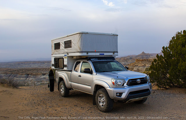 |
| My campsite at The Cliffs |
Before setting up I walked the short distance to the picnic area where there are tables under ramadas and a vault toilet. I saw a pickup truck and "baby" Airstream camped at one of the tables. As I was admiring the view an older couple (though probably younger than me) and their very enthusiastically friendly dog said hello. This was Dane and his wife (whose name went in one ear and out the other, sorry) are from Wyoming, near the north entrance to Yellowstone. They love the southwest and make a trek down every year. They were camped here as the campground at Chaco Canyon was full, which is par for the course (reservations are recommended.) We enjoyed swapping stories for a little while before I returned to my camper and set up. It was a cloudy evening, so I didn't take many photos, but the wind was mild.
Wednesday, April 27th
Angel Peak (continued)
The light wasn't that great for photos this morning, so I only took a few and am only posting this one.
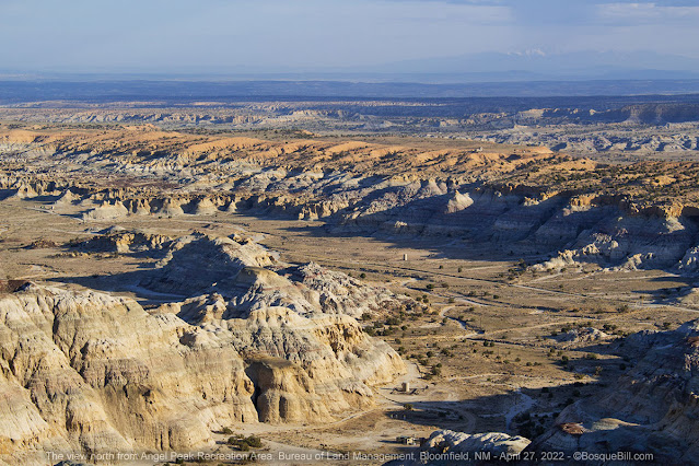 |
| View north from my campsite showing the badlands and the oil rigs & roadways |
I packed up and hit the road just after 9am, headed north on US-550. I took my usual Bloomfield/Farmington bypass route (drop me a line if you want details,) US-64 west into Arizona, then north from Red Mesa to Montezuma Creek. I topped off my tank at White Mesa on US-191 before heading west on UT-95.
Burch Canyon Road
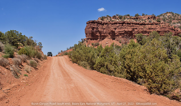 |
| Lower Burch Canyon Road. The gentleman driving the Jeep apologized for ruining my photo; "Not at all I," replied. "I'll just add to the caption: Jeep for scale." |
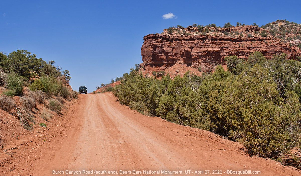
I took the turn-off toward Natural Bridges after crossing Cedar Mesa. The first dirt road one comes to leads up to Elk Ridge. The second dirt road to the right has a sign for Deer Flat; this is Burch Canyon Road. Burch Canyon is the larger of the two canyons which comprise Natural Bridges NM, the second is Deer Canyon. The first few miles has many dispersed campsites. Many of these sites fill up with Natural Bridges campground overflow, but as you drive farther the sites become nicer and slightly less likely to be taken. However, once you make a sharp turn around the end of the first white sandstone canyon there are no more sites.
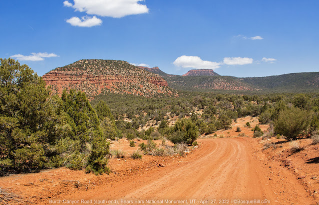 |
| A partial view of the Bears Ears behind the bluff. |
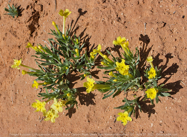 |
| Fringed Puccoon blooming along the road. |
The road is generally in good shape and easy. The final climb affords the best view of the canyon complex and is quite scenic. The last section has very steep climbs, is narrow, and with a drop off right there.
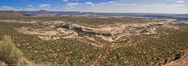 |
Deer Canyon in the foreground; Burch Canyon beyond. Both feed into Natural Bridges NM.
This is a very wide, 3-image panorama, so click then widen your browser window. |
Deer Flat
Once on top the terrain opens up. You are now headed NE on Deer Flat Road. The flat is mostly sagebrush and clump grasses. There were a few spring wildflowers. The road then reenters piñon/juniper woodlands.
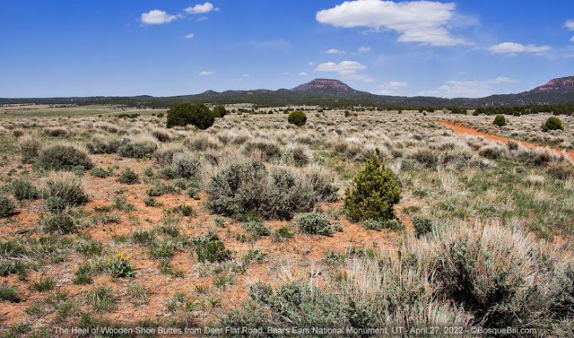 |
| Deer Flat with Wooden Shoe Buttes in the background. |
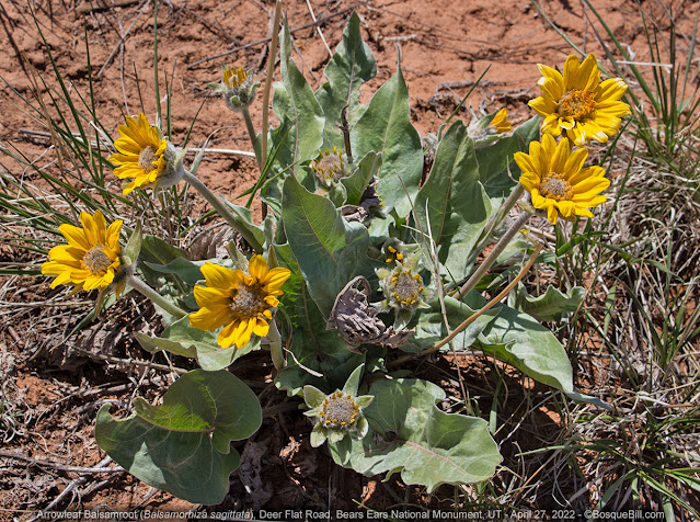 |
| Arrowleaf Balsamroot. |
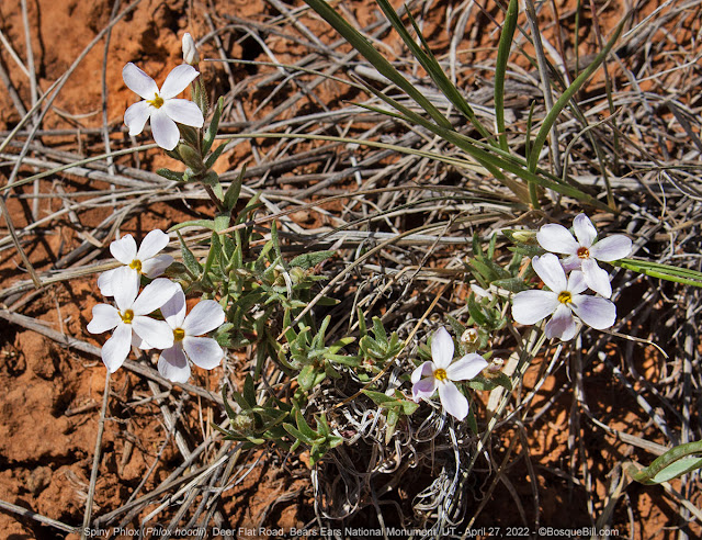 |
| Tiny flowers on Spiny Phlox. |
Wooden Shoe Road
I passed the left turn labeled as Wooden Shoe Road, which was my ultimate travel direction, but first I wanted to look for a campsite in the lee of Wooden Shoe Buttes as the wind was picking up. I went straight, which is the eastern section of Wooden Shoe Road, CR-256. However, my maps didn't seem to match where I was traveling, they didn't match each other either. In retrospect I should have been using one of my GPS enabled maps on my phone, but the way seemed straight-forward. I thought I was going around The Heel Butte, but was actually going around The Toe. I was on Wooden Shoe Road, so I wasn't lost. I came out where I expected, so no problem. If you look at Google Maps it shows lots of roads that are not really there or are not suitable for highway vehicles.
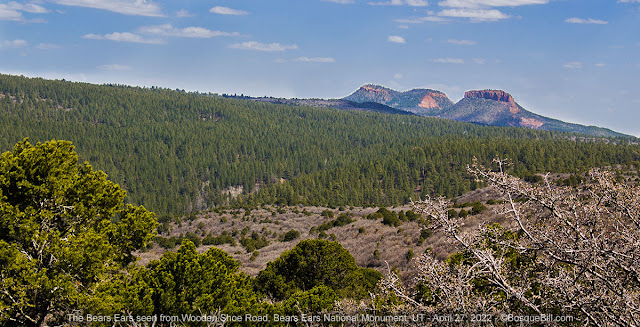 |
| The Bears Ears seen from Wooden Shoe Road. |
The road curved toward the southeast. The slopes leading toward Dark Canyon were thick with scrub oak that had not put out leaves for the season. There were no campsites, zero. I finally found one, just before the national forest boundary. It was a lovely green meadow beneath mature pine trees and a view of a butte. Unfortunately, due to the terrain it was too much of a wind tunnel than I would wish to subject myself to.
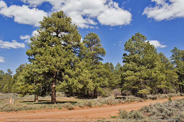 |
| Mature pines shading a lovely campsite. |
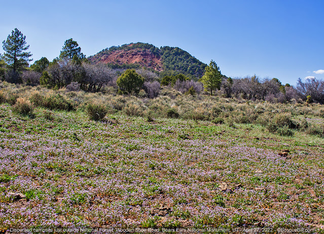 |
| Tiny flowers cover the ground. |
I continued on into the forest and down the side road to Wooden Shoe trailhead, but there were no suitable campsites. In a pinch I suppose you could camp at the trailhead, but as it was only 3pm I turned around and headed back the way I'd come.
I made the turn onto west Wooden Shoe Road, CR-256, which I would follow the rest of the day. The road was interesting in parts with views off the ridge and at other times just a road though the pine/piñon forest. The road was in good condition overall, though there were a few bumpy spots. There were no campsites. There were cattle ponds. I kept following the most traveled path at junctions. The side roads, some of which I peeked down, were in poor condition and gave no indication of possibly having good campsites. The road began to take on a straighter NW orientation and dropping in altitude. At close to it's northern most point there is a spur to a landing strip, which I also didn't take.
Lost Canyon
The road turned southerly with red cliffs and ridges on the left and open canyons bordered with Cedar Mesa sandstone on the right. There were wide vistas far to the west. I spotted a large flock of Piñon Jays moving though the trees, calling out to one another. The road was now well out of the pines and into the junipers. Approximately 5 miles after turning south, right where the road makes a sharp curve west was a slab of sandstone reaching out to the road on the inside of the curve. There was evidence of previous campers in the form of rock fire rings.
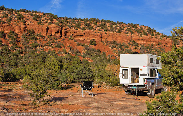 |
| Lost Canyon campsite with my chair set up on the "patio." |
I pulled off there and surveyed the site. It was beautiful. It was near the head of a white sandstone canyon surrounded on three sides by high cliffs of layered, red sandstone a thousand or so feet away affording an effective wind break. The sandstone on which I parked was enclosed by vibrant piñons and junipers, though there were also the inevitable dead trees one now sees everywhere in the drought stricken west. Far off on the horizon, mountains could just be seen through the thick haze. These were the Henry Mountains and the nearby Little Rockies. Through a gap in the distant cliffs I later discovered a glimpse of Jacob's Chair Butte.
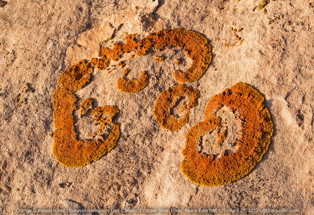 |
| Orange Sunburst Lichen—about 6 inches across—growing on the sandstone. |
It was 6pm. It was a very long day of driving, but I was rewarded with nature's beauty. I got set up by 7 and wandered around the immediate area looking down into the canyon and generally admiring the scenery. I set out my chair and enjoyed a little bit of a sunset over the Henry Mountains at 8pm.
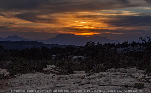 |
| Sunset over the Henry Mountains. |
Thursday, April 28th
Lost Canyon (continued)
My Benchmark road atlas called this Long Canyon, but several sources I've checked from home confirm it is named Lost Canyon.
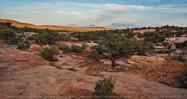 |
| Westerly morning view from my campsite across to the Henry Mountains. |
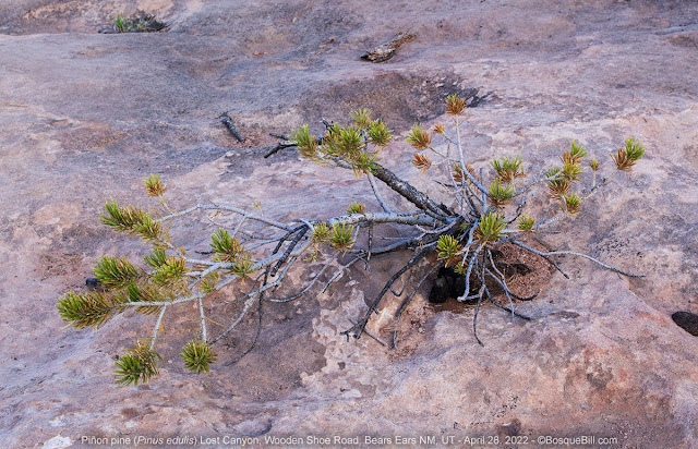 |
| Nature's bonsai, a piñon growing from a small pocket in the sandstone. |
It was a beautiful morning with a few clouds, though the haze was still pronounced along the horizon. It was chilly enough I set my camp chair in the sun to relax and enjoy my morning coffee. Ah, it felt good. I took a few photos around camp, including two with my telephoto lens. In retrospect, I should have taken the extension tube off for the Henry Mountains photo, or at lest framed it a bit better. Oh, well.
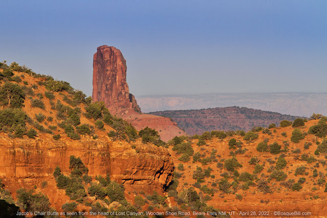 |
| The back of Jacob's Chair Butte from my campsite using a telephoto lens. |
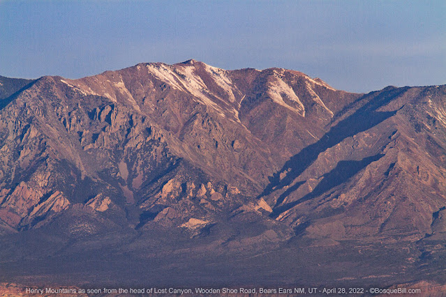 |
| Mt. Hillers of the Henry Mountains seen from my campsite. |
There was no doubt in my mind I would stay the day here to recover from my drive and the several days effort to mount my camper and prepare for the season. Seems preparations took a bit more out of me this year. It can't be because I'm getting old, no, perhaps I just sat on my butt too much last winter. I'll do better next year.
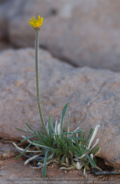 |
| A Colorado Rubberplant growing from a crack in the rock. |
Around 9am I took my drone up lest the winds pick back up in the afternoon. I took some photos and video. Here is a photo showing the beauty of my campsite, Jacob's Chair, Lost Canyon, and the far off mountains. The canyon looks more shallow than it is due to the angle of the photo. Not that it is that deep here near its head. I'm guessing it is about 20' deep at my campsite, then it drops off a ledge and is maybe 30' deep. Looked like there were places someone younger and more agile would have little trouble getting in and out. I figured I could get down, but might never get back out!
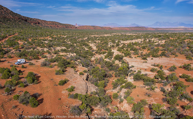 |
| Aerial view of my campsite, Lost Canyon, Jacob's Chair, and the Henry Mountains. |
A good sense of the entire area is provided by this spherical panorama. The light was challenging, especially toward the sun, so please ignore the seam in the sky. If your browser has a problem displaying the panorama, such as the Full-Screen icon not working,
click this link to view on the Kuula site.
After lunch I took a modest hike up a dry wash to get a closer look at the cliffs to the east. I was able to walk around a few of the obstacles, but finally had to give up as my agility was not up to the terrain. I returned to camp for more relaxing!
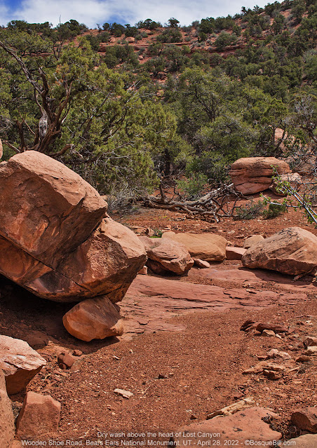 |
| View looking up the dry wash toward the cliffs. |
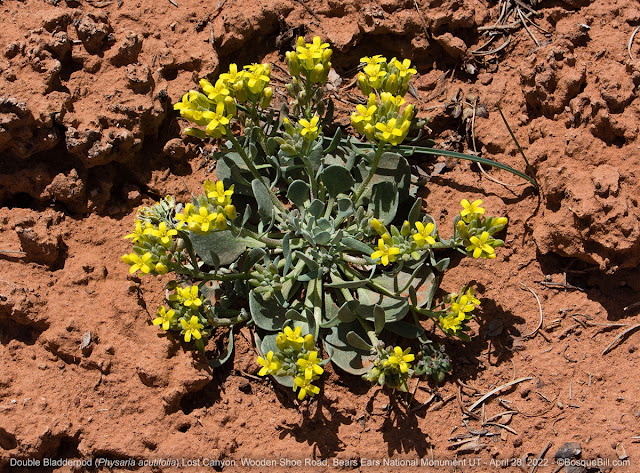 |
| A blooming Double Bladderpod plant seen on my hike up the wash. |
There were several birds vocalizing around camp. One was singing often across the canyon, but never came close for a look. There was a flycatcher that came through. His call was much like an Ash-throated specie. I did get a good photo which had me scratching my head as his chest and belly was so white, but studying the books there really is no alternative ID.
 |
| Ash-throated Flycatcher |
At some point in the afternoon, a few desultory cattle came walking up the road. They seemed shocked to see my camper and stopped dead in their tracks. It took them a quite a while to decide I was no threat and resume their trek. It appears to be a harsh land for cattle with little forage. I took no photos of the sun-baked beasts.
 |
| Looking back at my campsite from the canyon rim. |
A pretty sunset to bring a close to a lovely day.
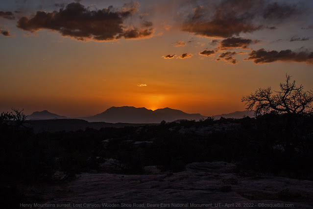 |
| Sunset as seen from my campsite. |
Friday, April 29th
Lost Canyon and Wooden Shoe Road (continued)
I enjoyed a leisurely morning soaking up the beauty of the area. I broke camp and got on the road about 10:30am. From here Wooden Shoe Road runs NW along the area between a ridge on the west and Lost Canyon on the east. The vegetation went from desert woodlands to bushes to scrub to low plants and native grasses. There were a few flowers beginning to bloom, too. There were a couple of Fremont's Barberry next to the road that were more heavily laden with blossoms than I'd ever seen.
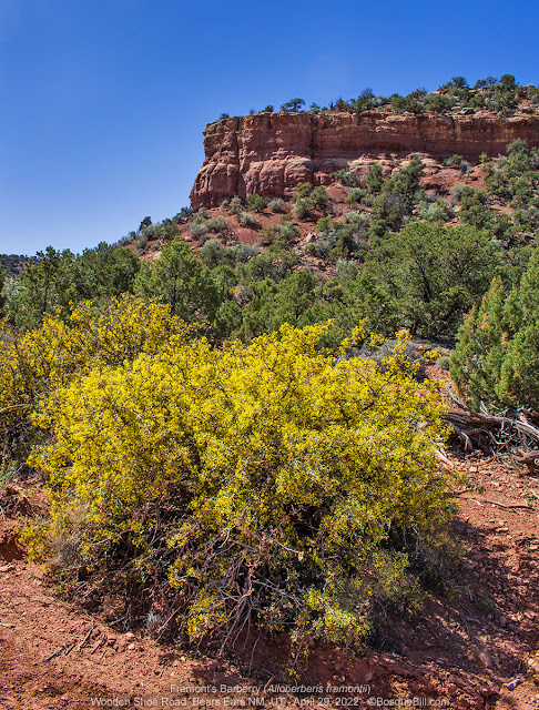 |
| Fremont's Barberry blooming alongside the road. |
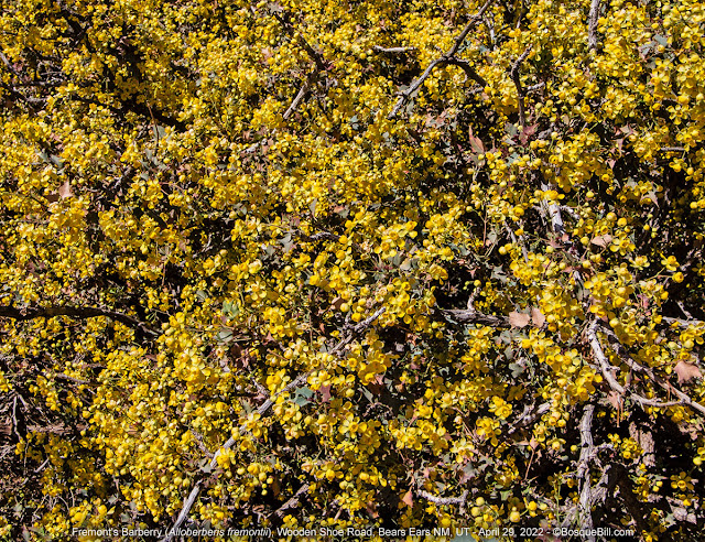 |
| A closer view of the profusion of blossoms. |
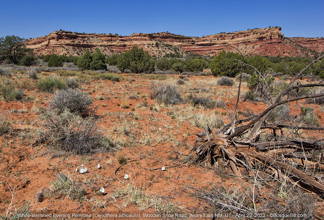
Here is where I stopped to photograph the Barberry. Note the smooth road surface--this is typical for this entire stretch. There seemed to be a few dispersed campsites long this stretch of the road, but I didn't stop to check them out.
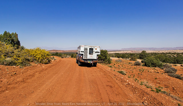 |
| Stopped to photograph the barberry plants. |
 |
| Stopped again here to photograph the flowers and the sandstone cliffs. |
 |
| White-stemmed Evening Primrose blooming in the morning light. |
For what it's worth, the entire time I was driving on Burch Canyon and Wooden Shoe Roads I saw not one single person. The entire time I was camped at Lost Canyon only two ATVs, traveling together, passed my campsite. When I reached Sun Dance trailhead there was one SUV driving out and several vehicles parked. I didn't see another vehicle or person until I came out on UT-95.
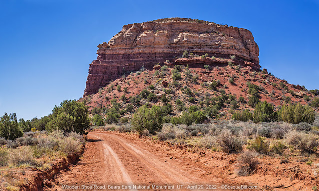 |
| Looking back toward this butte along the road. |
Sun Dance Trailhead
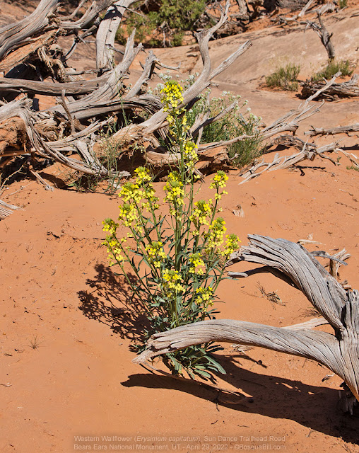 |
| A Western Wallflower posed alongside the road to the trailhead. |
About an hour after starting out I saw a sign pointing down a side road for the Sun Dance trailhead, 1 mile. I decided to explore. There is quite a bit of exposed sandstone in the roadbed leading to the trailhead, so the going was very slow. High clearance is recommended, though I saw compact SUVs parked at the trailhead.
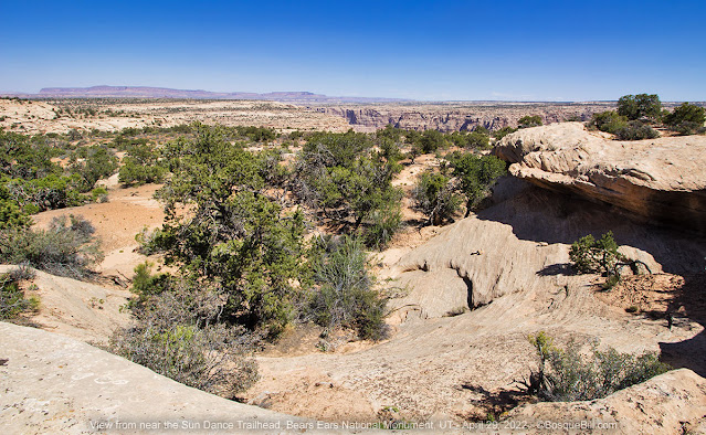 |
| View northwest from San Dance Trailhead. |
If you chose to visit, be aware that Google Maps and other sources show the road going much, much farther than a street legal vehicle can go. In fact, while I was there looking around I didn't even see tracks going farther. And I cannot see any sign of a road in the photos I took. There were about a half dozen vehicles parked at the trailhead on a large sandstone bench.
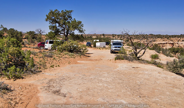 |
| Vehicles parked at Sun Dance Trailhead |
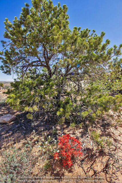 |
| Piñon and Paintbrush |
The views toward Dark Canyon and the Colorado River were dramatic. You could, if you wished, proceed (very slowly) about 50' farther along the sandstone where there was evidence of previous campsites. The views would be great as long as you didn't mind the parked cars and trucks in the foreground. There was also evidence of poor human hygiene practices, there being no toilet at the trailhead, so keep that in mind, too.
 |
| Canyon view from near the trailhead. |
 |
| The same view, but farther back from the sandstone rim. |
 |
| Sundrops, not primrose. |
I enjoyed the view while having lunch, then drove slowly back to Wooden Shoe Road and proceeded westerly. There are number of intersecting and branching unmarked roads, but the "main" route was easily determined as it was the only one showing signs of traffic. The main road merges with Fortknocker Canyon Road and takes that name.
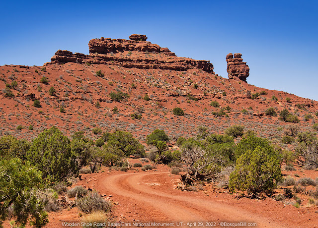 |
| View along Wooden Shoe Road. |
 |
| Looking northerly from Wooden Shoe Road |
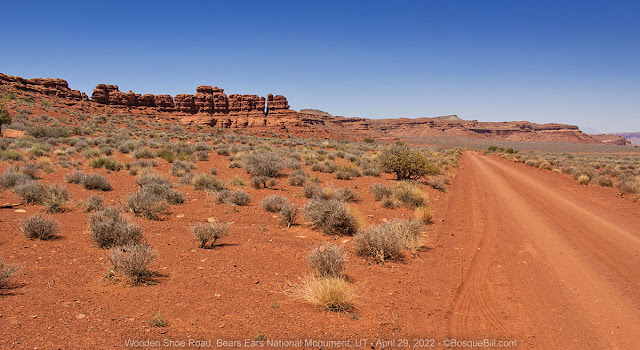 |
| Junction just over the rise. Don't know if this is Fortknocker Canyon Road, or not. |
White Canyon North Road
I finally came to a junction where both directions looked equally well traveled. The map showed both reaching UT-95. The northwest route enters Glen Canyon NRA. It may be slightly shorter before it gets to pavement, but the southeast route both looked more interesting and came out farther south on 95, which was my intended travel direction. So I turned southerly on White Canyon North Road (not that any of these backroads are marked or signed.)
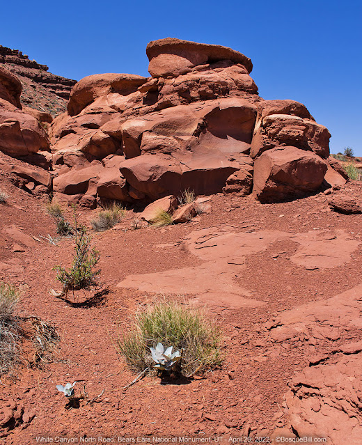 |
| Along White Canyon North Road. |
 |
| These white flagstones had naturally washed down to form this "path." |
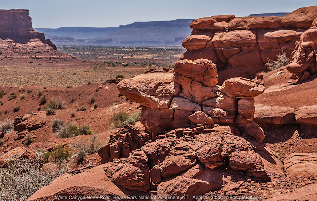 |
| Looking southerly toward UT-95. |
White Canyon, Red Canyon, not the most original names and White Canyon looked pretty red to me. There were some interesting rock formations and views. The road was in good condition, as were all the roads I drove on this loop. I took a few photos before reaching the highway.
 |
| Interesting cliffs along White Canyon North Road. |