
June 17 - 19, 2024
I wanted to get in one more camping trip before the heat of summer settled in and before the Independence Day holiday week. There had already been some hot days. However, the long range forecasts seemed to be showing the so-called monsoon season was beginning. I determined there might be a short window of opportunity if I moved quickly. I'd just head up to the northern New Mexico mountains to minimize travel time, thus maximizing time at my destination. I hoped it would be cool at elevation, though that's not always the case.
In considering my options, I decided to return to one of my favorites areas, the dispersed campground along the Rio de los Piños close to the Colorado border.
Monday, June 17
On the Highway
I headed up the Interstate and took the by-pass around Santa Fe. I stopped for provisions in Española and continued up US-285. There was road construction just north of Tres Piedras that caused a bit of a delay as a string of vehicles had to wait for a pilot car. The quickest way in to Rio de los Piños is just on the other side of the Colorado state line. First on narrow paved roads, then on gravel, passing a New Mexico State wildlife refuge that is popular with those fishing for trout.
Rio de los Piños
I found the nice spot where I camped last time and pulled in. When I stepped out of the truck, my legs were instantly covered with mosquitos. OMG! I'd camped along the river here many times and never had any issues with bugs. I wondered if it was only this one spot, so drove farther up the river and stopped at several other campsites, but they were just as bad. It was only mid-afternoon and there was no way I was going to slather myself in repellant only to sit around and wave off mosquitos all day. I decided to abandon my plans to camp here. I didn't take any photos this time. Click the link to the right for plenty of photos and description of my previous stays here.
I remembered there was a campground to the southwest, up in the same mountains, by a small lake called Lagunitas. I'd been there once about 10 years ago, but hadn't camped as the campground was covered in fallen trees—you could barely even drive in and most of the sites were inaccessible. It felt claustrophobic with all the downed timber so left after only a few minutes. Now I remembered reading somewhat recently that the campground had reopened. I'd drive that way, plus I knew there were quite a number of smaller dispersed sites in the general area if that didn't work out.
Carson National Forest
I left Rio de los Piños and turned south on NF-87A. I remembered there were some rocky stretches and after driving over one such I decided to pull over and air down my tires. When I drove on the ride was much, much smoother with my softer tires.

|
| View southeast from NF-87A |
I recalled there were a few dispersed sites on the ridge overlooking the Cruces Basin Wilderness. I saw the turn-offs, but it was way too windy to contemplate camping on the ridge line. At the intersection with NF-87 I continued straight ahead toward Lagunitas, which is the "main" route. This is a lovely section of road with views across wide alpine valleys.

|
| Roadside Lupines |
There were a few more rocky stretches and also some sections of road that showed deep ruts of hardened mud—not a road you'd want to travel early in the season or after heavy rainfall. I also noticed a few side roads or spurs. I'd have to explore those another time to see if there were interesting dispersed campsites up those.

|
| Southerly view from NF-87 of Cañon Largo |
Lower Lagunitas Campground
Laguntias is comprised of two old-style USFS campgrounds at 10,400 feet with a lower section next to the larger of the two lakes and an upper section on the NE ridge above the lake; they have separate access roads off NF-87. Both have a modern vault toilet. By "old style" I mean access to sites is narrow dirt roads and you can still find a site or two close to the lake; there are also heavy plank picnic tables. The USFS website claims 12 sites (most of the sites in the lower area had been closed off due to fallen timber for enough years that their access had all but disappeared beneath plants and grass; they are still there with their picnic tables if you search them out and are easily accessible.)
I turned off NF-87 about a half mile past the sign pointing to the upper campground. Both are clearly marked, unlike Los Piños where there is no sign. Less than a mile up a gentle climb you come to the campground where there is a vault toilet. At one of the first sites I spotted a USFS truck next to a picnic table with 4 people feasting on a watermelon. There was a nice view of the small lake.

|
| First view of upper Lagunitas Lake from my campsite |
I parked and walked over to talk to the workers who I assumed had been clearing and cutting fallen trees. They asked if I was going to camp there and I replied that I was thinking about it. They said they would be leaving in a few minutes if I wanted that site. I asked if they were going to be back the next day—thinking I might not want to camp there if the following day was going to be full of chainsaws running. They said they were not (but didn't say no one would be). They mentioned they were a wildfire crew from Arkansas. I guess fire crews who are staged are given tasks such as clearing fuel areas when there are no fires to fight.
Once the clearing crew left I backed into that site. It had a pretty view of the lake and surrounding hills. After I set up I was approached by a man who had camped a bit farther along the lake with his family. He asked if I had an axe. He wanted to split some of the many dry, cut logs left by the forest service to build a cook fire. At first I replied in the negative, but then remembered I had a nice hand axe (or large hatchet) I'd gotten on sale at REI, but only used a time or two. I dug it out of the bottom of my camper's under seat storage for him.

|
| My campsite |
I was rewarded later when I was invited to join Eugene and his family for a steak dinner that they'd cooked over coals from the wood they'd split. OMG, he had the best steaks (NY strip and ribeye), charred and cooked to perfection. What a treat! When I commented on the crust he showed me he used Montreal style seasoning as a dry rub. All enhanced by the view of the lake and hills on this beautiful evening.

|
| View of lake with wildflowers |
While we were talking after dinner we looked up when a tall, very weathered man walked up and asked if it was all right if he set up between my camper and Eugene's site. I blinked and asked him "Are those bike shorts you're wearing?" When he replied in the affirmative I then asked "Did you bicycle here?" "Yes," he replied. That's when I learned Lagunitas is on the Continental Divide Bicycle Trail. It's also a recommended stop on the Continental Divide Trail (CDT) for hikers, as well.
Eugene invited this newcomer to join us for dinner, but he declined wanting to set up his tent. As I long ago did some bicycle touring on the West Coast, I later spent some time talking to the cyclist, Dave, who is from the Yorkshire Dales in England. (This was also interesting to me as I've been reading a series of excellent English mystery novels that take place in the Yorkshire Dales, the Inspector Banks series. What are the odds?)
I also offered Dave water as I recalled from my bike tours that this was a precious commodity. The Lagunitas campground does not have potable water. Like the other cyclists and hikers he has a filtration system to get drinking water from the lake, but he was very happy not to have to use that at this stop. Perhaps that is why he generously shared a couple nips of his remaining stash of Speyside single malt. Mmmm—smooth!
Dave started his journey in the boot heel of New Mexico at Antelope Wells. Wow! He would follow the trail, mostly dirt and gravel roads, up the divide to Canada. He hoped he'd get to Calgary (if I remember right) to make his flight home. He was delayed getting started when the airline misplaced his cycling bags.
It was a very pleasant evening with a couple of beavers cruising the lake and feeding on the bottom vegetation. Only a few mosquitos came out briefly in the evening. The rest of the day was bug free!
Tuesday, June 18th
Lagunitas (continued)
The day dawned with beautiful blue skies and chilly temperatures. It was one of those mornings where the sun was a bit too hot and the shade a bit too cold which kept me moving my chair around while enjoying the view with my coffee.
Dave prepared to continue his trip and I took his photo as he was ready to ride off.

|
| Dave from the Yorkshire Dales, England |
I walked down to the bottom of the lake as I'd seen a footpath that appeared to go all the way around. I had assumed the lake was formed with a human made dam, as so many are in New Mexico, but it appears to be all natural—as is the pond just downstream. As I walked around I was chagrinned to see dark clouds moving in from the west. I knew a system was supposed to come though, but not until the next day, I thought. I was able to walk all the way around keeping my feet dry, but just barely.

|
| Upper lake at Lower Campground |

|
| View of my campsite from the other side of the lake |
Later in the morning I was greatly relieved when those heavy clouds moved away leaving clear blue behind. I walked the footpath down to the lower lake. There are several marshy ponds in the area, too. I explored around those ponds hoping to find dragonflies, but it was not to be.

|
| Lower lake |

|
| Trail Marker |
I also launched my drone to capture a spherical panorama to give you an overview of the area.
I was lazy, sitting in my chair and enjoying both the lake view and the antics of the fearless ground squirrels. I also ambled though the woods away from the lake looking for wildflowers. That's when I discovered the fallow campsites.


Eugene and his family left with me in sole possession of the campground. Though come evening I saw a hiker or two down at the lake filling their water bottles and setting up their tent in the trees near there.

|
| a.k.a., Cop Car Moth |

|
| Yellow-rumped Warbler at the tree top |
The beavers came out again and I spent an inordinate amount of time trying to get a good photo. A wonderful relaxing day in the lovely mountains.

|
| One of the two beaver in the upper lake |
Wednesday, June 19th
Lagunitas (continued)
Based upon the weather forecast I'd expected clouds on Wednesday heralding a storm. So when the sky was clear blue with no wind I thought I might be able to stay out one more day before the storm arrived. I would find a new campsite both for the variety and to get beyond the section of road I mentioned that showed evidence of deep mud when I drove in, just in case it did rain heavily.

|
| Douglas Squirrel with a snack |
I watched the antics of a squirrel next to my site. At first I couldn't figure out what he was eating, then I remembered the watermelon the forest crew had been eating. They must have discarded a piece in the bushes. This was confirmed when I saw the squirrel try to carry an entire piece up the tree, but it was just too heavy.
For the morning, though, I decided to hike north along the CDT for a mile or so (about all that my old knees will tolerate.) The trail climbs the ridge at the bottom of the lake and is not too steep. It provided a nice view of the lower lake. The trail here follows the ridge and there are additional views of the upper lake and the hills in the distance. It skirted the edge of the upper campground before climbing farther. There were a few wildflowers along the way. I stopped at a nice viewpoint before returning to camp. For campers who like to day hike this campground would provide a nice spot to explore either direction of the CDT.

|
| Pretty flowers along the Continental Divide Trail |

|
| A view of the lower lake from the trail |

|
| A view of the upper lake from the trail |

|
| Continental Divide Trail |
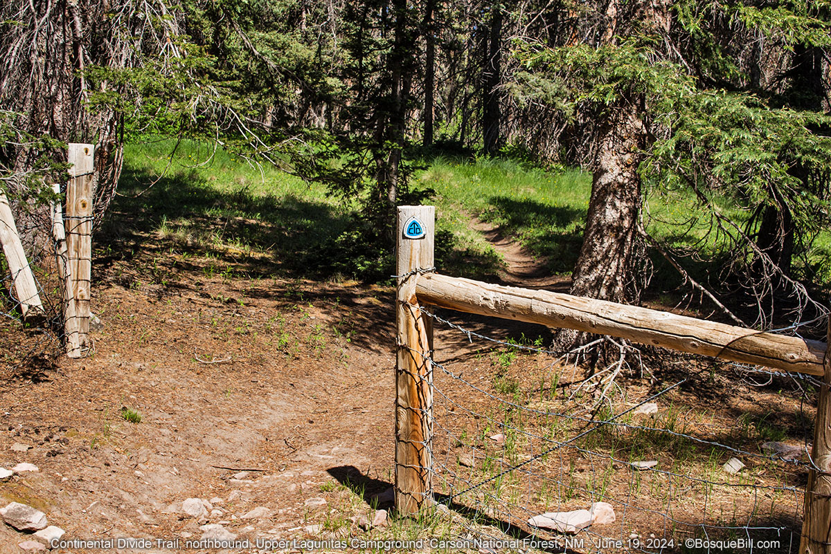
|
| Trail marker |

|
| A westerly view from the trail |

|
| Panorama of the ridge along which the CDT travels. |
After lunch I broke camp and headed back to NF-87. Looking at the map it showed that 87 continued west then up to CO-17, however I'd been warned by those with local knowledge that this is a very sketchy road and not to attempt it, so I'm passing that word along to you. I turned left (east) on NF-87 and drove the short distance to the entrance road to the upper Lagunitas campground. It's a good road and the little campground up on the ridge is nice. There is a vault toilet and the sites are spaced well apart. Two sites even have a bit of a view across the hills, but when I return I'll camp again in the lower campground close to the lake.

|
| A last view of my beautiful campsite. |
NF-87
Back on 87 headed east. I wanted to explore a couple of the side roads I'd seen driving in. I took the first one headed south and in less than a mile came to a lovely meadow on a ridge overlooking the mountains and valley to the south. However, the wind had picked up considerably and was howling across the meadow on the ridge. Not a good site to camp with southerly winds.
I tried another road to the south which lead to a larger meadow, what they call a "park" in Colorado. There was a shepherd's mobile hut and a horse grazing. I turned around about the time a man stepped out the door. I waved and drove off as he returned the salutation.

|
| A view toward the Cruces Basin Wilderness |
Later on I tried a road headed north, the Cruces Basin Wilderness access road, but it got uncomfortably rocky before I drove very far, so gave that up. When I got to the intersection of 87 and 87A, which I'd driven in, I turned right following the main 87 route. There were a number of side roads along here—I know they are popular with hunters in the fall. I didn't explore any as the clouds were getting heavier. I was beginning to think I should return to Plan A and head out rather than try another night.
When I came off the mountain instead of proceeding toward the highway I turned right on the road that follows Rio San Antonio upstream. From my detailed perusal of satellite imagery it looked like there might be nice areas to camp in the national forest 4 or 5 miles up the road. I figured I might as well explore while I was here. The first few miles are private property and beef ranching seems to be a viable concern. The road wasn't bad, exactly, but was slow going. I decided to stop and turn around as the weather was getting worse.

|
| A view up the road from where I turned around |
I returned to NF-87 and continued east. The road, especially the section just south of San Antonio Mountain had really deteriorated since I drove though a few years ago. It used to be good gravel the whole way; now there are sections of bare soil with deep ruts of dried mud. This is no longer an all-season road, just so you know.
I stopped at the turn-out where the public lands information sign is located to pump my tires back up to highway pressure. Wow, the wind was terrible with blowing dust! Miserable time to have to air up the tires, but unavoidable.
Back on pavement
I was delayed by road construction on US-285 again, but that gave me time to find a snack and restart my music playlist.
There were dark clouds ahead and the closer I got the darker they got. It started to rain at Ojo Caliente and by the time I got to US-84 it was torrential. I pulled off the highway in a wide spot, put on my flashers, and waited it out. Even with this slight delay my calculations would put me on the freeway south of Santa Fe at the heaviest commute time, so loitered in Española.
Nearing Santa Fe I heard the traffic report via our public classical music station. It warned I-25 was closed between the cities due to a multiple vehicle crash caused by a dust storm. Yikes! I contemplated the complete lack of any alternate routes and tried to get up to date info. I pulled off and tried both the 511 phone line (audio was horrible) and website, but neither had any info concerning a closure or even slow traffic. I started listening to AM radio and got only the tail end of a report "...open and traffic was slow, but moving." I crossed my fingers that this was referring to I-25.
Luckily all the reports were behind times and traffic was flowing smoothly the entire length of the freeway. There was still dust blowing, but it didn't significantly reduce visibility. So I got home safe, if a little later than I'd hoped.
This was a very enjoyable short trip to a lovely area of New Mexico. Thanks for coming along.
Lovely, pleasant. Thanks for sharing, Mr. Bosque
ReplyDeleteIt’s always a joy when these reports hit my inbox. I’m so envious.
ReplyDeleteYour trips are so interesting! And a book recommendation! Thanks for sharing.
ReplyDeleteLoved it as always. Glad you got home safe. Betty
ReplyDeleteAbsolutely beautiful. Thanks!
ReplyDeleteThanks, Rob. I agree. The area is beautiful and peaceful, too.
DeleteIt sure is fun to get away, and to such a nice area makes it even better! Thanks so much for allowing us to come along.
ReplyDeleteThanks, Ski, appreciate you stopping by.
DeleteReally great photos and narrative. Thank you for sharing.
ReplyDeleteWas good to read of your visit to Lagunitas lakes; which is a place my parents took us to camp in the 1960s when my family liivedd in Albuquerque.. From what I read, it seems the place has’nt changed much. I think we sadend to read another report of trash and dumping in that area; which I hope has been cleaned up by now. I hope to visit this area one more time within the next year. Thank you for sharing your adventure.
ReplyDelete