Sunday, May 26, 2019

Video: Valley of Fires, NM

This short, informational video was recorded primarily Spring 2019. Aerial views were were captured by a Mavic 2 Pro UAV; stills from an earlier visit.
For more photos of Valley of Fires, select my blog posting from the column at right.

Official website: https://www.blm.gov/visit/valley-of-fires

The video is in 4K UHD so I recommend watching on the YouTube site or select the full-screen icon.


If you enjoyed the video please consider giving it a thumbs-up, leaving a comment, and/or subscribing to my YouTube Channel.

Thanks for watching!

Wednesday, May 22, 2019

Video: Valley of the Gods, Utah

This short video was recorded primarily during the Fall of 2018 and Spring of 2019. Aerial views were captured by a Mavic 2 Pro UAV. Stills were from various visits.

For more information on Valley of the Gods, select it from the column to the right.

The video is in 4K-UHD so I suggest you watch it on the YouTube site or select the Full Screen icon.


If you enjoyed the video please consider giving it a thumbs-up, leaving a comment, and/or subscribing to my YouTube Channel.

Thanks for watching!

Saturday, May 18, 2019

Southeastern Utah; Part 3 - May 2019

Part 3 of 3 - Part 1 - Part 2

Friday, May 3rd (continued)


Remember to click on any photo for a larger version.


North of Cedar Mesa


My intention was to explore up Texas Flat Road north of Mule Canyon. This road is labeled Arch Canyon Road on Google Maps, which shouldn't be confused with the jeep/ATV trail that runs up the bottom of Arch Canyon from Comb Wash. One of my favorite campsites is located just past the bridge across North Mule Canyon, but I'd never ventured farther.

I didn't know what to expect, though I had some vague ideas based on looking at the satellite map. There were many vehicles at the South Mule Canyon Trailhead and many folks camped in the various dispersed sites along the road. The satellite images make this area seem arid, but it is primarily piñon/juniper woodland and was very green; Texas Flat has fewer trees and lots of range land with cattle grazing.

It appeared on the map there was a short road that would lead to the rim of Arch Canyon, maybe with a camping spot. In fact this is so. An amazing sight opened up before me. The canyon is wide and deep (about 2000' wide and more than 1200' deep according to Google Earth). You can walk to the edge and view Cathedral Arch down in the bottom. There is a point of sandstone accessible via steel steps. Watch your step, it's a loooooong way down.

First view of Arch Canyon from the overlook site.

There was one, largish campsite, but it was already taken by a pick-up camper. Rats! After taking photos of the view I noticed that it was a FWC pop-up camper in the campsite, so I walked over to say "hello." I met two interesting ladies from Durango who had their chairs set to overlook the fabulous view. We spoke for a little while. They mentioned hiking up along the canyon rim and returning on the road. I asked if there were any campsites up that way and they said they had not seen any and the road was very washed out. Then they said that they were leaving in the morning ("not too early"), if I wanted to come back and get the site.

On the way up the road I'd noticed a potential site about halfway near a couple of large sandstone outcroppings. I thought that might make an interesting camp, but when I got back there I noticed several tents set up that I'd miss seeing on the way up. My favorite site at North Mule had been taken when I drove up, and I returned just in case they had left, but no. I explored down the 4WD trail that goes from North Mule to Comb Wash. There was a campsite, but I kept exploring.

Dog Tanks Springs


I had noticed a side road about a mile and a half along Texas Flat Road from North Mule, so went back to check that out. That spur dropped down into a little dell next to a creek bed. There were a couple pools of water in the creek and wild flowers. I later learned this is Dog Tanks Spring and was told that "tanks" in this context referred to those pools of water which are fed by the spring. I had only been familiar with the term applied to man-made structures, but looking at my Webster's Collegiate Dictionary, 5th Edition (1939), the first definition is "A pond, pool, or small lake."

Campsite at Dog Tanks Spring. The creekbed is just behind the camper.

There were wildflowers everywhere.

This was a pretty enough little spot, but without much of a view. I walked up the creek bed a little ways and admired the many wildflowers. (Upon returning home and looking again at the satellite view, I see now that had I walked approximately 1000' NNE I would have come upon the rim of Arch Canyon. So if you camp here, check it out.)

Saturday, May 4th


I got up in the air above Dog Tanks Spring to look around not realizing that Arch Canyon was so close.

Aerial view from above Dog Tanks Spring looking toward Arch Canyon

Spherical panorama. Click the Full-screen icon (upper right) for a better view:


Arch Canyon


I returned to the Arch Canyon overlook in the morning ("not too early", but I didn't want someone else to come along after the nice ladies had left and take the spot before I could get there) They were in the process of breaking camp. We visited some more and they had lots of questions about my pop-up and the modifications I'd made. They hadn't had theirs very long and had purchased their FWC Hawk, used, only recently. Of course I love to talk about my camper and those things I've done to make it handier and homier, so was happy to oblige their inquiries.

When they left to continue their journey, I backed into the spot they'd just vacated and set up my chair to admire the view.

It may be hard to see in this flat photo, but Cathedral Arch can be seen here - look about a third of the way in from the left and a third of the way up

Close up view of Cathedral Arch from a different time of day.

You can walk out onto this sandstone point via steel stairs/bridge, though that's not required for the spectacular view.

This gorgeous location is not widely known and most everyone who I met there that weekend asked me not to promote it in my travel blog. I sympathize with the desire to keep the secret of this special place and gave it serious consideration. However, my readers are an exclusive group who would appreciate this spot and treat it with respect, so I'm including it here.

About a half-dozen high-clearance vehicles drove out to the overlook this Saturday (only one the next day.) As I was wandering around with my camera I stopped to talk to several of the visitors. Most had been there before. A nice couple from Austin told me about cliff dwellings in Texas Canyon that could be seen by walking northwest about a mile.

Later in the afternoon two experienced rock climbers from Colorado showed up. They had not been there before, but wanted to climb one of the towers in the canyon, though first they'd have to repel down from the rim (they seemed to think this was easier than hiking up the canyon from Comb Wash.) They set the "rap" that evening with plans to leave "at first light" in the morning.

Sunday, May 5th


Arch Canyon (continued)


I got up and out to take photos in the first light. Glorious golden colors on the sandstone.

You can just see my camper nested in the trees.

Early morning light on the southern rim, looking easterly.

This photo won't win any photography awards, but I can't resist taking a portrait of a scraggly pine.

This is the step/bridge that leads out to the point.

I walked a little ways southeast along the rim to look back at the overlook point.

Looking back at the point from along the southern rim. You can see my campsite, too.

There were plenty of these guys flying around just waiting for someone to take a misstep!

The rock climbers did not get out "at first light" as they had predicted. They confessed they'd stayed up too late telling rock climbing tales. Check out the album of photos of their descent from the point.

Click this link to view my Google Photo Album with these rock climbing action shots.

Although it was gusty I did manage to get a few aerial views, though I was loathe to actually fly over the deep, deep canyon.

Aerial view of Arch Canyon looking to the northwest.

Looking down at my campsite.

The point seen from above.

It was a beautiful evening with a few clouds to catch the setting sun.

Evening at Arch Canyon.

Evening view looking across toward Blanding.

Spherical panorama of Arch Canyon. Click the Full-screen icon (upper right) for the most spectacular view;


Monday, May 6th


Arch Canyon (continued)


Lots of paintbrush blooming in the area

I thought I'd hike northwest to see if I could find and photograph the ruins in Texas Canyon (which branches off Arch Canyon just up from the overlook.) I took the advice of the couple who told me about it to set off cross country in the right direction, as one cannot simply follow the rim around I was told. However, there is a good sized hill in between and I spent unneeded energy climbing its shoulder. I found a better way back by following the rim when possible and only climbing as far as needed to get around obstruction. So my advice is to follow the rim, where possible, and only climb around obstructions as needed.

On the rim, just before Texas Canyon forks off from Arch Canyon is this marker. Authority passes from BLM to the National Forest Service near here, the marker may be the boundary.

Close up of the survey marker. Note the year, 1919, and that it was erected by the U.S. General Land Office, the predecessor of today's Bureau of Land Management.

You can just barely begin to see Angel Arch in this view.

Texas Canyon

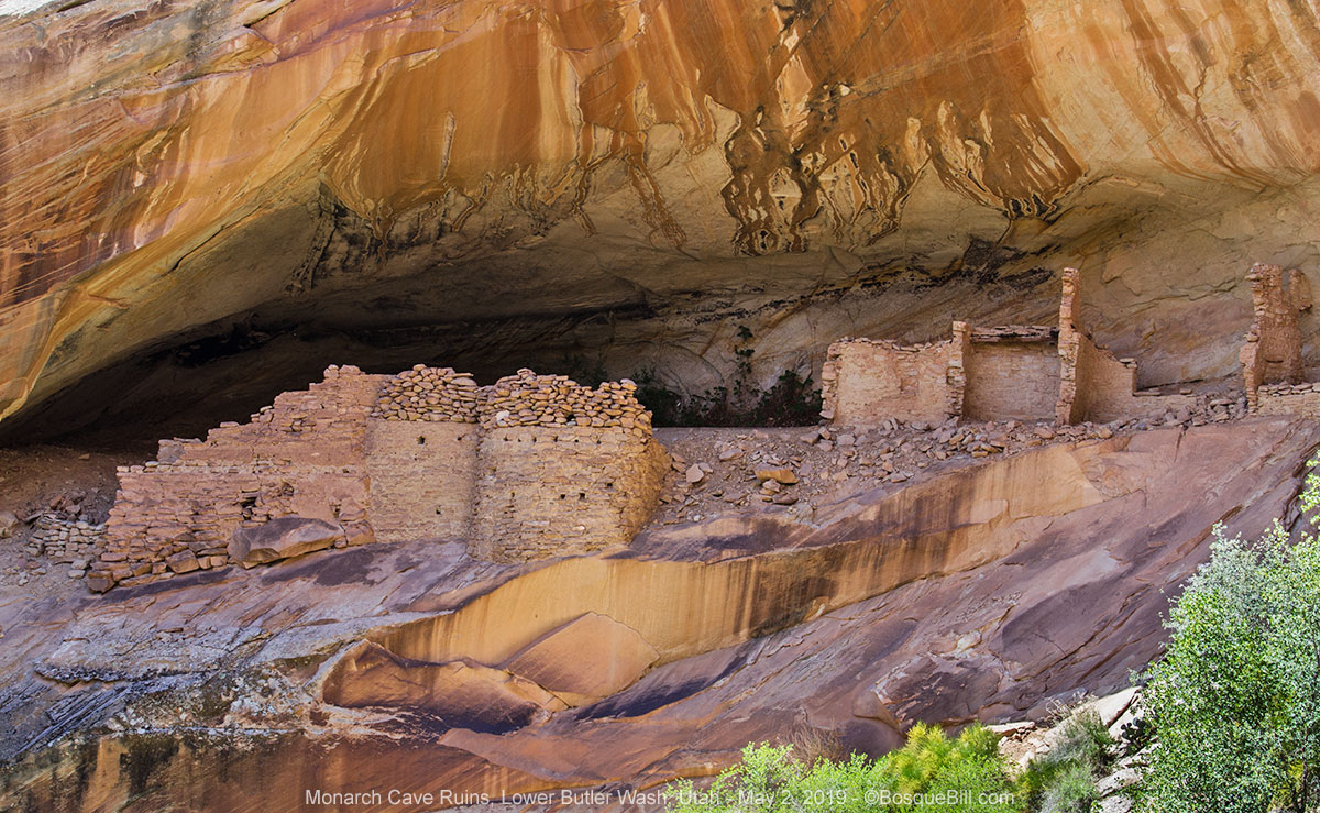
I did find the ruins. It was about a mile hike each way. Bring your binoculars if you take this hike.

The ruins are in the alcove between the pillars. Hang on, I'll show you...

The two pillars with the alcove in the middle...

Close up of the ruins using 420mm lens.

I was also able to get a better angle on Angle Arch. You can see the rock formation of that object, but not the arch itself from the Arch Canyon overlook.

Both arches can be seen in this view.

A close up of Angel Arch.

I returned to camp and had a leisurely lunch. I hadn't finalized a plan as to where I would go next, but did plan to break camp and move along. Rain wasn't forecast until Wednesday, but cloud cover began to move into the area in earnest.

On the Road


I drove to the north end of Comb Wash, thinking I'd head down that way, but the sky was now so grey it was bleaching all the color and contrast from Comb Ridge. I was so spoiled by the fantastic weather I'd had on this trip, that I stayed on the highway, pointed toward home.

I stopped at my favorite, locally-owned drive-in, That's A Burger, for an early dinner in Shiprock, NM. I examined my maps to see if there was a better way to bypass that stretch of US-64 that is so unpleasant. I did find an alternate route that looked promising and wasn't too complicated. It worked great - details below, if you're interested.

I thought maybe I'd camp somewhere in northern New Mexico, but the skies stayed so blah that I just keep heading toward home and a hot shower.

I got home just after dark, tired, dirty, and happy!

Thanks for coming along via my blog.

FOR SOME REASON GOOGLE/BLOGGER IS NOT LETTING ME REPLY TO YOUR COMMENTS ON MY BLOG. Hopefully this will be fixed sometime, but meanwhile, thanks I appreciate you taking the time to comment. If you have specific questions, email me at the address above. - Bill

--

US-64 Bypass: from the west take the truck-bypass in Farmington; turn right on NM-371 by the Shell Station; a scenic climb takes you up out of the San Juan River valley; turn left on Hwy-302, aka 7100; and left again on Hwy-3003, aka 7010, which goes all the way to US-550 south of Bloomfield. Wish I'd figured this out years ago. Coming from the south, 7010 is marked by a directional sign for the Raytheon Facility.

There's another route that bypasses even more, I might check it out next time - Indian Route-36 between US-491 and NM-371.

Southeastern Utah; Part 2 - May 2019

Part 2 of 3 - Start with Part 1

Thursday, May 2nd (continued)


Remember to click on any photo for a larger version.


Valley of the Gods


Valley of the Gods

I drove south back out of Butler Wash and turned west. Last fall I'd seen a camping spot in the Valley of the Gods along the wash, in the middle part of the north section, that looked interesting. At the time it was occupied. I thought as it was early afternoon, it might be available. It was and I settled in. The winds were quite gusty, so I braced the truck bed with the aluminum jack stands I bring along for this very purpose. I sat in the lee of the truck, read the latest Leaphorn, Chee, & Manuelito novel, The Tale Teller, by Ann Hillerman (quite good), and enjoyed the view.

My campsite.

Fortunately the wind died down by evening and I took a few photos.

Sunset.

And again.

Friday, May 3rd


Valley of the Gods (continued)


It was chilly in the morning, but the sky was clear. I got outside to take photos in that wonderful early light.

Spherical Panorama (click the Full-screen icon [ ] for best view:


Looking up the valley toward the towers.

I took a short walk up the wash below camp.

Primroses were blooming profusely.

Lots of yuccas were also blooming.

I broke camp and returned to the highway the short route, not completing the valley loop this time.

Moki Dugway


It's always fun to drive Moki Dugway (assuming you don't have a fear of narrow roads and sheer drop-offs). If you haven't done it yourself, or missed my earlier posts, this gravel stretch of UT-261 connects US-163 north of Mexican Hat to UT-95, east of Natural Bridges NP. The highway bisects Cedar Mesa after climbing up from the Valley of the Gods elevation.

View of the subway from below. See if you can spot any vehicles.

The view from an overlook. 

I drove north along the highway, admiring views of the Bear's Ears and the snow capped Abajo Mountains.

The Bears Ears and the Abajo Mountains.

The journey continues in Part 3

FOR SOME REASON GOOGLE/BLOGGER IS NOT LETTING ME REPLY TO YOUR COMMENTS ON MY BLOG. Hopefully this will be fixed sometime, but meanwhile, thanks I appreciate you taking the time to comment. If you have specific questions, email me at the address above. - Bill

Southeastern Utah; Part 1 - May 2019


May 1 - 6, 2019

Remember to click on any photo for a larger version.

Part 1 of 3

On my last trip of the season last year I drove up Lower Butler Wash Road all the way to highway UT-95. That was my first time up that road and I saw many areas that looked interesting enough to explore in future trips. Over the winter I did some research on-line and with friends to identify the first spots I wanted to check out - the Wolfman Petroglyphs and the Monarch Cave ruins. This is where I would start for 2019 and add on such favorites as Valley of the Gods, Cedar Mesa, and maybe explore a new area.

Wednesday, May 1st


After some delays I was able to get the travel/camping season started on May Day. I drove up toward the Four Corners after stopping for lunch at El Bruno's in Cuba. US-64 between Bloomfield and Shiprock is a dreadful stretch, lots of traffic, and cheap commercial development. I'd previously found a county road that bypassed Bloomfield itself, but this day there was an added "bonus" of road construction between there and Farmington. Filled my gas tank at Beclabito, NM and drove up US-191 across the San Juan River. A left on US-163 and at just less than a mile, a right on Lower Butler Wash Road, Co-262.

Wolfman Petroglyphs


The turn-off to the trailhead leading to the Wolfman Petroglyphs is one mile north of the highway on Lower Butler Wash Road. Turn west just before the fence and the parking area is 500' farther. It's about a quarter mile to the petroglyphs down the dirt trail, across the slickrock, then toward the south, down into the wash.

The trail crosses this slickrock. Follow the cairns southwest.

The pinch point is between the boulder and the rock face. The trail in the wash leads to the ruins.

Hiking sites rate the trail as easy, but it's quite a bit more challenging if you are mobility limited and/or dislike drop-offs. I was able to squeeze through the pinch point without issue, but immediately after is a rock to scramble down to the ledge that leads down into the wash. My knees said "No Way! Look at that drop off if you stumble", so I slid down on my behind (note to self: in future remove wallet from back pocket before sliding down a rock (at least I got a chance later to use the needle and thread I've had in my camper for years.))

Slide down that red sandstone, then walk down the ramp.

It's also a bit tricky once you get to the cliff face where the rock art is to be found. I suggest moving down once you encounter the chain BLM has installed and viewing from below.

NOTE: The panel has been damaged with bullet holes, as have many petroglyphs in Utah. In the two detail photos that follow, I chose to remove those holes in post-processing so you (and I) can enjoy their beauty without our blood pressure spiking because there are people with so little respect or appreciation of this art that they would intentionally vandalize it.

Left (north) panel. The smaller of the two.

Main, Wolfman panel.
Complete Wolfman Petroglyph panel.

Looking up the wash. You can see the ramp up the cliff face middle right.

The ramp up. You can get a better perspective of the slope in this photo.

There are small ruins up the wash. I didn't visit as I was told the terrain might be a bit tough for me to handle, and the adobe ruins are very small. Turns out you can seem them easily from the rim of the canyon north of where the trail drops down.

The ruins above the Wolfman Petroglyphs as seen from the slickrock along the edge of the wash.

Looking north up Butler Wash from near where the photo above was taken.

There was still snow on the Abajo Mountains.

Butler Wash


Driving north along Lower Butler Wash Road

I drove on up the road to look for a campsite. Just by coincidence I turned down the same side road looking for a site among the cottonwoods as I had last fall. This time there was a Tacoma with a simple shell in the site I'd used last year, but the road T's and the other direction was a very nice site at the end. There were enough trees and vegetation that each site was fairly private.

My campsite.

I did walk over and introduce myself to my neighbor. The young man was a professional musician from Wyoming and very congenial. I also asked to make sure he would be OK with my flying my Mavic 2 to acquire some aerial photos. He thanked me for asking and said it would be "all good."

Aerial view of my campsite with Comb Ridge to the west.

Looking north along Lower Butler Wash Road.

Looking south along the road.

Thursday, May 2nd


I took a few photos from around my campsite before packing up and heading north the next morning.

View of Comb Ridge and my campsite from across the road.

I scrambled up the small cliff across the road to get this southern view with boulders in the foreground.

Monarch Cave ruins


My destination was the cliff dwellings in Monarch Cave. There are no directional signs along Lower or upper Butler Wash Road to inform you where any of the trailheads can be found, so it pays to do your homework. Using Google Maps I had found and entered the coordinates for the trailhead into my Garmin Navigator app, so was able to easily find the parking area. It would have been tricky otherwise as there are many side roads leading toward the wash and ridge in the area. An online search also turned up a few hiking websites with directions on finding and following the trail, its length (1 mile each way), and rating (easy), along with some photos.

There was a post marking the trailhead. The trail dipped down into and across the wash before following the canyon west. Other than the first small slickrock section, the trail mostly stayed in the canyon bottom until approaching the end. Here is a sequence of photos illustrating the trail.

Parking area and trailhead.

The trail quickly cuts down into the wash.

After crossing through the cottonwoods in the wash, and walking over a short section of slickrock, you continue up the bottom of the canyon.

The end of the canyon is in sight. The ruins are at the end, beyond those trees.

You climb out of the canyon onto a wide terrace which narrows to a ledge leading to the ruins. There are great views of the dwellings, as well as back down the canyon. If you are agile (and fearless) you could work your way along the steeply sloped slickrock and walk among the ruins. I chose not to do that, but had brought along a camera lens that allowed a closer view.

First view of the ruins. The area with the metates and pictographs is on the right.

Closer view of the ruins thanks to a 70mm lens.

Here you can see the steep slickrock you'd have to traverse if you wanted to walk among the ruins.

Along the ledge that is easily accessible are places where the inhabitants ground corn, and holes in the cliff that likely helped anchor wood structures for this living space. There are hand prints and other figures painted on the cliff walls, as well.

Examples of the pictographs found along the the walls of the smaller cave.

Trough and Basin Matates.

I met a number of interesting folks at the ruins and along the trail. They told me about the Processional Petroglyph Panel that is located about a half-mile, or so, south of where we were. They all said it was amazing. Another time.

This is the view the inhabitants saw, looking down their canyon.

Many of the cacti were beginning to bloom.

The journey continues in Part 2

FOR SOME REASON GOOGLE/BLOGGER IS NOT LETTING ME REPLY TO YOUR COMMENTS ON MY BLOG. Hopefully this will be fixed sometime, but meanwhile, thanks I appreciate you taking the time to comment. If you have specific questions, email me at the address above. - Bill