White Rim Trail Pop-up Camper Expedition - Day 2 of 5
April 3, 2017
For an introduction to this trip and an explanation of the White Rim Trail, see
Day 1.
Click any photo for a larger version!
A strong, gusty wind came up in the middle of the night. Although the forecast had promised at least partly sunny skies, it was cloudy all day.
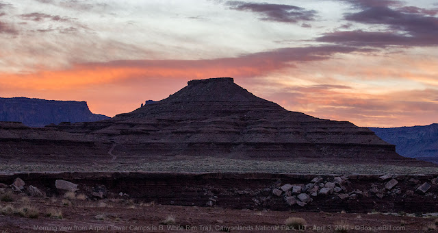 |
| The sun tries to break through at dawn. The WRT can be seen descending the bluff |
 |
| We begin to break camp. Airport Tower can be seen behind us. |
On the road
As we drove the WRT, Bob stopped to point out Washerwoman Arch and later Mesa Arch.
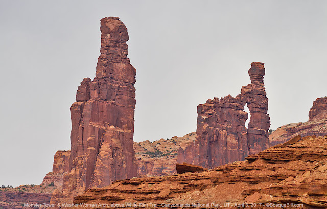 |
| Monster Tower on the left. Washer Woman Arch on the right. |
 |
| Bob captured the moment I crested this rise. |
 |
| One of the many times we played leap-frog with the bike tour sag-wagon. |
 |
| A broader view of the Island in the Sky mesa from this section of the road. |
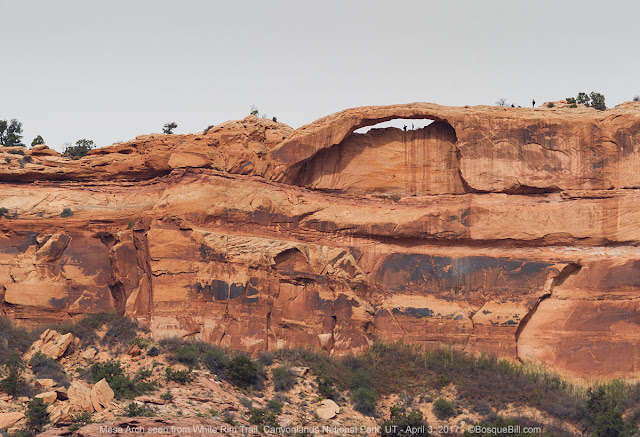 |
| A telephoto view of Mesa Arch up on the mesa. Yes, those are people standing around up there. |
 |
| A view of Washer Woman and Monster from farther along the WRT. |
 |
| Gotta love a parade! |
We also paused for photos where the road lies above a giant drop-off.
 |
| You can see the White Rim Sandstone is about 20' thick here and the road is partially suspended out over the drop off way above the canyon bottom. |
 |
| Bob has already traversed this slope and catches me showing Dan what I think is the best way down. |
 |
And here I give it a go.
When I saw this photo that Bob took, I jumped into my truck drove to the self-serve car wash to power clean the roof! |
 |
| Looking off to the east are the La Sal Mountains beyond Canyon Rims Recreation Area |
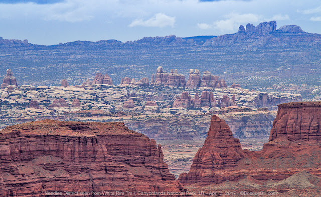 |
| Here is a view of Canyonlands NP Needles District taken with my telephoto lens. |
 |
| Another canyon that cuts right up to the edge of the road. |
 |
| Dan takes a photo and John admires the view. |
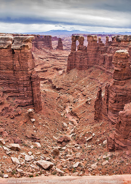 |
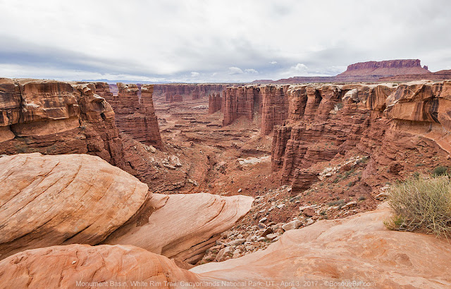
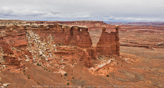
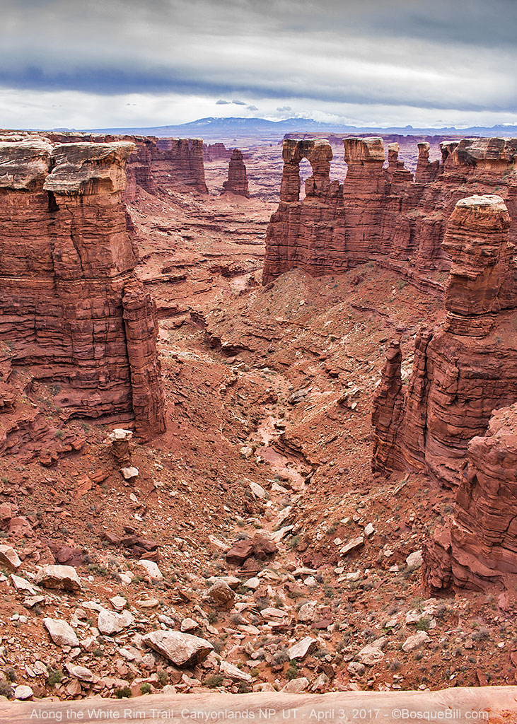
| The White Rim Sandstone forms the caps for these pinnacles in Monument Basin. |
 |
I took this photo the day before we started the WRT from the Grand View Overlook on top.
You can see the road skirt around the canyons that lead to the Colorado River. |
 |
| Dan follows along. I believe the cliffs behind are near the Grand View Overlook. |
White Crack Road
We turned off the WRT to take the side road to the White Crack Campsite and hiked out to the point. The vistas were wide and wild. This was the closest point on the trip to the confluence of the Colorado and Green Rivers, but neither could be seen as they were deep in their canyons and we were too far away.
 |
| Miniature paintbrush growing along the trail out to the overlook. |
 |
| Approaching the edge, the White Rim Sandstone is pocked with wet and dry pools. |
 |
| A view of the La Sal Mountains from near the edge. |
 |
| A panorama from the southern most point of our journey |
Back on the WRT
 |
| Back on the WRT where it twists, turns and climbs. |
 |
| Another view off to the side of the road. |
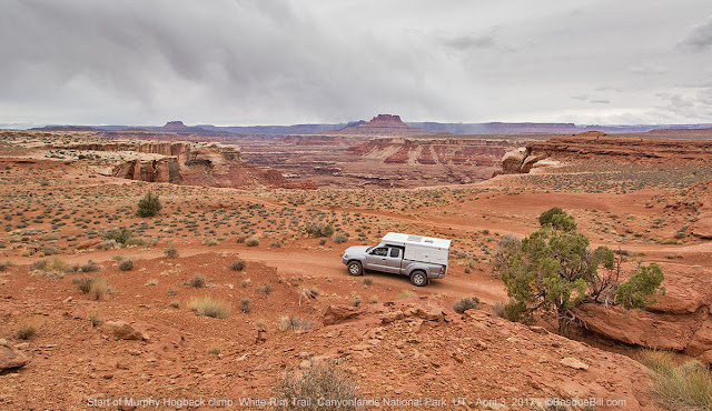
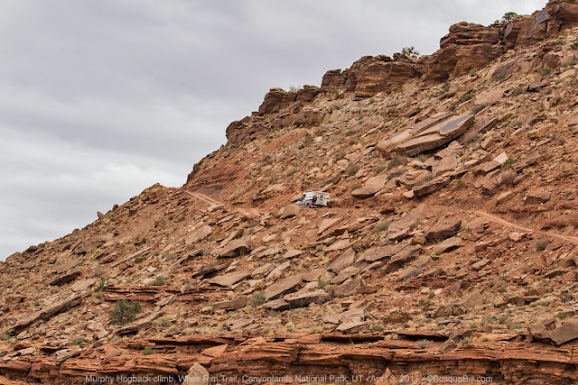
Murphy Hogback
This was also the day we climbed the notorious Murphy Hogback formation. The climb was steep, but much smoother than we were led to believe.
 |
| As we reached Murphy Hogback, I took a photo of Dan coming up behind me. |
 |
| Then I took a photo of Bob up above me. |
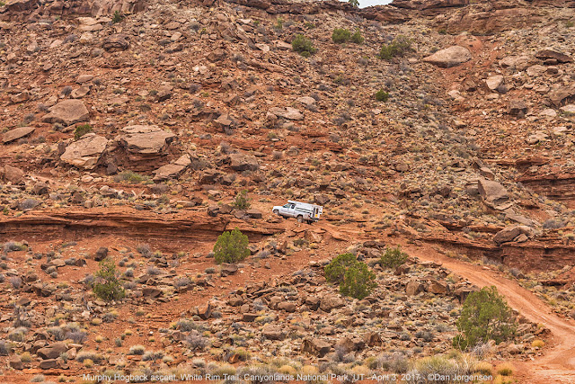 |
| Dan took a photo of me starting up the long climb. |
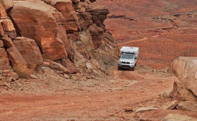 |
| Bob took a photo of me nearing the top of the climb. |
 |
| A wider view looking back at the way we came today. |
Our camp was the one closest to where the road descends the other side of the hogback. It was the prettiest campsite of the trip with great views, but the chilly wind kept us from enjoying it as much as we would have liked.
 |
| Beautiful campsite with fabulous views on top of Murphy Hogback. |
This ends Day 2.
Continue on to Day 3.


No comments:
Post a Comment
Thank you for taking the time to comment. I really appreciate it!