August 26 - 30, 2015
Blitz Headquarters: City of Rocks State Park
 |
| One of the Odonates found on the Blitz: Serpent Ringtail |
What the heck is an Ode Blitz, you ask? Ode is short for Odonata: the scientific name for dragonflies and damselflies. Blitz is German for flash, as in quick as a flash, but in this case refers to a gathering of folks to intensely search for odes within a certain geographical area in a short period of time - a flash snap-shot of species in an area.
Why would anyone want to do this? Well, much like birders seek out, photograph, and list bird species; we get a kick out of finding and photographing interesting and colorful dragonflies. Our efforts also help biologists, ecologists, and the scientific community to determine what species are where and when. But mainly because we find it fun and interesting; we love nature and all it's beauty and critters. Southwestern New Mexico, where this event was held this year, is particularly underreported, has interesting scenery and also has some cool species that are not found in other parts of the country. This last point attracted Blitzers from coast to coast - Oregon to Florida; Vermont to California; and points between.
The SW Ode Blitz this year was headquartered at City of Rocks State Park, between Silver City and Deming, NM. The organizers reserved a group site for our use, though I stayed in the adjacent area that had electrical hook-ups so I could keep my compressor fridge plugged in (not having solar, like some campers do, and staying in one spot with driving to recharge the batteries.)
Our field trips were to Grant, Catron, and Luna Counties where we cataloged species via photograph. Some species cannot be conclusively identified by sight or photo alone, so a number of our party brought nets to snag those. There was no collecting on this Blitz, strictly catch, photograph and release.
I will only include a couple dragonfly photos in this blog; use the following link to view all my best photos from this trip.
Click the photos below to view larger versions. I tried to present the photos on their proper day, and I did for the most part, but sometimes it was better to move them around to balance the page.
My Journey - Wednesday
I set out south on I-25 in the morning. I planned to take a small detour to visit what is called the Percha Box - a box canyon on Percha Creek - east of Hillsboro, NM. Though I had excellent directions I was not able to find the primitive road that lead to the canyon trail. Consequently, I returned to the freeway and headed south to Hatch, NM, where I filled the tank and took the cut-off toward Deming. Just before Deming I turned north toward Silver City on US-180, then took NM-31 to City of Rocks State Park.
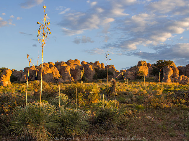
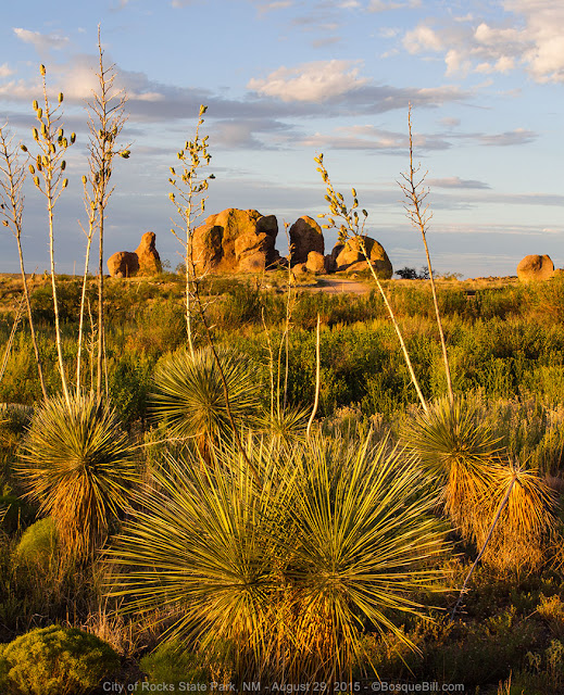
City of Rocks State Park
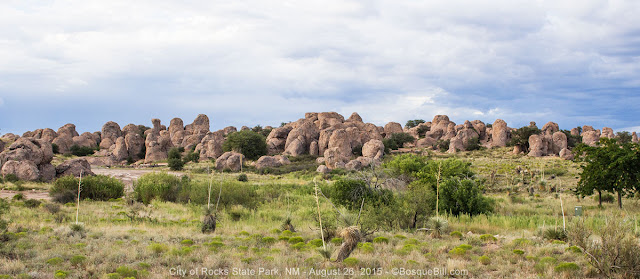 |
| This is just the central section of the "city." |
As I got nearer and nearer to the park I kept expecting to see some of the exotic rock formations for which the park is named, but I didn't. I became concerned. It wasn't until I topped the final hill on the park road that the rocks appeared all in one large, isolated cluster. Amazing! (Though I failed to take a photo from this perspective, darn it.)
I had made reservations to insure I had a site with electricity, but that would not have been an issue. There were electric sites available each night. If I were to go again, on my own, I would simply chose any one of the many individual sites situated around and among the interesting rock formations. Some even had a bit of shade.
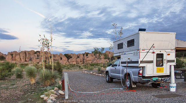 |
My campsite with hook-ups. I remembered to bring my humming bird feeder,
seen hanging from a pole off the back corner of my camper. |
I set up camp in the late afternoon with temps in the high 80's/low 90's (as the sun set, it cooled off due to the altitude and dry air). I walked around the rocks a bit in the early evening and met Kathy, the organizer of the Blitz, and her husband Dave, setting up their tent in the group site they'd reserved.
 |
| There were many Desert Cottontails around; there were also a number of Black-tailed Jackrabbits. |
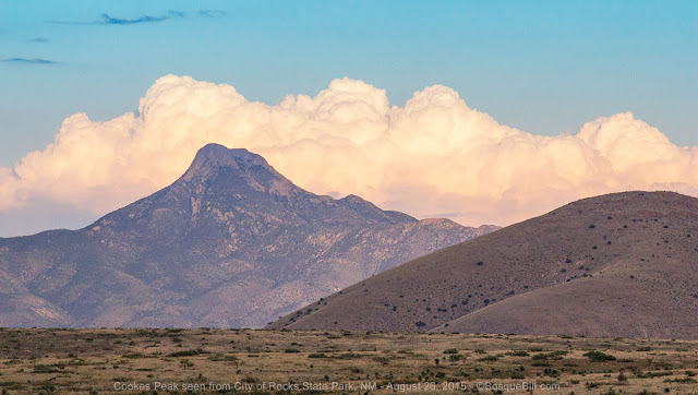 |
| Dramatic clouds behind Cookes Peak, east of the campground, as it gets close to sunset. |
 |
There were many species of birds in the park, including this Ladder-backed Woodpecker.
She was finding bugs burrowing into these yucca seed pods. |
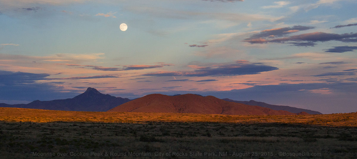
 |
| Moonrise over Cookes Peak |
Thursday - Day 1 of the Blitz
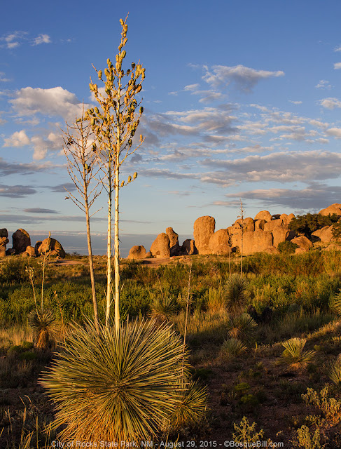 |
| Iconic yucca and rocks in the early morning light (from Saturday morning). |
After breakfast I wandered over to the group site to see who all had arrived. There was supposed to be an initial group meeting at noon, but when I got there before ten, a meeting was already in progress.
East Tank
The initial field trip was to be in the afternoon, but they were planning an impromptu trip and I got there just in time. The field trip leader, Tony Godfrey, works for the State Park and wanted us to visit nearby East Tank - this artificial pond was originally constructed to catch water for livestock. The state now owns this land, and hopes to eventually open it to the public. We had to drive on a rocky two-track for about half a mile (honestly, I didn't have to drive, as I left my camper set up and bummed a ride with other folks each day), then hike a bit over a mile to get to the tank. I think there were about 10 of us on the hike.
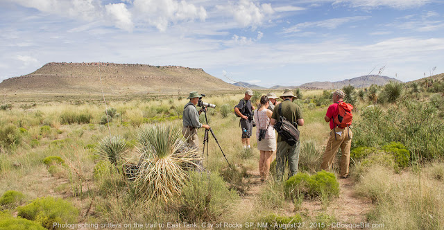 |
| Excitement over a horny toad. |
It was an interesting walk with lots of things to see, including a cooperative Texas Horned Lizard.
 |
| The subject of the excitement above. He really blends in, doesn't he? |
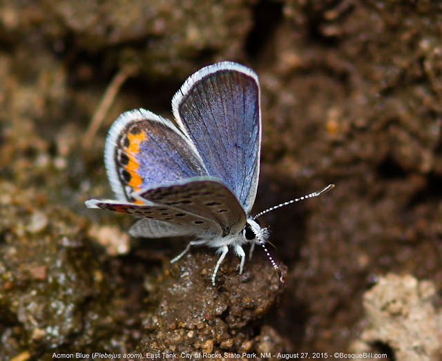
There were lots of dragonflies and damselflies around the pond; see my gallery. Everyone got lots of photos of those and also the butterflies that were feeding on the minerals on shore.
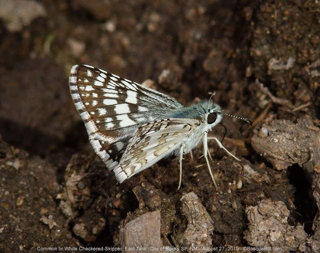 |
| Very small Checkered-Skipper |
 |
There were several groups of 4 to 6 of these tiny guys feeding on the minerals.
I chose to just focus in on this iridescent male. |
 |
Tony was happy when I found this Prickly Poppy, as they had not been seen in the state park.
Though in the following days, we passed many on the roadside farther north. |
The walk back to the cars was very warm and the trail seemed even rougher.
Katfish Kove
After lunch back at City of Rocks and a short meeting with those who had arrived after we took off to East Tank. We formed a caravan to Katfish Kove, a private "resort" with oxbow lakes (ponds really), off the Mimbres River. It is in Luna County about 10 miles south of the state park. It formerly was popular with birders, but had been closed many years. The new owners are refurbishing the resource and Tony secured permission for us to check it out.
 |
| American Rubyspot posed prettily along the banks of the Mimbres River. |
There were a few pond damsels and dragonflies, but the ponds were filled with cattails and frogs (that eat odonate larva), so only a few species of interest were found - none by me.
We returned to camp. The plan for tomorrow was to head up to the Gila River, about a two and a half hour drive north, the next morning.
 |
| A Western Wood-Peewee, a flycatcher, visited my campsite. |
 |
| Another campground visitor. |
Day Two, Friday
 |
| Sunrise Friday morning. |
The previous night my friend Leslie offered me a ride with her and a gentleman named Norm, whom she'd met on a previous Blitz, for today. He is from Medford, Oregon and had picked up Leslie in his car where she lives, south of San Francisco, on the way to the Blitz. They were tent camping at the group site. Those of us from the campground left at 8am and met up with those who had motel rooms in Silver City in the village of San Lorenzo - last stop for gas, ice, and food before heading into the Gila Mountains.
West Fork of the Gila River
 |
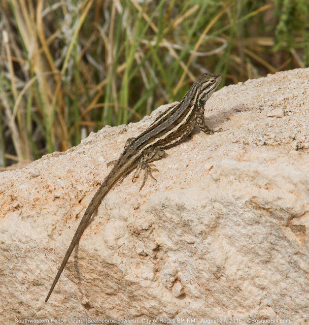
| The first critter seen once we reached the river was this Spiny Lizard with his grasshopper lunch. |
We drove through very nice scenery - a wide valley to start, lined with interesting rock cliffs, then rugged mountains once we were well into the national forest. The road ultimately leads to the Gila Cliff Dwellings (
see my photos from 2014.) We drove to the end of the road, and parked in the cliff dwellings parking lot, where we accessed the West Fork of the Gila River. A few additional folks joined the group there resulting in a total attendance of between 30 and 40 avid Blitzers. This was not as unwieldy as it sounds as we naturally broke into smaller clusters as we wandered the river.
We hiked along and waded up the West Fork. Tony had warned us to wear water shoes or sandals as we'd spend much time in this shallow, cool mountain river. I should have taken photos of the scenery, but like my companions, was totally focused on seeking out those dragonfly species found here, but few other places.
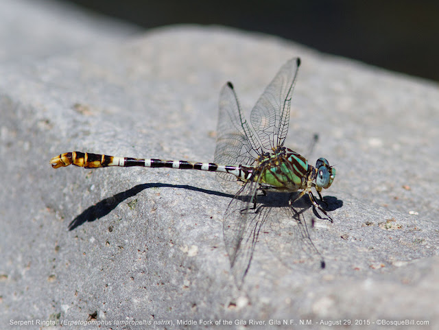
It is a wonderful feeling to be walking up a beautiful mountain stream and to spot one of those species, an Arizona Snaketail, on a willow branch extending over the water. Another Blitzer quickly found a Serpent Ringtail nearby perched on a rock. Both brightly colored dragonflies became the center of much attention by many photographers.
 |
| One of our target species, the Arizona Snaketail |
We continued upstream seeing many Painted Damsels and other interesting species.
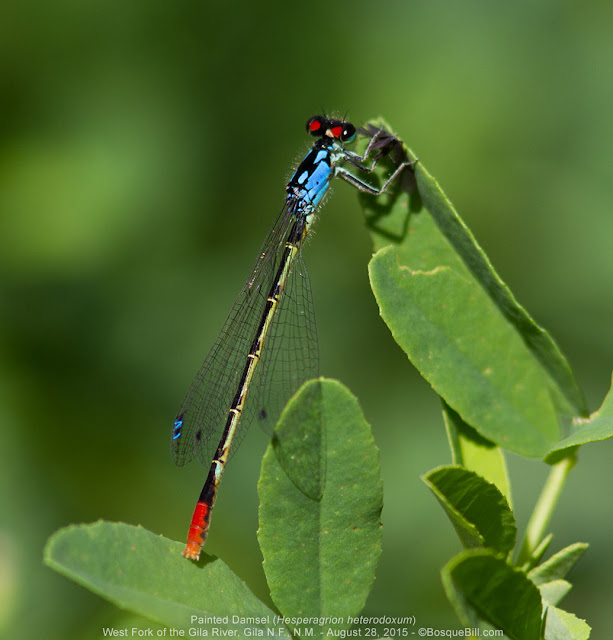 |
| Handsome Painted Damsel |
Tony's original intention was to hike the West Fork in the morning and the East Fork in the afternoon. However, we took much more time exploring up the West Fork and by the time we turned around, we could hear the rumble of thunder in the mountains of the afternoon storms that were building.
We grabbed a quick lunch back at the cars, before heading to a place a little bit downstream. By this time, though, clouds had moved in and the odes had pretty much stopped flying. At a quick group meeting before heading out, we reached a consensus to change the itinerary. Rather than drive over to the Rio Grande the next day (a long drive that would put us into heavily used state parks,) we would instead return to the Gila and hike the East Fork the next day. A change I heartily supported, because it was about 20 degrees cooler in the mountains than would be along the rio, and because there were still species to be found in the Gila that we hadn't yet seen.
Many in the group did stop in San Lorenzo for dinner as recommended by Tony. I had chorizo and eggs and it was very tasty and filling. Others had green chile cheeseburgers or the fish & chips special. Everyone drank lots of ice tea to replenish our fluids, even those who'd started with a beer also drank volumes of tea.
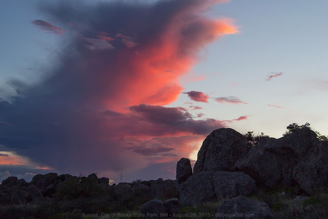 |
| Dramatic cloud behind the rocks as the sun set tonight. |
The photo above reminded me that we had a heck of a thunderstorm one night. You could see it slowly working its way in from the east, so there was plenty of time to batten down. There were strong wind gusts and pounding rain, but not too much thunder. I could hardly sleep due to the shaking and the racket. Ironically, despite the storm being so memorable, I cannot remember exactly on which night this occurred, Friday or Saturday. I expected to see all sorts of signs of the deluge the next morning, but everything was in order - just another stormy night for City of Rocks. [Update: Kathy replied that the storm was Saturday night and that half the tent campers ended up sleeping in their cars for safety. There was some damage to tents, but no one was harmed.]
Day Three, Saturday
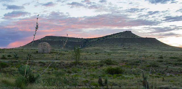 |
| Table Mountain just before sunrise. |
I again rode with Leslie and Norm as they were very pleasant and interesting companions for the drive back into the Gila. We parked at the Gila Cliff Dwelling Visitor Center, a couple of miles before the prior day's parking. At the VC some folks enjoyed photographing the hummingbirds at the feeders, and others purchased better hats in the gift shop than they had had the previous day, before walking down to the river.
Middle Fork of the Gila River
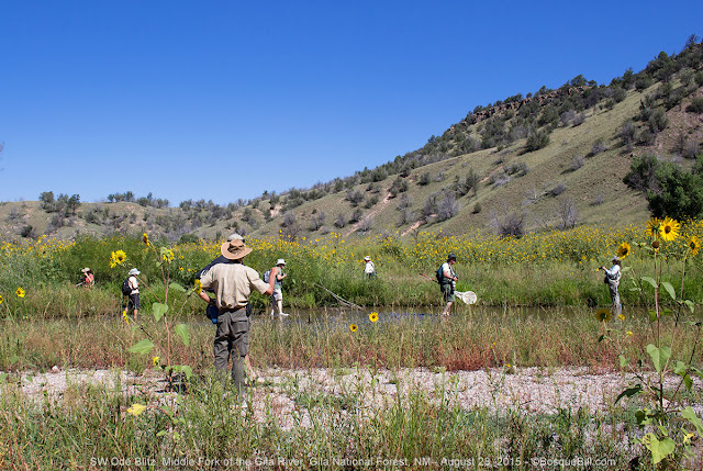 |
| This is where we entered Middle Fork. As you can see, the Blitzers are eager! |
Middle Fork of the Gila River was a bit wider and slower than the West Fork had been. When I'd realized the night before that I'd failed to photograph the beautiful scenery Friday, I resolved to do better today. So now there are photos of the scenery and Blitzers to give those who didn't attend an idea of what they missed.
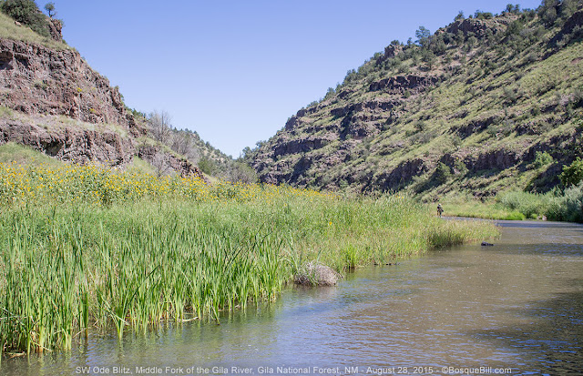 |
| These are the cattails where the Arroyo Darners were mating. |
 |
| This is the area where the Desert Firetails were found and actually photographed. |
We hiked and waded up the Middle Fork on a gorgeous clear day. Again we dispersed along the river. When someone found something interesting, they'd call out and those within earshot would gather around with our cameras. Again some folks brought nets to catch those flyers that never landed, so we could ID the species and get pictures.
 |
| A side channel of the main river. |
 |
| Note the small cave up on the cliff side. This is the type of formation in which the cliff dwellings were fashioned. |
We were once again chased out of the area by the sound of approaching thunderstorms, but neither day did we actually get rained upon. As we drove out we briefly stopped after the bridge from the Visitor Center hoping to find the Filigree Skimmers that had eluded us this trip. No joy.
 |
| Searching in vain for Filigree Skimmers. |
On the way out of the canyon there was a break in the clouds affording a brief stop at The Forks - this campground/picnic area is just above where the East Fork of the Gila River joins the main flow. But little was found there other than dramatic rock cliffs.
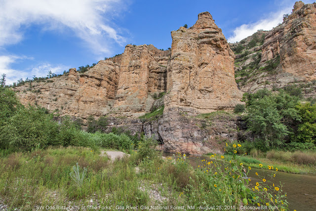 |
| Dramatic cliffs along the river. Can you see the tiny human in the river below the big cliff face? |
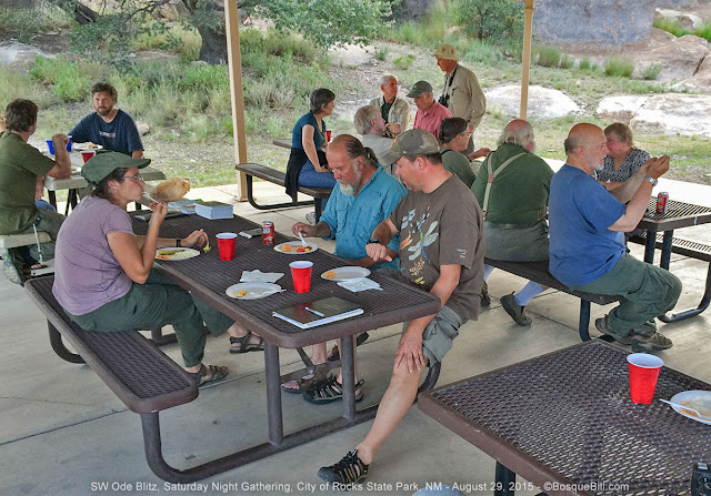
Saturday Night Gathering
Tony had arranged a cook-out for Saturday night. Volunteers grilled hamburgers and hot dogs. We all gathered at the picnic tables under the group shelter for the meal and a final meeting. Tony read off species names and we called out if we'd seen that species and at which location.
I tried to photograph everyone at the gathering. My apologies if I missed you or only captured your backside.
 |
| "Here, have a fork." |
 |
| The hamburgers were enjoyed by many as they talked of past and future adventures. |
 |
| Fruit for dessert while resting weary feet. |
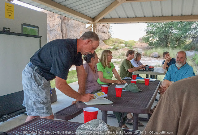 |
| Tony logs the species identified and photographed during the Blitz. |
[Update: Here is the group shot, courtesy of Sheila; amazing she's is in the shot, too ;-) ]
 |
| And here are the Blitzers (at least those who were around Saturday evening.) |
We were going to have a star gazing party to end the evening, but the clouds came in. So instead our astronomy expert gave a presentation on NASA's Pluto fly-by mission.
We also bid our new friends adieu with promises to see them at the next Blitz or dragonfly festival, as many were not joining the group on Sunday, myself included.
Day Four, Sunday
 |
| As the sun rose, the moon set. |
 |
| A Rufus Hummer at my feeder in the golden light. |
 |
| The early morning light was wonderful. |
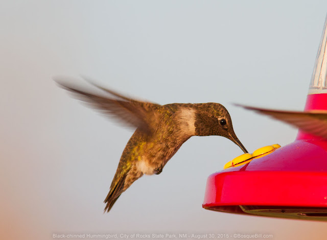 |
| A Black-chinned hummer having breakfast, on me. |
 |
| I call this image "Stonehenge." |
I didn't participate in the official field trips which were to be Mimbres River Preserve, owned now by the Nature Conservancy, or Bear Canyon Reservoir, a small lake controlled by State Game & Fish. I encourage any readers who did participate to comment below on your experience.
Paseo del Rio
Instead, on the way home I stopped at a location suggested by Sheila and Tony - the Paseo del Rio Recreation Area (though it has a new official name) this picnic/camping area is along the east side of the Rio Grande below Elephant Butte dam. There is a long-since closed fish hatchery there, built in 1937 by the CCC, and two of its three ponds still hold water. The ponds are surrounded by very thick, heavy vegetation including thorny mesquite. I didn't even see the ponds until I'd parked and gotten out of my truck. There is modest water flow through the ponds so they are not stagnant, at least.
Earlier this year ownership of this area was transferred from NM State Parks to US Bureau of Reclamation who will continue to run it in the near term; the concessionaire, Lago Rico, will supervise daily operations. Day use of the area is free; camping is $10.
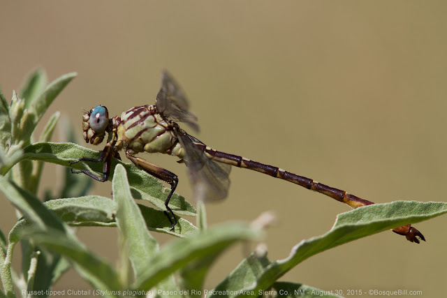 |
| Russet-tipped Clubtail in the bushes |
I walked around the ponds trying to peek in to see the water, but mostly hunted in the surrounding vegetation. I found a dragonfly I hadn't seen on this trip, a Russet-tipped Clubtail, as well as a Checkered Setwing. A Halloween Pennant had been found here before, but not today. I walked along the Rio Grande, too, but only saw a few common pond species.
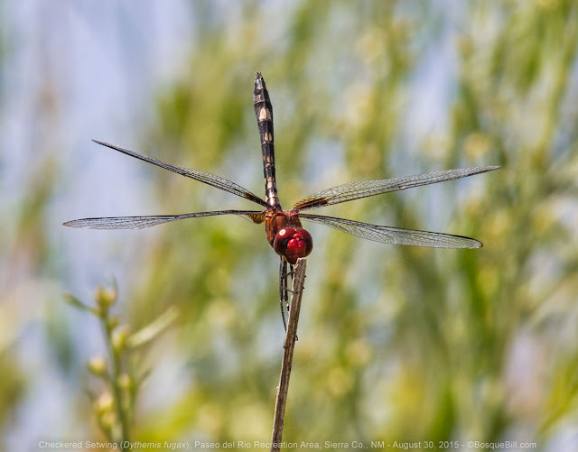 |
| Checkered Setwing perched up high. |
... and Home
From there I returned to the freeway and north to home - battered by rocks, cut by whatnot, punctured by thorns, hot and a bit dehydrated, but not sun-burned, and very happy.
It was fun seeing old friends at the Blitz and even more fun meeting new people and making new friends.
My thanks to Kathy and Dave, and to Tony and Sheila for the great job they did organizing the event and leading the field trips!