Pages

Friday, November 4, 2022

Southeastern Utah - October 2022 - Part 3

 Continued from Part 2

Fry Canyon Ruins - Moss Back Road - Red Canyon


October 14th (continued)

Fry Canyon Ruins

Those who read the blog post for my May trip earlier this year may recall I spotted a sign for Fry Canyon Rd which Google called Fry Canyon Ruins road. I did not explore it at the time. I decided to check it out this trip since I was going to be nearby. The road sign is gone. This short road crosses an old airstrip (which looks like it would be a disaster zone if any pilot had to use it.) There  are a couple of dispersed sites along the road, one which was occupied by two trailers while the campers were apparently off exploring. The road deteriorates before the end and high clearance is necessary. You can pull off before that point as it's not that much farther to walk.

The view up Fry Canyon from the overlook.

The view down canyon. The ledge mid-way down on the far side leads to the ruins.

The ruins, cliff dwellings, are clearly visible from the rim of the narrow canyon, but were in shadow. I tried to compensate for this during photo post-processing. I saw no way down into the canyon from this side of the canyon.

Fry Canyon Ruins.

Moss Back Road

Back on the highway I took the turn south on Radium King Road. The road had been washed out in several places in the recent past, but the county had come through and made complete repairs. For a more detailed description of the road, with photos, see my earlier post. I turned onto Moss Back Road. Though this road had not washed out, there were many, many places where flood waters had washed over the road - not enough to block travel, but I had to slow the truck to a near standstill multiple times to cross without impact.

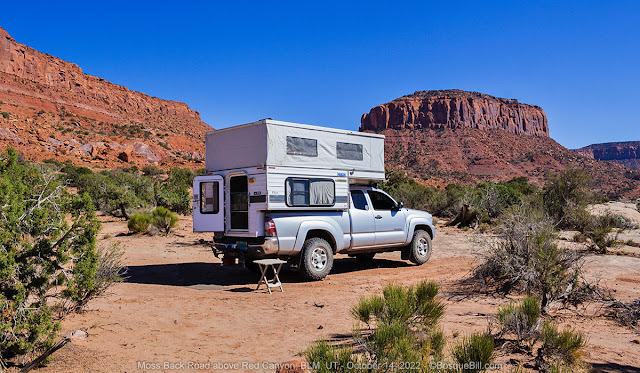
I really liked my previous campsite, but wanted to try another location. I drove for a couple of miles, creeping over the washes. I found an interesting site off the road, a little ways from the rim. I figured out a level spot with the side of my camper where the fridge is mounted on the north side as the sun was hot even with mild temperatures.

My campsite.

One of the nice features of my campsite was a nearby ancient juniper. There was plenty of room underneath in the shade to set up my chair - a rare treasure indeed to find in arid Utah. I sat in my chair, enjoyed a cool drink, and gazed out over Red Canyon.

This juniper was the largest I saw anywhere around.

Looking along the rim of Red Canyon toward Tables of the Sun Middle.

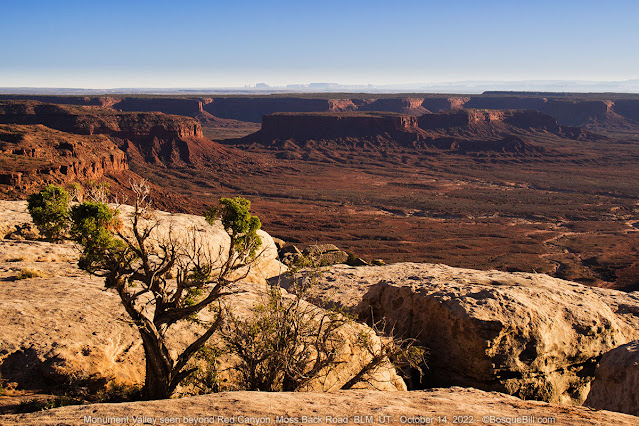
Red Canyon looking toward Monument Valley.

Another photo of the edge of Red Canyon.

As the day moved into the golden hour, I wandered about taking a few photos. There were no clouds, so not much sunset photo potential. 

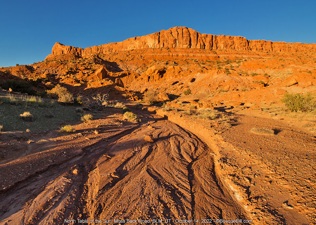
Looking up a recent rain wash toward North Tables of the Sun.

No traditional sunset, but I loved the look of the ancient juniper against the darkening sky.

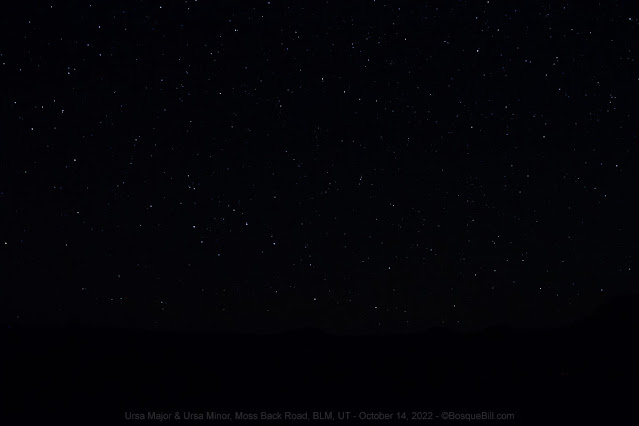
I suddenly realized I should try to shoot the sky when it got truly dark. I got out my tripod and my camera for which I had a remote shutter release. I set that up and remembered I needed to set focus on infinity while there was still light enough to see. Venus was up by that time and I tried a couple of exposures. With a little tweaking in Photoshop one of those turned out pretty well. (Photographers, I was able to use Live View with magnification to dial in my exposure; then gaffer tape to hold it for night shots.)

Venus rising over Middle Tables of the Sun butte.

You may need to click the photo to enter the lightbox viewer to see the stars.

I was disappointed when I looked at the photos to discover the Milky Way was simply too faint for my 10 year old camera sensor to capture. Maybe I should have tried a wider aperture and might have the following night except for (spoilers) there were clouds, so I didn't even try. I did try my hand a light painting using a bright red LED flashlight.

The Milky Way faintly shows on the left side of the photo.

My first ever attempt with the "light painting" technique.

The Big Dipper (bottom center) and the Little Dipper with North Star.

October 15

Moss Back Road (continued)


Early dawn at the campsite.

Looking east along the rim as the sun begins to lighten Wingate Mesa.

A gorgeous early morning. I took a few photos, then later walked north along the road. 

Here an entire section of the rock bench subsided into Red Canyon.
You can also see patterns in the foreground where water flowed over the edge in the storm.

Red Canyon. Sure are a lot of photos of rocks in this post.

One thing I noticed was that the heavy rains seemed to have severely damaged the cryptobiotic soils washing away much, or sometimes most, of the protective crust. My hope is that the microorganisms are still present in the soil and will be able to recover before more erosion of the soils can occur. I took a photo to show you, but perhaps unsurprisingly it just looks like a picture of dirt.

Though I loved this new campsite and enjoyed gazing at the view for hours, I don't think it's quite as photogenic as my earlier site. So I again encourage you to view my previous blog post on this area.

After lunch I "raised" my home-made awning. It is not nearly as convenient as the permanently mounted awnings, but it has one big advantage. I attach it at the roofline so it shades the entire side of the camper - all the mounted units I've seen on pop-ups are at the top of the hard side, so the soft sides and windows still get full sun. My awning shades the entire camper keeping it cool enough inside for an afternoon nap! Of course in a situation like here there is not enough soil for staking the pole guy lines, so had to use either conveniently placed dwarf trees and large rocks. But those worked very well as a substitute.

My cheap home-made awning with guy lines anchored with rocks.

I took my drone up in the afternoon to capture a panorama and some images of my campsite. The spherical panorama was not nearly as good as the image set I got last spring which show the colors much better. I encourage you to view that panorama and pan around at the scene. I did get a more traditional stitched panorama of the mesas and buttes, and a shot showing my campsite.

Wish I'd panned down a bit more, but you get the idea.

Multi-exposure horizontal panorama. Click for larger view.

High clouds started moving in during the late afternoon. Looked like the weather forecast was going to be accurate. At least, I thought, there would be clouds for a spectacular sunset. 

Middle & South Tables of the Sun and Red Canyon as the sun goes down.

The clouds didn't really cooperate, so this is the best I could do.

October 16

Moss Back Road (continued)

No photos today. It was breezy and cloudy when I got up per the forecast, so simply packed and broke camp. On the way out I saw two "campsites" close to Radium King Road were occupied. I was surprised they camped there rather than driving just a little farther and getting the full view. Both had vehicles that could have easily driven the road. Whatever. 

Homeward Bound

I made my way down to the highway and turned east. One benefit of the cloudy morning was that I didn't have to stare into the sun as I drove.

I took the "northern" route across the top of Cedar Mesa, crossing Comb and Butler Washes to the highway south of Blanding. Red Mesa had relatively inexpensive gasoline, and my gauge was nudging E, so I filled up. I took my usual short cuts down through Montezuma Springs and Red Mesa Road. I was feeling hungry by the time I made New Mexico so stopped at the little C store in Beclabito. They have a hot cabinet full of locally made burritos, chimichangas, corndogs, etc. I got one red and one green chili baked burrito. Hit the spot.

My usual route from there. Looked like it had been raining in Albuquerque and I drove through a light storm once I got close. Made it home safe, but had to unpack in light rain and coldest temperatures of the entire week. No worries, I was home safe after a great trip, and looking forward to a hot shower.


Thanks for coming along on my fall trip to Utah.


Southeastern Utah - October 2022 - Part 2

 Continued from Part 1

Johns Canyon Road - Muley Point East - Cedar Point Road


October 12th (continued)

Johns Canyon Road

I first drove on this road back in 2014. I'd been to Muley Point East and I spent the night (and nearly got blown away... or so it felt.) When I was admiring the views I noticed the road far below and wanted to explore it. When I was planning this trip I remembered seeing some amazing views of the San Juan canyon, spectacular sights of Muley Point and the bluffs above the road. I remembered there was a gate (there are two) and I remember a few rough spots, but nothing too bad. At that time I saw a couple of places that I thought might make good camping sites, and I remember the springs where I turned around. But that's about it. So I thought I'd drive it again to camp and explore.

You get to John's Canyon Road from the paved road to Goosenecks State Park from UT-261. It angles off on the north side about a half-mile from the state highway. The initial section is in pretty good shape. 

A short while later I stopped to talk to two women coming out driving a jeep. I wanted to ask them how far they'd gone on the road. Turns out they'd been hiking the Honaker Trail which I'd never heard of (but later found on Google Maps.) They explained the hiking trail leads down to the San Juan River. They told me how to drive there by turning left at the large tank (which is about 2-1/2 miles from the pavement) and mentioned there were two nice campsites. They had stayed at one of those last night, but said many people park before the road drops down. They claimed the road wasn't bad, but it was wise to stop at the rock cairn rather than drive all the way to the trailhead. I took the turn-off, but stopped where the other cars were parked. I wanted to do more research before going farther. 

Johns Canyon Road about 3.5 miles from the turn-off.
Cedar Point on the right; Muley Point ahead to the left.

I returned to Johns Canyon Road and proceeded west. A mile or so after entering the canyon proper I pulled out on a short side road that could be a camp site. I had a snack and looked around. I noticed another vehicle pulled over a few hundred feet farther along the road, so when I started up again I stopped by them to say hello and ask if they had driven the road. They had not. They'd pulled over so he could walk up the road to where it looked like it had been washed out. The road had not washed out, but was hard to see in advance and he had not wanted to have to back out. They didn't know if they wanted to go on or not, but he said the section he examined was certainly drivable. I continued on.

Looking out the truck window toward the San Juan River.

That section was not bad, though it was certainly steep with a drop-off. I came to the first gate. It is below Muley Point East. I opened it, drove through, then closed it. Always leave gates open or closed as you find them. The next section was nasty. There were couple of steep, rocky stretches where I used 4LO to get up. After that the road was in good shape.

You can see the road clinging to the ledge at right. Muley Point ahead.

The road however was much longer than I'd remembered. I kept waiting to find the second gate as I knew there was a big rock just past that and a prospective camp site. I finally came to the gate and the rock. The site was desolate and baren. Much of Utah and the four corners area had seen a good monsoon season. The bench between Cedar Mesa and the San Juan River looked like it hadn't seen rain in years. It was hot, dry, and not the least inviting.

This is the point of Muley Point seen from a prospective campsite.

I continued on aiming for Johns Canyon Spring and hoping it would be more verdant and offer a camping site. Again it was much farther than I'd remembered. Yes, there were trees and greenery in the area of the spring, but there was absolutely no where to camp even if one were willing to ignore the prohibition for camping near a water source. There was barely room to turn around and it wasn't even level.

Johns Canyon Springs.

I walked around a bit, enjoying the scene, and taking a few photos. I then climbed in my truck to make my way out. Somewhere on the long way out I decided I'd quit the canyon and camp somewhere else, maybe Muley Point.

I did spot a big rock right by the road with petroglyphs which was very interesting. Somehow I had not seen it when I drove by the time before.

Petroglyph rock.

Petroglyph rock in situ with Muley Point East in the background.

The dodgy section just west of the first gate was no better on the way out. If anything it was worse and I had to use 4LO in several sections. I think it was much worse than in 2014. I was glad to be out of there. I cannot recommend driving John's Canyon Road past that first spur (37.225291, -109.967893) about a half mile after you pass Cedar Point unless you are experienced and have the proper vehicle.

I returned to the highway and headed up the Moki Dugway. At the top I turned south on Muley Point Road.


Muley Point East

As I was driving up to what Google Maps now calls Muley Point East and what lots of folks mistake for Muley Point proper. (It actually has more spectacular views as it's right on the edge whereas the official vista point is not.) I saw a side road leading east. It's maybe a hundred yards before you get to the vista point. I was curious, but didn't explore at the time. 

By the way, the Muley Point area along the bluffs is actually within the Glen Canyon National Recreation Area and their regulations apply. "All human body waste solids shall be contained and carried out using a portable toilet or a specifically engineered bag waste containment system." Which is really the only responsible thing to do everywhere in the backcountry. Some other jurisdictions allow burying human waste, but even those now require you bag your toilet paper and pack it out.

I found a spot to park and set up camp a ways back from the edge of the bluff. I walked the to the edge to look around. It was very hazy across the canyon, not ideal for photos and as I had nice ones from previous trips, I only took one down at John's Canyon Road where I'd just driven. The road sure looks tame from above.

Looking over the edge of Muley Point East down at Johns Canyon Road.
You may notice the profile of Monument Valley on the horizon.

As the afternoon progressed to evening, more and more vehicles were setting up to camp in this area. Their voices easily carried in the quiet. Finally I decided it was just too crowded and rather than sit and fume about the noise, I'd move camp. I stowed my gear and closed the top.

Looking along the edge of Muley Point East.

I drove onward on Muley Point Road. There were a number of nice campsites along the road, but they seemed to be already occupied. (Looking from home I see there is a side road that heads westerly for some ways with a few dispersed sites along it; the satellite view even captured what looks like a pop-up camper about 4000' along the road at a spot with an amazing view. Maybe I'll check that out next time.) I turned around to check out that side road I'd seen earlier in the day.


Cedar Point Road

The road is not labelled in Google Maps, but I'll call it Cedar Point Road as it heads generally in that direction. I drove about a mile down the road to a nice campsite where I set up. It was getting along toward dark, so didn't take any photos that evening.

The fall is the season to camp at Muley Point or any other exposed site in southern Utah; summer is too hot and in spring the winds might keep you up at night as they blast your camp.


October 13

Cedar Point Road (continued)


Dawn at my campsite with the moon still high in the sky.

It was a beautiful dawn as light spread across the landscape. I tried to capture the sunrise, but without any clouds to reflect the light all I got was overexposures. I did much better capturing a view of Monument Valley, Arizona and Muley Point with Navajo Mountain and the San Juan canyon behind it.

Monument Valley, Arizona is across the San Juan River valley.

Last night I had spied a campsite a bit farther along Cedar Point Road where a small white van was parked. It looked like it might have even a better view. I decided if the van left I'd check the site out. It did and I did. I moved my campsite to this higher vantage which was also farther away from any adjacent sites, not that I had been bothered last night.

Muley Point (right) with Navajo Mountain in the background.

I enjoyed the rest of my coffee in my comfortable camp chair. Later in the morning I walked farther along the road to see what was there. I saw a couple other campers, I spotted at least two side roads that led down toward the edge of the bluffs, one looked very rough. 

Cedar Point Road view.

I walked to where I could look east toward Valley of the Gods and took a photo. I was curious if the road stretched all the way to the end of Cedar Point, but in looking at the satellite view from home, it doesn't look like it does. It does appear to go farther north, as double track, but I bet it is not a comfortable surface.

Near the east end of Cedar Point Road with a view of Valley of the Gods.
You can just see Ute Mountain, Colorado on the horizon.

After lunch I wandered around the immediate area and took photos of some of the miniature plants thriving close to the ground. I made a collage of six species. You can judge the comparative size of the plants by the size of the gravel in the photo, as the decomposed sandstone is the same size and consistency in all the images.

Miniature plants seemed to be thriving throughout this area.

I was pretty lazy the rest of the day. Sitting in my chair hypnotized by the view or reading my library book.

My campsite as the sun was going down.

The light was delightfully crimson as the sun went down. There were no clouds to manufacture a full sunset, as had been the case the previous nights, but I caught the last of the sunlight illuminating the side of Navajo Mountain.

The last of the light reflecting on the side of Navajo Mountain.

The wind came up during the evening. It wasn't bad, but after dark something was rattling on the outside of my camper. I stepped out to quiet it and was astonished by the night sky. The first night of my trip the nearly full moon was too bright to see more than a few stars. Tonight they were out in their glory. It was windy, but very mild, so I stood out for a while admiring the diamonds in the sky. The Milky Way was directly overhead, too. Beautiful. In the short time I was outside I saw two falling stars, as well!


October 14


Cedar Point Road (continued)


Navajo Mountain seen in the early morning light from my campsite.

Early morning was amazing. I sat in my chair, drinking my fresh brewed coffee, and watched as the sunlight slowly crept from the tops of the mesas to down across the landscape. I took a number of multiple exposure panoramas. I've processed two of those, but haven't figured out how to share the very wide images on Blogspot.

I packed up and headed out. I drove north on UT-261 up the middle of Cedar Mesa. I stopped at the Kane Gulch Ranger Station. I didn't know if they'd be open, as their hours had been limited in the past, but they have nice vault toilets by the long term parking area. They were open. I talked to a lady inside and apparently with the new permitting requirements they are open every day. According to the Trip Planner I was given they are actually only open mornings during the spring and fall.

Here are some useful links: Cedar Mesa Trip Planner (PDF); Cedar Mesa Permits & Passes

See also: Bears Ears National Monument


End of Part 2; continues in Part 3.


Southeastern Utah - October 2022: Part 1

Valley of the Gods - Johns Canyon Road - Muley Point & Cedar Point - Moss Back Road & Red Canyon 

October 10 - 16, 2022

The monsoon season this year was welcomed by southwestern trees, plants and shrubs, but not necessarily by those of us wanting to go camping. The rains seemed to be continuing well into October and I wondered if I'd be able to get out this month. Suddenly the forecast changed and the week ahead looked dry, sunny, and mild. I quickly gathered my supplies and headed for southeastern Utah. My tentative plans were two nights each in Valley of the Gods, John's Canyon, and Moss Back Road above Red Canyon, UT.

Remember to click on a photo to see a larger version


Part 1 - Valley of the Gods

October 10

I had to fill my tank before I left the city and the lines at Costco were the worst I'd ever experienced, but finally got on the road. I took my usual route up to the four corners area, not that there is really any choice. Instead of turning north as I often do, I continued on US-160 to US-191 which crosses the San Juan River just west of Bluff, UT. Although the forecast was clear there sure seemed to be a large thunderstorm to the north. I was concerned, though as I traveled farther west I could see it was over the Abajo Mountains and Elk Ridge west of Monticello. It appeared Valley of the Gods was probably safe, but I didn't know how dry.

Comb Ridge

After crossing the ridge I looked up Comb Wash and saw a photo opportunity. I turned north and took a few photos. I was pleasantly surprised the road was dry so was hopeful my destination would be dry, too. I continued west on US-163.

Looking north along the west side of Comb Ridge.

Valley of the Gods

I turned off the highway at the east entrance of Valley of the Gods. The water crossing that's within sight of the highway was no deeper than usual, so I guessed the storm had passed well to the north. The first several dispersed camp sites were empty, but soon the camping areas within sight of the distinctive sandstone formations were full of RVs and travel trailers. That middle stretch of the east side is popular with the big rigs as the sites are large with easy access.

Looking north toward the middle stretch of the east side.

As I got to the northern third of the road all my previous campsites were occupied. I crossed my fingers and kept driving. I made the horseshoe turn just past Castle Butte, and those nearby sites were taken, as well. Past the tall formations west of the road I spied a pop-up camper set up near the road next to a little hillock. It looked similar to a FWC or ATC, but was another brand. As the folks were by their truck I rolled down my window to say "hi." It was a Caribou Lite from Outfitter Mfg. in Colorado. The nice folks were from Montana.

Turns out there was a good campsite beyond that hill which I quickly claimed. It had a great view across the valley and the adjacent hill provided privacy between the two sites. As I set up my new neighbors waved as they pedaled by on their bicycles to explore down the road.

My campsite for the first night.

I didn't see much in the way of wildlife on this trip. There were bats flying in the late evening in the valley and I heard one coyote sing out in the no-mans-land between the U of the road. Only very few birds here or at the later locations. Not many wildflowers still blooming in October, either, but I did see a few.

Some variety of Beeplant though it doesn't match any I found online.

I relaxed in my camp chair and watched the shadows grow. If there was a sunset, I missed it.

A note on campsites in Valley of the Gods: for the most part sites are simply bare patches of natural gravel near the road in seemingly random locations. A few are down short spur roads. A few may be perched near a wash. There are a few piƱon trees in the area and a few of the larger washes may have cottonwood trees along their course. Most campsites have none of those trees. None have any amenities. Most are vulnerable to winds in season. Yet the sites are gorgeous because of the amazing views of the sandstorm buttes and canyons. It's one of my favorite places to camp in the world. (And judging by the number of campers there, I'm not alone in my opinion.)

Also note that I've not stayed in the same campsite twice in this beautiful area, so each separate blog post has photographs from unique vantage points. This will make the 8th post I've published for this spot. Look at the locations list in the right-hand column for additional photos and descriptions of this area.


October 11

Valley of the Gods (continued)


Moonset at sunrise from my campsite.

Another view of my campsite.


I was out my door at dawn with my camera. Took lots of photos, but mostly just admired the morning. I climbed a small hill across the road to get a new vantage.

View of the head of the valley.

After my neighbors decamped late morning. I moved up to their site where the view was better.

It was a beautiful clear day with a light breeze to moderate the warm sun. I flew my drone to get a few photos. The spherical panorama was not as good as any of my previous versions (here's my favorite), so haven't posted it, but here is a stitched 3-image panorama.

View of the head of the valley from above my campsite. Click to enlarge.

In the early evening I walked southwest cross country along the edge of the basin from my camp. I was able to photograph the pinnacles west of my site from a vantage opposite of the road.

The sandstone formations near my site, but seen from the side opposite the road.

The sunlit edge of the mesa across the valley with just the top of my camper showing.

I walked up a informal trail to see if I could catch the setting sun reflecting off the pinnacles to the east, but the shadows were all wrong. When I turned around to go back to my campsite I was shown this sublime vista.

Looking southerly down the valley at sunset.


October 12

Valley of the Gods (continued)

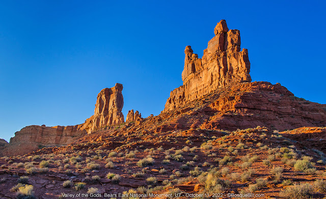
Yesterday I missed the golden light on the sides of the pinacles up the road from where I'd camped, so today I made that a priority. The moon was still high enough above the horizon to capture it behind the sandstone formations. I took many photos, but they just didn't have as much magic as the actual scene. Here are a couple.

First light at sunrise.

Golden hour as the moon sets behind the sandstone.

I packed up and headed out toward the western end of Valley of the Gods Road. This leg of the road is longer (and maybe a bit rougher with fewer pinacles), but still beautiful. See my earlier posts for photos.


End of Part 1; go to Part 2