Pages

Tuesday, January 12, 2016

Four Corners: November 2015 - Part 2

A Loop along the Ancient Way though the Navajo Nation
November 8 - 13, 2015

This tale begins in Part 1, where you can also find a road map of my journey.

Part 2 of 2 - Navajo Redlands

Wednesday, November 11th (continued)


After leaving the Hovenweep area the storm began in earnest with torrential rain and gusty winds. The westerly route toward Bluff was narrow and not easy to follow as it was poorly marked, but I did find my way (though I had to backtrack at one unmarked intersection). At US-191 I turned south toward Bluff. This small town seems to have shrunk even more since the last time I was through there, perhaps more places were closed simply due to it being November and not the thick of tourist season. From the highway I could see the storm structure centered over the Monument Valley area appearing as a wall cloud indicating severe weather, though the rain had let up where I was. West of Bluff I drove straight at the junction where 191 heads south; I was now on US-163 which leads to Mexican Hat though I didn't go that far this day.

I thought I'd check out Goosenecks State Park as I'd driven by the turnoff a number of times. You take UT-261, then turn south a few miles along. I didn't know if I wanted to camp there or not. Though there is no attendant this time of year, the state certainly emphasizes the need to pay a fee to enter and/or camp. The camping area is basically a flat area with an occasional picnic table; there is one vault toilet in the day use area. The wind was fierce at this edge of the canyon of the San Juan River, resulting in a wind chill of "too damn cold." I hurriedly took a few photos, retreated to my truck, and exited the park.

Remember to click on any photo to see larger versions in a lightbox type presentation.

View of the San Juan River from the canyon rim at Goosenecks State Park

Valley of the Gods


I returned to the Valley of the Gods area and entered via the east entrance from US-163. I viewed with some trepidation the warning sign that the road was impassible when wet, especially as there is a creek crossing as soon as you drive in, and the clouds were still threatening more rain. Nonetheless, the road was in excellent condition even after the afternoon rains. I drove in looking for spots to camp, taking note of likely sites. Most sites are in the open which afford wonderful views of the landscape, but there were one or two more sheltered that might be appropriate this stormy evening. Despite the heavy clouds, there was much rugged beauty in the area and I took photos in the low light, hoping, but not expecting, them to turn out.

Stormy evening vista of Valley of the Gods

The wind began picking up, I could see more rain approaching, and I knew it would soon be getting dark. I turned around and drove like the dickens back the way I'd come with the intention of finding the campsite I'd spied earlier that seemed to be sheltered from the wind on a couple of sides by small hills. Luckily the site was flat enough I didn't have to level the camper and got set up in record time, barely beating the rain and dark.

I turned around here and scurried back to what shelter I could find.

It's hard to judge rain intensity in the camper with its large aluminum roof area, so was relieved when it let up, though had no idea what condition the road would be the next morning. Not that I had a pressing schedule to keep.

Wednesday, November 11th


As I awoke with dawn approaching, I peeked out the window and the sky appeared cloudy, so I didn't rush my morning routine. As I was making coffee and breakfast I heard a vehicle. Looking out I saw a small sedan driving by from the direction of the east entrance, so the road was ok that direction apparently. I was surprised though to see there were only a few clouds along the eastern horizon, but most of the sky was in fact clear.
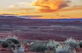
Just before sunrise looking east from my campsite.

This stirred me to grab my camera and tripod to get some dawn photos from next to the campsite - I wasn't even fully dressed at that point, but the light wasn't waiting for me. It was a glorious dawn. I'd take photos then go back into the camper to dress and finish breakfast, rush out for more photos in the changing light, go back to the camper to start breaking camp, out for more photos, etc.

My campsite, sheltered from the worst of the previous night's winds, is lit by the rising sun.

Gorgeous view just as the sun lights the scenery. Monument Valley is along the horizon.

I got underway and drove deeper into the valley stopping frequently for photos.

Looking across the valley basin in a southeasterly direction. Muley Point is on those cliffs.

This bluff and tower stands alone.

Another view across the basin with Monument Valley in the background.

Following the road deep into the formation of Valley of the Gods.

Towers along the way.

The square rock block along the road is about the size of a large truck.

Lots of amazing views all along the road.

Looking back as I drive out of the area of the most formations.

After driving through the valley, I exited onto UT-261, turned south back to US-163, headed toward Monument Valley. FYI, if you are wandering in this area, it seems that Mexican Hat is probably the best place to get gasoline. The Shell station is nicer than anything in Bluff and the prices were lower than there or in Kayenta, at least this trip.
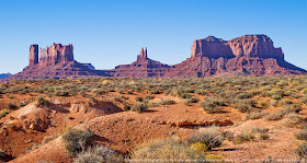
View just off the highway of the north side of Monument Valley

Monument Valley


Note: though I have included a number of photos in this post, there are more in my Google Photos Collection, many I think are quite nice and I bet you will enjoy seeing.

There have been some changes to this Navajo Nation park since my last visit 10+ years ago. The visitor center is a new complex right next to the US highway, you join the jeep tours there (if not at Blandings.) Also, back in the day you could drive to the hotel complex and get fabulous photos of The Mittens from their overlook for free. Nowadays, you pay your $20 (1 to 4 persons/car) long before you get to the hotel complex. Your entry receipt is good for four days, I was told.

I did indeed stop at the hotel complex. Their overlook is one of the best views of the valley.

View from the deck outside the gift shop.

They are putting this new income to good use. The main (dirt) road into the valley has been widened and is kept graded; plus, they are installing culverts at the major wash-out places. Smart, as this will keep the park accessible even after a gully-washer rain. Another change is the great increase in the number of "jeep" tours on the road. I put the vehicle in quotes as there are no Jeeps (and I saw no "people movers" either); they all seem to be variations on heavy duty pickups with the bed converted to hold about a dozen visitors in the open air - and man, were those tourists ever shivering this November morning as I drove in.

I drove around the loop road, stopping often for photos. Some of the features were in good light, some would be better later in the day, and others would have been better earlier in the morning. So I hoped to stay somewhere in the area to get photos the next morning. The main tribal park campground was closed for the season, but their "primitive" site was open. It is a small area with picnic tables and ramadas, located about halfway between the US highway and the hotel complex, not the most scenic spot. The lady at the entrance station said it cost $20 per night.

When I pulled into the overlook called Artists Point, I noticed an old VW bus camper (along with the spectacular view.) This brought back fond memories of my '68 VW Campmobile (tm) and I strolled over to share this with the owner of the bus. Jerry, a TV producer from L.A., had only recently acquired said VW after a long search for one. This friendly fellow was interested in my tale and we spent an enjoyable time swapping stories.

Afternoon view from Artists Point.

One of the things he mentioned was being in Monument Valley during the worst of the previous day's storm, and it soon became apparent that he had camped within the valley that night, which caught my attention. When asked about this, he told me who to talk to at one of the horse tour corrals, which I did.

The primitive campsite is down one to the roads closed to all except guided jeep tours, so my host drove in with me following behind though a complex of "roads." Wow! The spot was literally at the foot of Thunderbird Mesa with a view of the Sleeping Dragon. I set up the camper at the base of the enormous sandstone formation and walked out to try and capture the scene with my camera.

Campsite at the foot of Thunderbird Mesa

My host, who'd stuck around to make sure I got settled, saw me taking pictures and asked if I'd like to see the Totem Pole? He cleared off the front seat of his aging Chevy 4x4 pickup truck and off we went. The truck only had 1st and 3rd gears, bald tires, and you had to throw yourself at the door to get it to open (but at least it wouldn't accidentally fly open as we went blasting along these "roads.")

The Totem Pole

My personal tour guide was having fun showing me the sights and I did not have to pretend to be amazed by the beauty of the scenery. The day was well into the "golden hour", or even a bit late, so photography was a challenge, especially as I'd not brought my tripod.

The finale was a view of the icons of the valley as seen through the "periscope" on top of Submarine Hill.

Looking through the periscope.

I was returned safely to the campsite as it was starting to get dark, and my host took off to return to the corral and watch over the horses as they have a talent for getting themselves into trouble, he said.

As I fell asleep that night I tried not to think of the huge sandstone cliff looming over me.

Thursday, November 12th


Monument Valley (continued)


I got a reasonably early start in the morning. The light was very nice and I got lots of photos of features that were in shadows the previous afternoon.
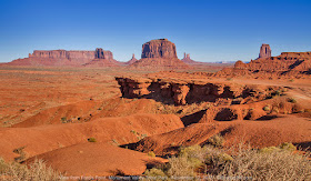
View from Ford's Point, looking northerly.

When I felt like I'd done it all, I headed out of the park and toward Kayenta on the US highway, where I picked up provisions at Basha's market and filled the gas tank. My intention was to visit Canyon de Chelly as I worked my way toward home. I drove east on US-160 for a few miles before turning south on Indian Route 59. Going this way cuts a number of miles off the route. It's a two-lane highway in very good condition with interesting scenery.

Agatha Peak, a volcanic diatreme between Monument Valley and Kayenta.

Canyon de Chelly


Note: There are several more of my photos collected on this Google photo page that I hope you will find interesting and/or scenic.

View from the Tsegi Overlook

I arrived at the national monument shortly after lunch, picking up a map at the visitor center. I checked out the private campground just inside the park. It looked very nice with lots of trees and grass, though only one loop was open this time of year. I didn't know if I'd stay the night or not at this point, but didn't have to decide then as my plan was to drive the south rim, which is an out-and-back route.

White House ruin, in situ. For a closer look, visit the photo collection.

I stopped at all the overlooks on my drive east along the rim and took lots of photos. I paused at one and ate the turkey sandwich I'd bought earlier at Basha's. This late in the season the shadows were long and the days are short, so I didn't take the trail down near the White House ruins. One doesn't need a guide for this trail, whereas you need a guide, or to take a tour, to explore the canyon bottom at all other locations. Next time.

I realized I'd made a mistake once I got to the effective end of the road to view Spider Rock, as the shadows had already started climbing the rock. I would have gotten much better photos if I'd driven to the end of the road first for those photos, then worked my way back. Oh, well. I told myself that I'd just have to come back sooner rather than later. With that last understanding, I decided not to camp at the park and drive the north rim in the morning. I'd head for home and save all that for another trip.

Spider Rock (with the shadows cropped out.)

I drove out of the park and south on US-191 all the way to eastbound I-40. I stopped for cheap gas in western Gallup and it was soon dark. I topped up my belly with a green chile cheeseburger at the Lotaburger in Grants. The drive on the dark freeway was thankfully uneventful and I made it home safe.

Thanks for reading along.


Four Corners: November 2015 - Part 1

A Loop along the Ancient Way though the Navajo Nation
November 8 - 13, 2015


Part 1 of 2 - Four Corners


I wanted to take one more journey in my camper before winter, but events and the weather kept pushing it back. I'd been trying to find a good time to return to Chaco Canyon for several years. This idea seemed like a good cornerstone for the trip. I also wanted to check out the Bisti/De-Na-Zin BLM Wilderness having seen the signpost many times as I drove by on US-550 to SW Colorado.

When finally the weather forecast was generally favorable, it did come with one day in the middle in which a fast moving Pacific storm was predicted to pass though. I thought I might visit Aztec National Monument that day as it was a small area and the reconstructed Great House would be out of the rain.

I considered also visiting Mesa Verde, but while perusing their website I discovered the campground closes at the end of October and a few of the areas in the park would be closed due to a rock slide and/or maintenance. So, another time.

From there it was up in the air. I'd seen signs for Hovenweep National Monument in my travels in SE Utah. I'd picked up a brochure when I'd been at Black Canyon the year before and the ancient puebloan towers at Hovenweep sounded interesting. And if I did go there, then Valley of the Gods, UT and Monument Valley were not that far away. OK, I had a tentative plan.

Map of my journey. Click here for full-size version.

Sunday, November 8th


I got a reasonable start around 8 o'clock and headed northwest out of the Albuquerque area on US-550 toward Chaco. On Friday when I finally came up with my plan, I made a campsite reservation for Sunday night. I didn't think I really needed one in November (the campground is open year around), but there is no additional fee by using reservation.gov and I figured it would be convient to have already paid.

US-550 between San Ysidro and Cuba, New Mexico

Chaco Canyon


The turn-off to Chaco Culture National Historic Park, as it is officially known, is between Cuba and Aztec, NM and has a large highway sign that's hard to miss. I turned west and followed the smaller signs through a number of turns as the road went from paving to gravel. One intersection wasn't marked, but it was obvious enough to figure out. As I was blasting down the gravel road at about 45mph I thought the road was in much better condition than I'd remembered from my previous visit. Then I saw the sign that said "End of County Maintenance" and the road turned to rutted, uneven dirt - that's what I'd remembered. There were also places that would be problematic or impossible if the ground were very wet.

This entrance sign, with Fajita Butte in the background, is actually at the south entrance to the park.
I photographed it at the end of the day in the Golden Hour, but placed it out of sequence here for effect.

Last time I was here the visitor center was in a trailer, now they not only have a nice, new building, but also a small astronomical observatory out back - very nice. One stops at the center to pay one's entrance fee, pick up a map, ask questions, and use the bathroom. There is one ruin accessible from here, the others are along, or off, the driving loop.

I was attracted to how the standing wall of the Hungo Pavi great house parallels the canyon wall.

Chaco Canyon is a fascinating place if you have any interest in ancient puebloan civilization or ruins. Experts still have no clue why so many great houses were built in this one area or the significance of the "roads" that were built, radiating away from here other than they tend to point toward other pueblos or outposts. Each of the great house ruins accessible from the paved loop road is unique in both structure, construction and materials. The park service has placed each of the parking areas at a small distance from the ruins, so some walking is required to reach each site, but this allows you to appreciate the site in a more natural environment. There are a few other sites that require longer walks.

I will not provide a detailed report of my activity at Chaco, other than to say I enjoyed walking the ruins and viewing the petroglyphs. I hiked the Pueblo Alto Loop trail, which is 7 miles long, measured from the parking area. It involves a very steep trail up the cliff beside Kin Kletso ruin and includes wonderful views. It was a great hike, but I discovered too late that the inserts in my hiking boots were worn out. I had blisters on both feet by the time I got back to my truck.

There is very little left of Pueblo Alto, but adjacent are these walls of the New Alto ruin
which appear dramatically on the hilltop as you walk the Pueblo Alto loop tail.

I'd driven through the Gallo Campground on my way into the park so I'd know where my reserved site was located. I was able to get set up quickly as the sites are pretty level. Also a nice bonus on this chilly November evening - the restroom was heated and had running water. There is a dishwashing sink, but no showers.

Campsite with Alcove Home ruins in the background.

Monday, November 9th


As I peeked out the window at dawn there was a beautiful sunrise. My big cameras were locked in the cab, so I grabbed a snap shot with my phone.

Sunrise over the campground.

I broke camp after breakfast and drove back into the valley to visit a few additional sites.

I took lots of photos this trip, but have posted very few here. You really need to visit this wonderful area to appreciate it. I have displayed many shots from my previous visit on my Bosque Bill website, please go to this page if you would like to see them.

After picking up a couple of souvenirs at the visitor center, I headed back toward the highway. There are usually pueblo indian vendors at the intersection of the county road and US-550. I decided to stop and buy lunch. They were primarily offering fried bread and Navajo Tacos. A Navajo Taco was only $5, but all I had was a twenty and they had no change. I almost drove away disappointed until I remembered the cache of quarters I keep for the coin-operated car wash. Supplemented by a few nickels and dimes, I had $5 worth and the taco seller was happy to take them. If you've never had a Navajo Taco, you owe it to yourself. This one was huge, way more than I could eat.

Bisti/De-Na-Zin


I had seen signs for the Bisti/De-Na-Zin Wilderness on my travels up and down US-550 between Aztec and Cuba for years and this is the trip I'd check it out. I viewed the BLM website before leaving home (links below) where there is a map showing access to the wilderness. I used Google Maps to zoom in on the roads and parking areas. My plan was to check the De-Na-Zin trailhead on my way in, but I guessed the geologic features would be more accessible from the Bisti trailhead, which also seemed to have a larger parking area in which I could set up my camper.

The turn-off from US-550 was clearly marked, but as you drive down County Road 7500 the obvious route becomes confused by unmarked forks and side roads that are as well used as the main route. This area is part of the checkerboard of the Navajo Reservation and there is also lots of oil and gas wells in this region. I had turned on my Garmin GPS which did show the roads, but did not have them identified. Only because I'd studied the Google Map I knew about where I was to take a left fork and that was the only thing that kept me on the right path. Even then I flagged down a pickup truck headed toward me (the only vehicle I'd seen once in the maze) and asked the lady driving if this was the road to Bisti. I mispronounced the name so badly I had to further specify I was looking for the wilderness before she understood what I was asking. I learned later it is pronounced "bis-tie", and if I understood that lady correctly that De-Na-Zin is not pronounced like three separate words, as I was doing, but like the word "denizen". I've also learned that the reason for the "/" in the name is that these were once two discrete wilderness areas that have been merged into one administrative unit.

The parking area for De-Na-Zin was indeed small and it looked like there was a long narrow trail though the brush to get to the canyon. I should have taken a photo, but didn't think of it. I continued down the county road to State Highway 371 and turned north where the turn-off to Bisti was about 7 miles along the highway. Then a couple of bumpy country roads brought me to the parking area.

Though I didn't set up camp before my hike I did find a good spot to park the truck with a bed of gravel underneath. Rain wasn't forecast until the next day, but I wanted to be prepared in case it came in early, overnight.

For some reason I thought I’d be able to simply walk into the wilderness and all would be revealed. Nope. This suddenly became clear to me when confronted with the large wash before me and no sight of any interesting geological features other than some small red hills in the distance and the black & white layers in the canyon walls.

Important: as I learned first-hand, before visiting this area one should do one’s homework and have a detailed plan. A GPS is almost a necessity both to keep from getting turned around in the side canyons and to find the features. Also, this is not an area you want to visit if there’s been lots of rain as it reportedly gets very muddy - I even found a pair of sneakers in the parking area that had been abandoned due to excessive mud encrustation (I suspect they took them off before getting in the car, then forgot them.)

There is a map board at the parking area and on the back side the BLM had a detailed map showing the approximate location of the features with distances shown as concentric circles. (Another missed photo opportunity. Sigh.) My feet were still very sore from the previous day and the afternoon was advancing - it was almost 3:30pm - so I chose the closest features on the map, the "Named Hoodoos", which also had the virtue of being easy to find in the first large side canyon on the south.

I think I did find the hoodoos, but they were much smaller than I had imagined. I had envisioned them as being about the same size as those at Kasha Katueue, but not so.

A hoodoo standing alone before a layered bluff, one of the few at ground level in this particular side canyon.

Note: instead of providing a number of boring photos taken in poor light, I refer you to the Flickr link below should you be interested in seeing what is available in the wilderness. When I return and get better photos, I'll upload those in that new post.

When I had signed the log book at the trail head I noticed someone had left a printout describing the Bisti sights. After setting up camp I borrowed the printout to read after dinner. I was comprised of pages from the Bisti Hiker website that included details for hiking to some of the interesting features up the wash. It sure would have been helpful to read before my visit. I've linked the site below. And yes, I did replace the homemade brochure for the next visitor.

Bisti parking area and my impromptu campsite.

Additional Information

Since returning from the trip I've researched Bisti/De-Na-Zin further for my next visit there. I read the resources on the Bisti Hiker site and also discover the excellent resource that Flickr can be. I've included a link to a map of geotagged photos below. When viewing the map, I recommend you change the layer type to satellite. You can look the the photos then decide which ones you want to see. Unfortunately, Flickr does not provide an easy way to retrieve the coordinates, though I discovered if you look at a photo's page there is a map thumbnail below it on the right. The latitude and longitude are embedded in that URL (as you can see by examining the link below); it is relatively easy to copy the URL and extract the coordinates.

Also I've learned that most of these amazing geological features are actually fairly small. If you are expecting grand features such as in Arches National Park you may be disappointed. Instead enjoy these small treasures for their uniqueness themselves.

Bisti/De-Na-Zin Links

BLM website that also includes a map and a link to the BLM Bisti Flickr page.

Bisti/De-Na-Zin Hiker website with photos and hikes.

Flickr map showing locations of geotagged photos in the Bisti area.
Note: there are some gorgeous photos not geotagged that can be found by searching Flickr for the tags Bisti and Bisti Badlands

American Southwest website, also check their maps and hiking guides:
http://www.americansouthwest.net/new_mexico/bisti_badlands/index.html
http://www.americansouthwest.net/new_mexico/de-na-zin/wilderness-area.html

Tuesday, November 10th


I wasn't sure if it would be raining or cloudy when I woke up this morning. It was neither, it was crystal clear. My feet were still in no condition for a long hike, so I broke camp and headed out, then north on NM-371. I'd originally thought to visit Aztec National Monument, as it was a small site close to the town of Aztec so should be a good spot even if there was rain. Since it was clear, my thoughts turned to getting a photograph of Ship Rock in the morning sun.

Ship Rock


I turned west at Farmington onto US-64 for the town of Shiprock. (I'd recently learned that the current convention, though not universally followed, is that the town is one word; the geologic formation, two words.) I took the US-491 south at Shiprock to look for a spot for my photo. I turned right down a small paved road to a pull-out with a nice view of the ancient volcanic plug, though I did have to photoshop out some power lines.

Ship Rock - a volcanic diatreme.

Hovenweep NM


I returned to Shiprock to gas up and get breakfast. I left Shiprock continuing on west US-64, then turned NE on US-160 headed toward the Four Corners. I bypassed the actual corners as I think you only need to do that once per lifetime. I drove a short ways into Colorado before turning northwest on CO-41, which turns into UT-162. Just past Aneth, Utah, one turns north off the state highway. A variety of county roads brought me to Hovenweep National Monument. The route was marked fairly well, but you should have a good map just in case as there are many turns.

One of the first overlooks on the trail from the visitor center. A few clouds gathering.

This is a very interesting ancient puebloan site which can easily be explored in an afternoon or morning. The jewell of the park is the Square Tower Group which can be accessed via the Little Ruin loop trail from the visitor center. The trail is approximately 2 miles and for most if its length relatively flat. If you complete the loop, however, you will need to take the steep section of trail to the bottom of the canyon and the climb back up top.

Scene from along the trail. More clouds coming.

At the head of the canyon, you can look east toward Sleeping Ute Mountain. Becoming more cloudy.

Looking back up canyon from the trail on the south side. The clouds are getting dark.

How many towers can you see?

Looking up the canyon from the bottom. Of course it wasn't this wild back in the day; they built small dams to catch
rainwater and planted crops along the canyon bottom. The towers must have appeared formidable to intruders.

I next drove the few miles to one of the outlier sites. The Horseshoe & Hackberry, and Holly ruins are a short walk off a primitive road. A high-clearance vehicle is a necessity, though 4 wheel drive was not needed. As my feet were still very sore and the forecast storm seemed to be closing in, I didn't walk to the ruins, but attempted photos from the truck. I could tell from the ruts in the non-rocky portions of the road that the mud would be axle deep if the ground got saturated. Best to save further explorations for another trip. I didn't include my photos from these sites as they are not that great.

The story continues in Part 2