Part 3 of 4 - Continued from Part 2.
May 17, 2018 (continued)
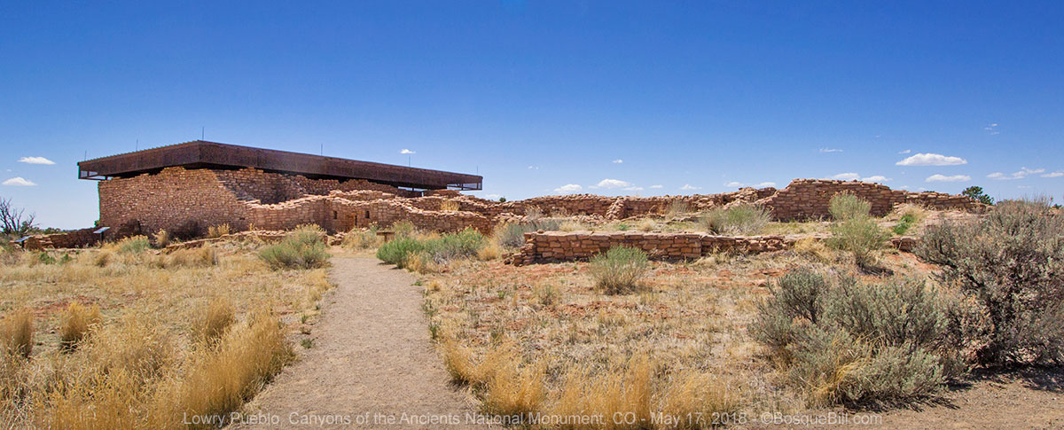
Chronologically, this post should begin with Lowry Pueblo, but I've skipped that for now so I can keep all the Canyons of the Ancients part of the trip grouped together in Part 4.
Dolores Canyon
Remember you can click on any photo for a larger version (recommended.)
Dolores Canyon Overlook
Next on my agenda was Dolores Canyon. I'd seen a photo somewhere and it looked very rugged and beautiful. I was only able to find a small amount of information on the area on the BLM website. No one I knew was familiar with the area. It was still relatively early in the afternoon, so I thought I'd check out the overlook I'd found on Google Maps, first.
I'd seen recreation and/or forest access signs along US-491 every time I'd driven between Cortez, CO and Monticello, UT and wondered about them. These are the typical brown, rectangular highway signs and easy to see if you're paying attention. The country the highway passes through is rolling farmland as far as you can see in both directions. I found the sign just south of the village of Dove Creek for "Dolores River Access" and the canyon overlook. I turned off the highway and followed the BLM directional signs.
After a few miles the road climbed slightly and the land changed from agricultural fields to pine forest. I turned up into the forest and continued.
[Note: this road would be impassible in wet weather!]
I noted a few side roads as I drove along as possible dispersed campsites. At the end of the road is a parking area with picnic tables and vault toilet, but no view. You have to walk a trail a hundred yards or so to come to the actual overlook.
 |
| Looking up the canyon toward Dolores. |
 |
| Looking down the canyon. Note Abajo Peak and the mountains west of Monticello on the horizon. |
 |
| Panorama taken with my phone. |
I looked up the canyon and down. In one place I could see the Dolores River far below. When I looked to the northwest I saw a road descending down into the canyon. I bet myself that this was the road down to the river.
 |
| From this spot you can see the Dolores River below. I was happy to see a lovely flowing river with trees all around. |
 |
| I closer view down canyon. You can see both the town of Dove Creek on the plains and the road diving down the side canyon toward the river. I would be driving this road very soon. |
 |
This is the "staircase" that leads from the trail on top down to the actual overlook point.
I quite liked how they simply laid slabs of mudstone on the ground to form the path. This was much easier on my knees and provided plenty of grip to negotiate the incline. |
On my way out I tried a couple of those side roads and they did indeed lead to dispersed campsites. A couple were in meadows surrounded by pine trees; one was closer to the canyon edge, but with heavy undergrowth and no shade.
Dolores Canyon
I drove back toward the highway and picked up the directional signs leading to the river access. After a few turns on various farm roads, the route began dropping down into the canyon. FYI, on this road there is one dispersed campsite by the road, and perhaps another up a side road. They're only about a mile from the last turn-off and before the road gets really steep and narrow. The steep road and the canyon are definitely not recommended for trailers.
 |
| The road down into the canyon and the Dolores River. |
At the bottom of the road is a pumping station for Dove Creek and then a BLM area for picnics and raft launching/retrieval called
Mountain Sheep Point Rec Site. I didn't see any sheep. When the water is high enough this is a rafting river. Rafters can put in at Bradfield Bridge and get out here or continue for nearly 100 miles in favorable conditions according to a brochure I found online; it also showed locations for river accessible campsites all along the way. I was told later that last year there was good rafting from April to June, but this year the river never had enough flow.
About a quarter of a mile farther is BLM's no-fee
Box Elder Campground. I drove in to check it out. I saw maybe a half-dozen sites and a vault toilet (although the BLM website says there are 11 sites and two toilets). There was lots of shade, but it felt a bit too closed in for me. Also, there was so much brush along the river there was no good access. There was one car there, but they weren't camping.
I left the campground and continued north, downstream. In about a hundred yards the road climbs up over an ancient landslide and is rocky and rough - high clearance is needed here; four wheel drive is not necessary, but did help with traction.
[Note: past the campground there are sections of road that would be impassible in wet weather. High clearance is also recommended. The farther you go, the narrower the road, with limited turn-around opportunities.]
 |
| The road down the canyon just past Box Elder Campground right before it climbs an old rock slide. |
 |
| Looking upstream from the same place as the photo above. |
About half a mile from the campground I found a dispersed camping area - you can easily see it in Google satellite view. There were a few sites in the main area, but none really grabbed me, however there was one at the north end that I quite liked. It was sheltered on three sides by oaks, in case the wind came up later, and had nice access to the river... and beautiful views of the dramatic, red canyon sides!
 |
| My campsite. The river is just down from the rock fire ring. |
I found a level spot, popped up the camper, and got my chair out. The temperature was in the upper 70s with just a slight breeze. I sat and marveled at the gorgeous scenery.
 |
| Another view of my campsite. This one includes a bit of river. |
 |
| Looking at the far side of the canyon by the river near my campsite. |
 |
| Looking downstream from near my campsite. Note the tall Ponderosa pines. |
 |
| My campsite as seen from the river bank and showing the canyon walls on this side. |
Friday, May 17
Dolores Canyon (continued)
A beautiful morning in a great camp site. I sat out enjoying the view and the river. There were lots of interesting bird calls in the oaks, but the vegetation was simply too thick to see anything, much less photograph it.
 |
| Morning view of my campsite. |
 |
Telephoto of a rock formation down canyon that I thought looked like a face in profile.
Note also the commercial jet flying by in a roar. |
 |
| One more photo from my campsite looking down river. I don't think the large pine actually leaned over this far. I think much of that lean is due to wide-angle lens distortion. |
I was wrestling with myself on whether to stay here one more night or go explore down river both to see what was there and to see if there was even a better site to camp. Frequently the need to move proves overpowering. I decided I'd stay here as long as my chair was in the shade. I could tell that the site would lose all shade around noontime. I had my lunch and broke camp.
I continued down the road that parallels the river. The views continued to be wonderful. I passed one Tacoma pulled over on the side of the road - no sign of people, perhaps fishing or hiking. I found another dispersed campsite, then another, but kept going.
 |
| Lots of beautiful views as the road follows the river. |
 |
| View of the Dolores River where the canyon was somewhat wider. I believe I turned around near here. |
I was using the Avenza Maps app with the USGS Quad loaded to track my progress and guess what would be ahead. After the first couple of miles, dispersed campsites became much less frequent and the scrub oaks at the sides of the road began to encroach, scraping the sides of my rig. The soft green leaves hid the stiff limbs beneath. Keep that in mind if you drive a full-size truck. I was approaching the top of the topo map, and though I knew the road continued, the next Quad did not show the road. I decided I'd turn around next chance, as the wider canyon was becoming less dramatic, and go back to one of the campsites I'd spied earlier.
I returned to the site I liked the best. It was a little more than a mile farther north (downstream) from the previous night's encampment. It was a beautiful little spot with a few trees for shade all day. Nice view of the river and easy access, too. Someone had arranged rocks across the river, perhaps for fun, perhaps for raft access. This also provide a pleasant background bubbling-creek sound. There was also a large boulder that had fallen from the western cliff face maybe 30 years ago, judging from the ways the trees had grown around it.
 |
| My second campsite - a bit smaller with better shade and view of the river. |
I set up the camper, placed my chair in the shade overlooking the river, and relaxed. After a while I decided my feet were hot, so I strapped on my water sandals and cooled them in the Dolores River for a while. It was a beautiful afternoon, probably around 80º.
 |
| View of the campsite from the other direction. |
 |
Looking downstream from near my second campsite. I was standing in the cool waters to take this shot.
You can also see a high-water cut on the left bank. |
 |
| Looking upstream. |
Dolores Canyon is a gorgeous area, lightly used, and the views of rock cliffs and the river are beyond compare. The photos do not begin to convey the majesty of this wonderful landscape. The only negative, and it's a small one, is that the air corridor above the canyon is busy with commercial aircraft and the sound of their jet engines is reflected by the canyon walls both coming and going.
 |
| Evening view of the canyon. The double-track at left leads to my campsite. |
Saturday, May 18
Dolores Canyon (continued)
 |
| This is the boulder that sat at the head of my campsite. |
What can I say?... another beautiful morning. It was tempting to stay out and not head home, but a friend I hadn't seen for years, as he lives back east, was passing through Albuquerque on Sunday and wanted to meet up, and it's very unlikely I'll get back to the Eastern Seaboard anytime soon.
 |
| A last fond look at my second Dolores Canyon campsite. |
I figured I'd have time to check out the upper canyon access and visit the Anasazi Heritage Center near the town of Dolores, and still get home at a reasonable hour. So, I packed up and headed out. I stopped briefly to take photos at the picnic/raft-launching area, before climbing up out of the canyon.
 |
| Mountain Sheep Point Rec Area |
Bradfield Recreation Area
Upon reaching US-491 I turned south toward Cortez. Just before the town of Pleasant View I spotted a recreation access sign for Lone Dome Recreation Site. It didn't mention Bradfield, but a quick look at my map confirmed this was the northern route (coming from the south, I believe the sign is before you come to Pleasant View.)
This time the road dropping into the canyon was wide, gravel, and not very steep. Dolores Canyon at this point is pretty tame - more of a valley than a canyon. I pulled into BLM's Bradfield Campground just to see what it was like. It was wide open grassland, no shade other than from each site's ramada. Access to the river was from a picnic area/raft launch site before you get to the campground. Not a very attractive choice for us dispersed camping types. I had time to explore a few miles upriver.
 |
| Bradfield Recreation Area Campground. Suitable for trailers. |
Bradfield Bridge
 |
| Bradfield Bridge as seen from the campground access road. |
After you cross the bridge, you need to climb a short ways up the ridge to the second junction before taking the road toward McPhee Reservoir. Once you drop down into the valley there were a couple, marginal dispersed sites in the first two miles that would be better than the campground as a last resort.
 |
| An abandoned cabin near where the sandstone is exposed in the canyon. |
The Cabin Canyon Recreation site shown on Google Maps is apparently permanently closed (I've reported this to the maps team, who knows maybe it will be updated before you look). I drove 6 miles up the road and did not continue to the dam. At 6 miles there were a couple slightly better dispersed sites. I see now that had I driven just a little farther I would have come to the Lone Dome Recreation Site. If the satellite view is anything to judge by this tiny campground may be open, but it is impossible to tell if there's a gate closing the road or not.
 |
| This section of Dolores Canyon is very different from that farther downstream. |
 |
| One last look at the sandstone canyon walls here above Bradfield Bridge. |
From here I drove to the Anasazi Heritage Center near Dolores, CO, however Part 4 will actually begin with Lowry Pueblo in Canyon of the Ancients National Monument, which should have been at the start of this post, chronologically. I chose instead to keep all of Canyons of the Ancients in one post to make it more concise for those who later wish information only on that subject.
Continue to Part 4.