
Southern Utah - September 2016
Spectacular Switchbacks, a Secret (Camp) Site, and Hidden Splendor
Part 4 of 4:
Hell's Backbone Road, Spencer Flat, Natural Bridges, and Comb Wash
Tuesday, September 20th (continued from Part 3)
Click on any photo to see larger versions - highly recommended!
Boulder
I thought I might stop in Boulder for lunch, but first I wanted to see if I could find the reported Escalante National Monument visitor center. It took driving through town and back to notice the sign - the VC is inside the building that hosts Anasazi State Park. Inside I found the information counter with a small sign saying "Sorry We Missed You" and advising visiting the interagency visitor center in the town of Escalante. There were maps, brochures, and a permit pad at the desk, so I guess that covers most needs.
I wanted to ask about the approaching rain and condition of Hell's Backbone Road that I'd heard about and was interested in exploring. The state park building did have good, free wifi, but I wanted local information. I lucked out as a state park ranger wandered within view. I asked him about the rain and where I had hoped to drive. He stepped outside and looked at the clouds, which pleased me. He said, "Rain usually rolls in from that direction," pointing SW; "and Hell's Backbone is that direction," pointing to the NW. "I believe you will have plenty of time to drive the road, but I wouldn't want to try it this evening." That was all I needed to know. I thanked him and hurried off - lunch could wait.
Hell's Backbone Road
 |
| The view from the first few miles of the road. |
I drove southwest out of Boulder on UT-12, the road climbing up a sandstone mesa, and turned off north on Hell's Backbone Road, which was built by the CCC in 1933 to connect Escalante and Boulder. It travels through rolling hills, then ranch/farm country for a while before ascending onto the mountain, complete with pines and evergreens. I didn't know what to expect along the road, the only photos I'd seen didn't include forests. Perhaps I shouldn't have been surprised, I'd been driving in Dixie National Forest since turning off the main highway. I came to a bit of old road and drove in a short ways to have a picnic lunch.
 |
| I stopped here for lunch. You can see this old road is blocked behind my truck. Folks had camped here. |
Resuming my drive toward the west, I soon came upon Sand Creek. It looked like there were dispersed campsites along there and a forest road heading north. Looking at Google Maps since my return home, I can see a forest road that follows the creek and should provide a number of camping opportunities. There are other forest roads in the area, as well.
As the road climbs out of the little valley of Sand Creek, domes of white sandstone appear on the north side of the road. Only a short while later the iconic views I'd been expecting from the advanced PR opened up on the south side of the road. Wow! I seem to be using (or over using) the term "dramatic" in this post, but what else can I say? Spectacular? Yes, at least that. I stopped to take photos that cannot begin even in the smallest way convey the breath-taking drop and view toward the Box-Death Hollow Wilderness. I suddenly wished I had a stereoscopic camera, but don't know how I could get you a stereoscopic viewer - perhaps in a few years when we all have VR goggles.
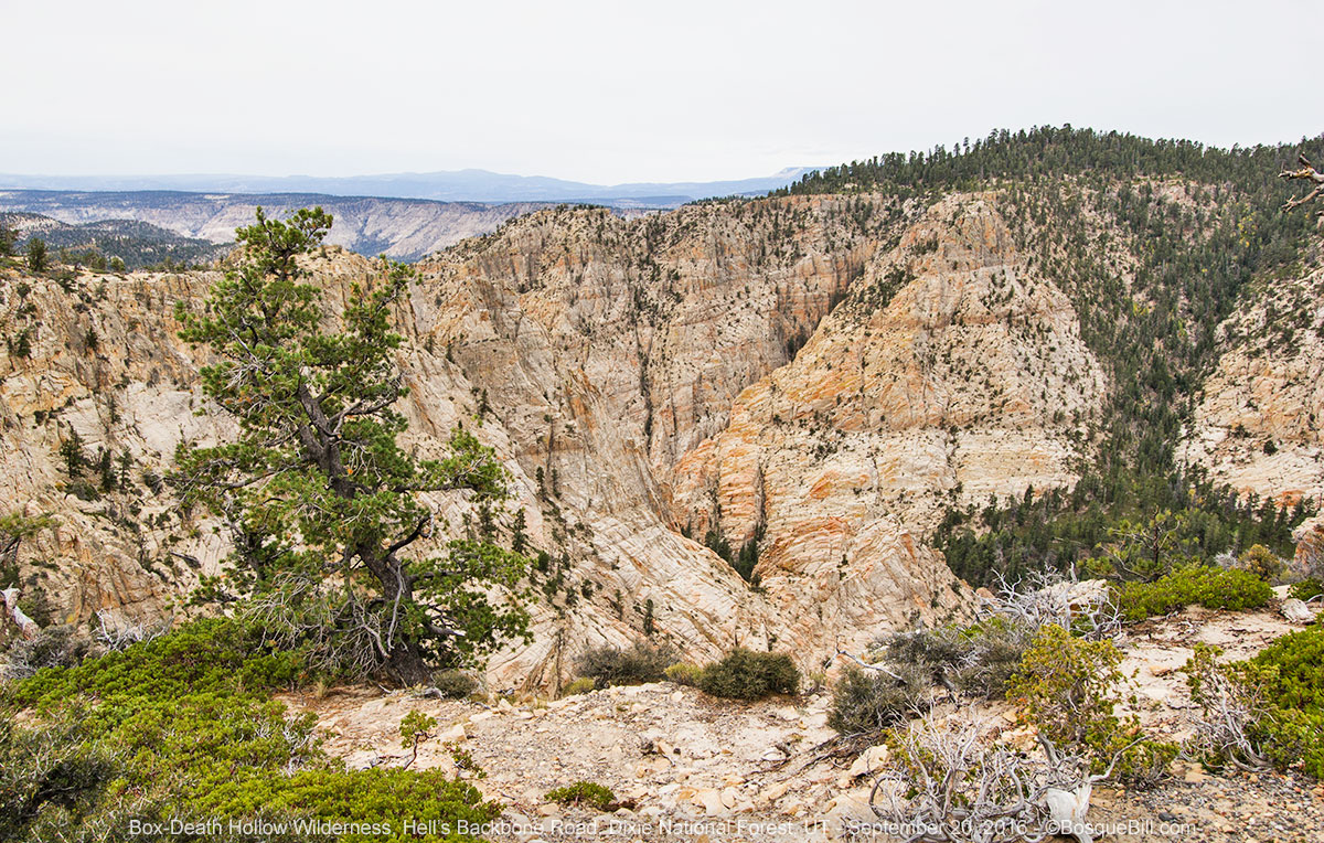 |
| The view to the south over the chasms of the Box-Death Hollow Wilderness. |
 |
| On the north side of the road, more colorful rock formation and aspen covered mountainside. |
 |
| Hell's Backbone Bridge |
 |
| Here is a little information on the road and its construction. |
 |
| View of the bridge from the side. |
I crossed the famous single-lane bridge over the top of the spine, after stopping for more photos. The road continues through the forest, back a ways from the edge of the canyon. I stopped to photograph some aspen that were already turning, but as the sky was still threatening rain I kept to the main road and didn't turn off to look at Posey Lake or its campground.
 |
| The elevation in this area was about 9000' |
Escalante
I reached town just as it was starting to sprinkle and I got gas first thing. I then drove to the west side where the consolidated, interagency Visitor Center is located. I wanted an update on the weather and their opinion if it was safe/risky to drive out Hole in the Rock road to find camping. I was already thinking of heading back home as the weather report I got in Boulder indicated that the rain would last for days.
They said it would rain, but did not know how hard, though the ranger said when the chance of rain was 80%, as it was, that usually meant lots of rain. The young man at the information counter and I discussed options and I settled on Spencer Flat Road as a destination. He helped me fill out a permit, which is required for all overnight camping in Grand Staircase-Escalente National Monument (and Glen Canyon National Monument, too.) The permits are free and you don't have to be too specific in your final spot.
There is a nice, little organic grocery store along the main street, next door to the Escalante Post Office. A bit pricey, as you would expect, but I wanted fresh fruit which they had. They also had lots of frozen items - also not a surprise at this outpost. To balance this out, I stopped at Nemo's before leaving town for a pretty good cheeseburger and fries.
I drove east out of Escalente on UT-12 in light rain. The turnoff would be in about 10 miles, in the middle of the big switchback where the highway drops off the rock cliffs, at mile marker 70.
Spencer Flat Road
I found the road easily and turned south. Very quickly I spotted a nice campsite just off the road with some small trees. Not one to take the very first site, and it was not that far off the busy highway, I continued down Spencer Flat Road. There were a couple side roads within the first mile or so that likely led to sites, but there were also a couple of washes that might be problematic if the ranger's heavy rain came in the night.
I turned around and pulled into that first site. Though it was within one or two hundred feet of the highway, the pavement was below the cut for the most part and it was a nice level site with a bit of a view. I got the top up and the items I store in the truck cab moved into the camper in time for a pretty good rain shower at around 4pm. I sat inside, listened to satellite radio and finished a good book I'd been reading.
 |
| My campsite just off Spencer Flat Road. |
Head of the Rocks
An hour or so later the rain had stopped, though the sky was still overcast. I decided to explore a bit as there was a hint of a path leading to a promontory nearby. I took my camera hoping to find a place to overlook the dramatic little valley. I was able to skirt a cattle fence and with an easy climb was delighted with the wonderful view over the white sandstone canyon. The photos look a little flat, especially with the overcast, but the landscape was anything but flat.
 |
| The depth and breadth of the view was wonderful as were the colors. |
 |
| From the end of a promontory, decorated with a cairn, you can see the state highway descend. |
When I'd first driven through here in 2013 after visiting Bryce Canyon, I was totally amazed when the highway dropped off the flats into this scene of twisted and domed rock. On that sunny day, I stopped on the other side and took a photo looking back west.
 |
| View looking west at Head of the Rocks from my May 2013 trip. |
I've now seen this geologic feature referred to as Head of the Rocks. It seems to be comprised of Navajo Sandstone, Kayenta Formation, and Wingate Sandstone. If you are interested in the geology of the national monument you will want to view this pdf.
 |
| iPhone panorama (180º plus) of the view of Head of the Rocks. |
It only rained lightly during the night and the traffic on the highway dropped to nil once it got dark.
Wednesday
Spencer Flat Road (continued)
As the roads were still in good shape, though the clouds were heavy, I decided to explore farther down Spencer Flat Road after breaking camp. The road roughly parallels the rim of the valley and there did seem to be a number of dispersed sites available. The road climbed a moderately steep and rocky section, then went across a cattle guard. At the top of that rise was a large site close to the rim with a few junipers. I may come back here in future. I turned around there, headed back to the highway, and proceded east.
Back on the Highway
I did not stop at the Boyton Overlook as the heavy cloud cover muted the colors and view. here is the photo I took of the overlook my first time by here.
 |
| Boyton Overlook from my May 2013 trip. |
I did pull into the campground at Calf Creek Recreation area, as I'd heard it was a lovely spot. It is indeed an oasis in this rugged canyon country. The sign said the campground was full, but there were a number of empty spots where campers had recently pulled out. You should grab a spot early if you wish to camp here. This is also the trailhead for Lower Calf Creek Falls, a hike that was recommended to me.
I didn't stop and photograph the Hog's Back this trip either, as the light rain diminished the view. Here is a photo from my earlier trip.
 |
| The Hog's Back from my May 2013 trip. |
It was lightly raining as I traversed Boulder Mountain on highway 12. The gorgeous views off to the south and east of the canyon country that I'd enjoyed on my previous trip through here were veiled by mist. The road even passed though pockets of heavy fog. I was heartened to see that even in the few years since I last drove through, the aspen groves had made great strides toward recovery.
Torrey
I wanted to fuel my belly, so stopped at the Capitol Reef Inn & Cafe in Torrey. It was around 11am. They said they were only serving breakfast, which was OK with me. For some reason I ordered waffles with fresh strawberries and a side of scrambled eggs. They were OK, but nothing special. They did have good wifi, however, and I was able to examine the brochures I'd picked up earlier and come up with a travel plan.
Capitol Reef Petroglyphs
I'd seen the sign on the main highway for petroglyphs when driving by days before. This pass I had time to stop and check them out. The national park constrains visitors to a wooden walkway, the far end had been closed due to a fallen cottonwood.
 |
| This is the main panel which is just off the parking area. |
 |
| This faint animal panel was down the walkway. |
 |
| This arch-typical figure was the last before the walkway was closed. |
I drove back east on UT-24, stopped in Hanksville for gas, then drove down UT-95 toward Lake Powell. This section seemed much more scenic than on my last trip, perhaps as it was about 40 degrees cooler. I made a quick stop at the lake overlook to see just how low the lake had fallen, then proceded to Natural Bridges National Monument
Natural Bridges
The only time I'd been here was late on a hot, windy afternoon so only took a few photos from the overlooks. I'd wanted to hike down into the canyon for photos this time, but again it was late in the day, so only hiked down the shortest trail to Owachomo Bridge. I also took photos from the rim viewpoints, and with the scattered light from the overcast, the images turned out better than those from my previous trip.
 |
| Sipapu Bridge from the overlook. |
 |
| Kachina Bridge from the overlook. |
 |
| iPhone panorama (180º plus) of the canyon and Kachina Bridge. |
 |
| Owachomo Bridge from the trail. |
I had anticipated the campground at Natural Bridges would be full. It's small and popular. If you're curious, it filled at 1:15pm on this day. It would have been a convenient stop, but I already had a plan. When talking to David and Peggy back in Moab, they'd raved about what a wonderful place Comb Wash was to explore and camp. I'd seen the road and sign at the southern terminus of the wash every time I drove between Bluff and points west, and had always wondered about it.
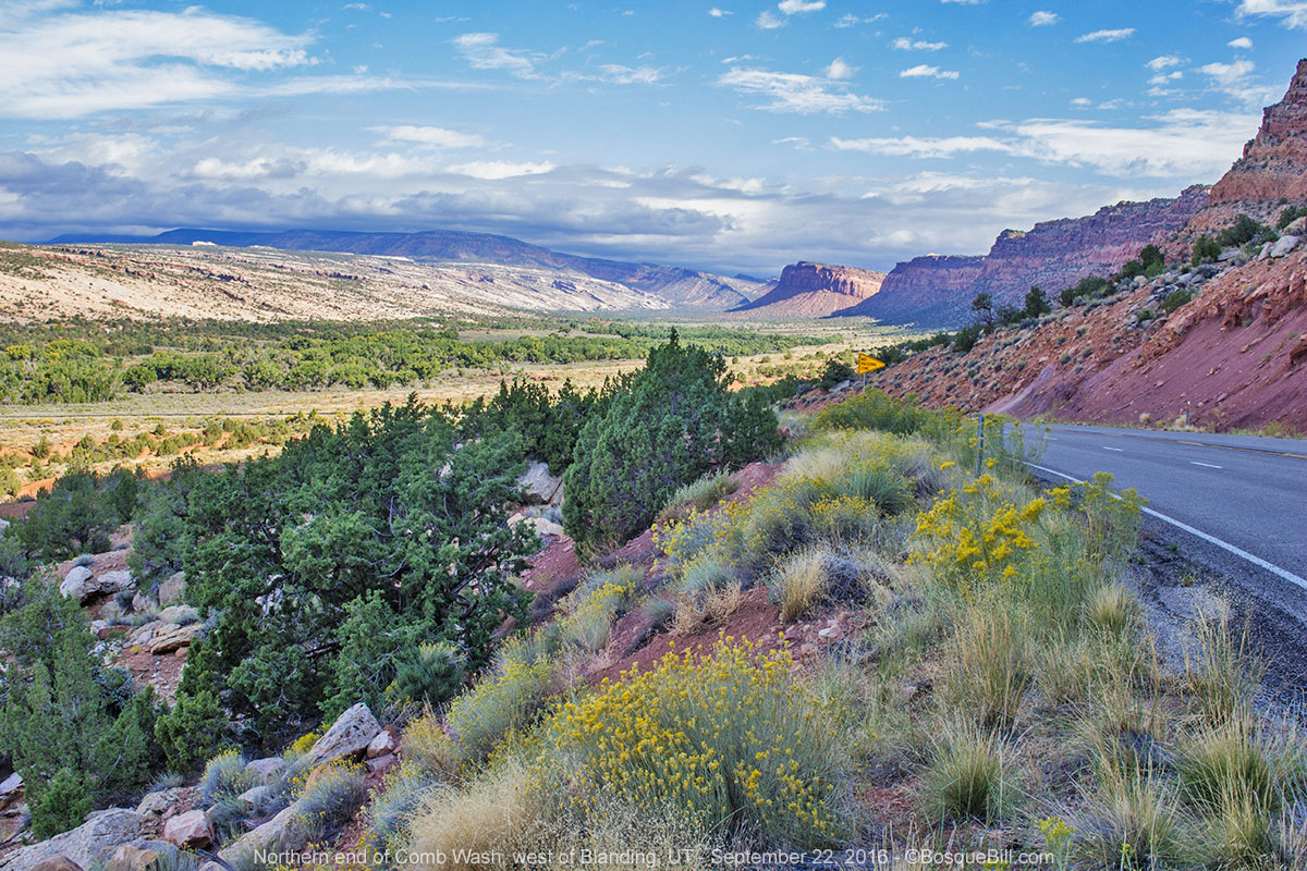
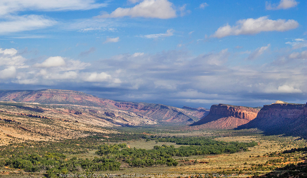
Comb Wash
One of the brochures I'd picked up at the info center in Torrey was the 50 page San Juan County: Utah's Canyon Country (www.utahscanyoncountry.com 800-574-4386). It is worth requesting. I was looking though it to figure my plans for the day/evening while having lunch in Torrey. In the back, in the list of public campgrounds, I found Comb Wash listed as a primitive campground of the BLM, 12 miles west of Blanding on US-95. That was about the extent of the listing, they gave the phone number and URL for BLM Monticello. I used the wifi back in Torrey to check out the web page and there was absolutely no mention of Comb Wash Campground in the Monticello District's web pages. Curious. Well, I knew about where Comb Was was located and the area had been recommended, so I would go looking.
Secret Campground
I passed the junction to UT-261 that leads south, though Cedar Mesa, to the Moki Dugway and points beyond. As I continued along 95 I saw quite a number of dirt roads leading off on both sides of the highway - lots of places to explore.
There is no mistaking when the highway drops off Cedar Mesa into Comb Wash. I spotted what looked like camp trailers several hundred yards south of the highway in the riparian area of the wash. I slowed, looking for a BLM or highway sign. There was none, and I could have easily missed the road had I not been looking for it. Once off the highway there were large flat areas on either side of the road that would be suitable for large 5th wheel trailers or mobile homes. There was a BLM single-panel info kiosk with a map of Comb Wash, but no mention of a campground.
I continued down the narrow, sandy road and stopped abreast of a couple out walking. I asked about the campground. The sky was dark and the forecast was still for rain, so I didn't want to drive too far or get beyond a place on the road that could wash out in a storm. They said there was a very nice campground just ahead, complete with vault toilets, and they believed there were a couple of spots open, or there might be more camping farther down the road.
I pulled in and it looked nice, but of course I had to explore a bit farther before settling. There was another, occupied, camping area just south of there, then the road went through a deep wash before continuing. I decided to be prudent, turn around, and take of of the sites in the official campground. I found a beautiful spot beside the cottonwood trees among sage, brush, grasses, and wildflowers. The camp sites also had fire rings, but I didn't start a fire. It was a pleasant evening and night with only a few sprinkles.
 |
| My campsite in Comb Wash. |
Thursday
I took a short walk through the riparian area (assuming I can use that term for a wash that is dry most of the year.) I enjoyed the trees, bushes, and wildflowers as I ambled down the dry channel. I returned to my camp and packed up.
 |
| Near my campsite. |
I drove east up the highway, literally up the incline toward the cut in the cliff. I pulled off to take a few photos of the wash and surrounding area, including the camping area.
 |
| Spectacular view of the highway as it climbs out of Comb Wash. |
 |
| Looking across the wash from the highway. You can see the campground below. |
 |
| One more look at the northern end of Comb Wash. |
On the road
I followed my navigation app's directions toward home. It routed me east on UT-95, south on US-191, east on UT-262, then east on UT-162.
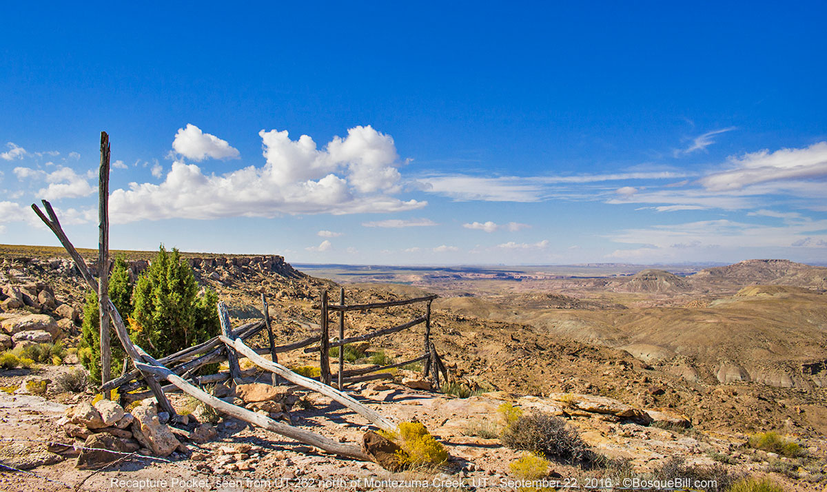 |
| View from UT-262 on the way home. |
I cut the corner of Colorado and back to Shiprock, NM, where I stopped for lunch. I drove east into Farmington and was dreading the stretch from there through Bloomfield, but this time the app chose the route bypassing the awful congestion. Hooray! If you, too, would like to take this alternate route, follow County Road 5500 between US-64 and US-550 (I hope it will be easy to remember as going NW, you turn off 550 to 5500.)
There were several thunderstorms in the area as I drove southeast on 550. I hit a couple and missed a couple. I caught a little "rush hour" traffic as I got close to the city, but made it home safely.
Home again
All in all, an excellent trip! I could have wished for more sun and less rain the last couple of days, but I'm not going to complain. I saw lots of beautiful scenery and now am full of ideas of places to explore next time.
I hope you enjoyed following me along the trail.


