New Mexico and Colorado - June 2014
I'm breaking this trip into two blog posts, which is not unusual. However, instead of doing this strictly chronologically, I will divide the posts into a New Mexico post (Monday, Tuesday, Wednesday morning, Thursday afternoon and Friday), then a Colorado post (Wednesday noon to Thursday afternoon).
Remember: to see larger versions of the photos, simply click on one.
Monday, June 23, 2914
Jemez Mountains
I started out this trip by revising favorite areas in these mountains only about an hour NW of home. I intended to search out the small rivers and streams for dragonflies. For some reason all the fishing access spots along the lower Jemez River were closed.
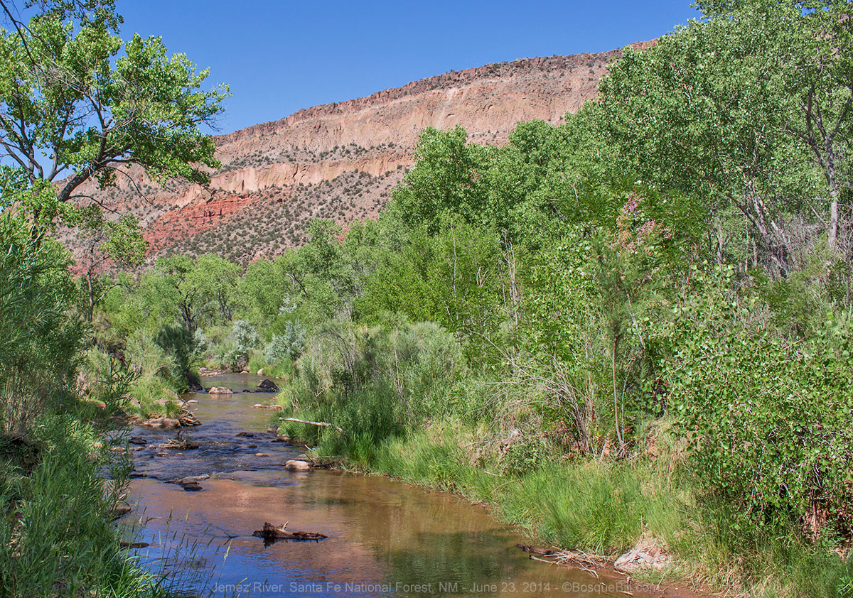 |
| Jemez River |
I stopped on the shoulder of NM-4 where it was close to the river. There was no dragonfly activity, but I did photograph this lizard.
 |
| Whiptail Lizard next to the Jemez River |
I turned back to the NM-485 turn off that leads to FR-376. I always enjoy the scenery where the Gilman Tunnels punch through the narrow canyon of the Rio Guadalupe before it flows into the Jemez River.
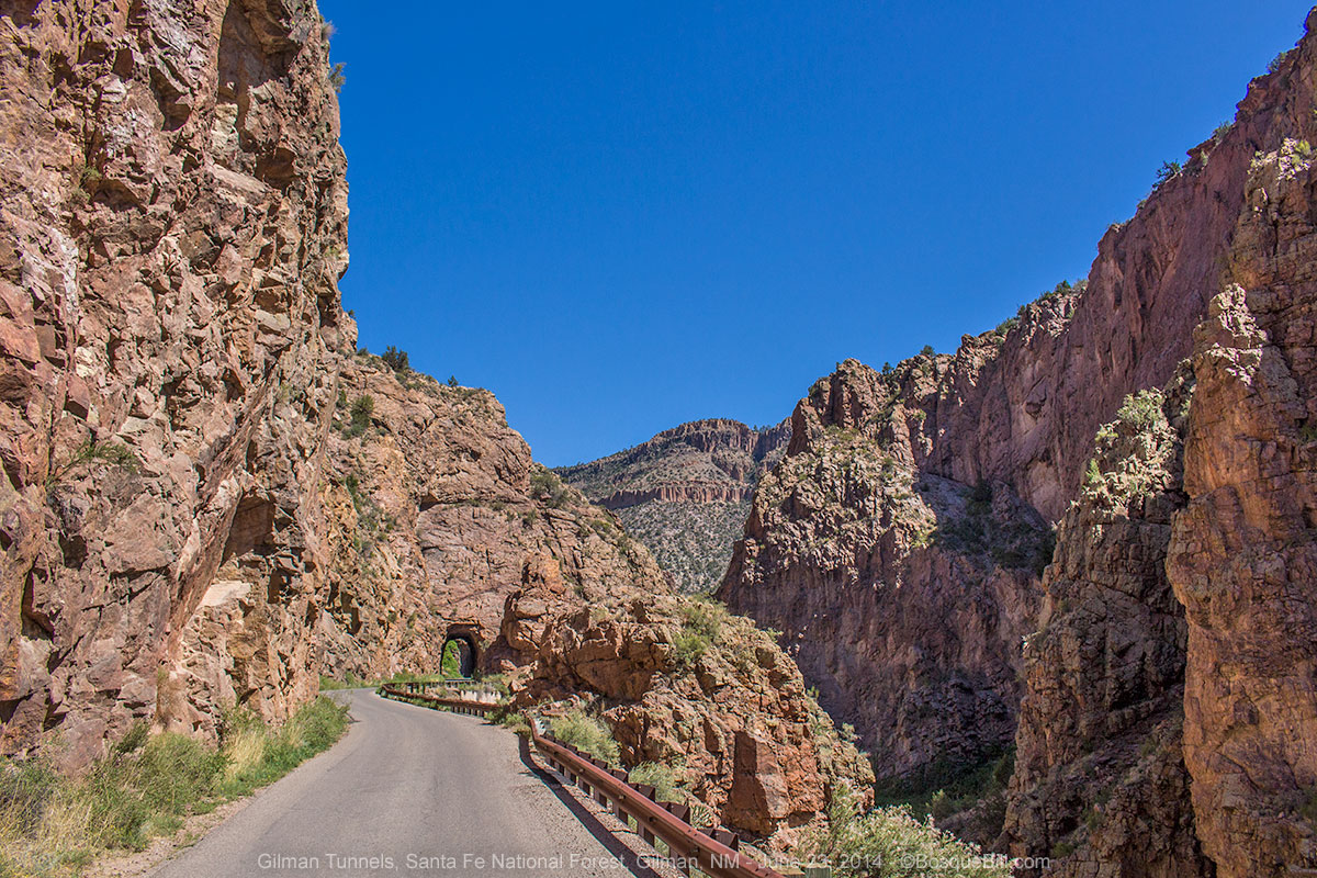 |
| Gilman Tunnels |
I stopped at my favorite place to access the stream just past the tunnels. Very little activity there, though I did see a Four-spotted Skimmer dragonfly that is usually only seen on lakes and ponds. I'll post a photo of this species later in this narrative. I also was happy to find a Red Rock Skimmer, a species I'd been looking for in the Jemez for two years, though other people didn't seem to have any problems finding them.
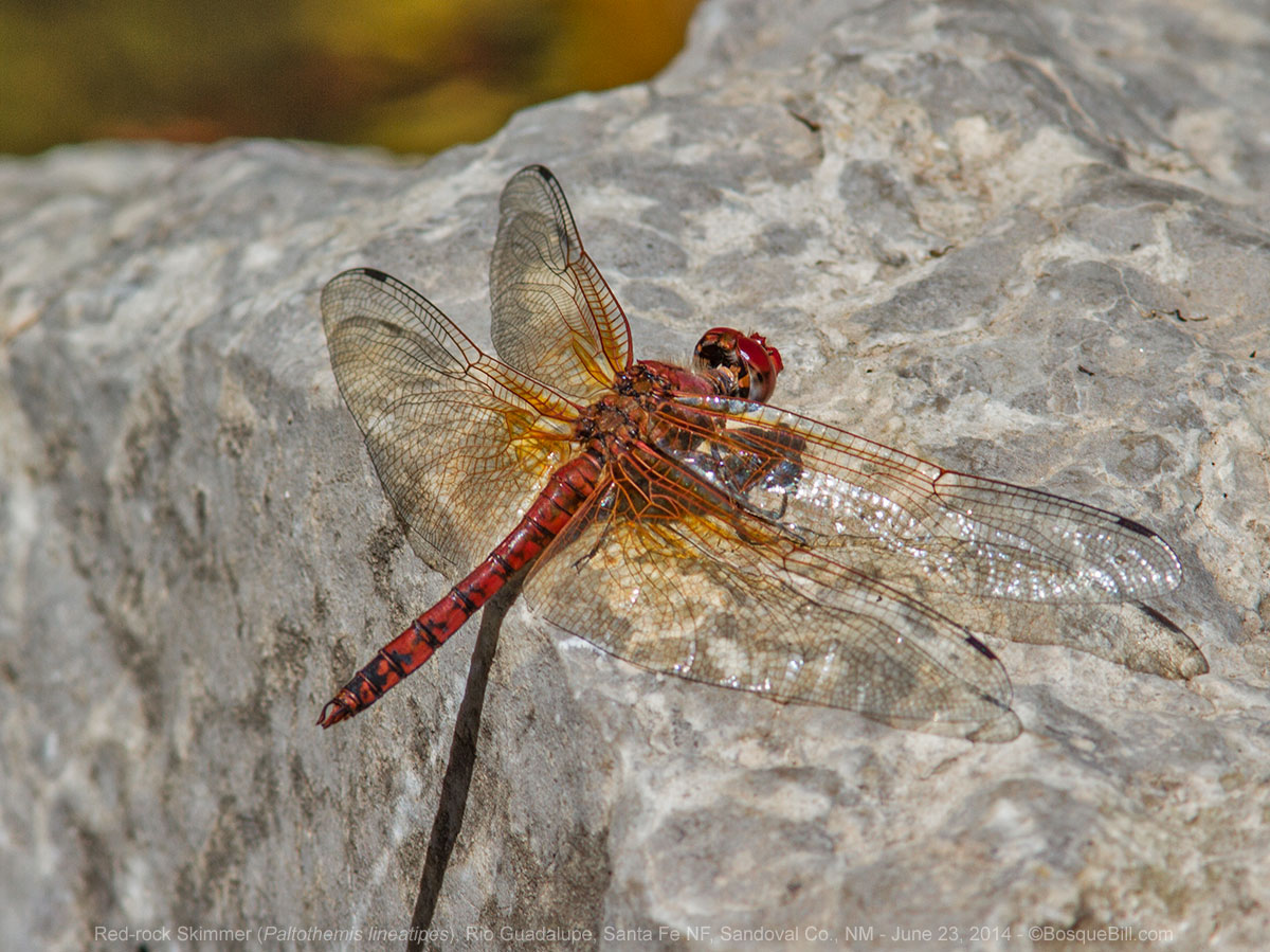 |
| Red Rock Skimmer |
I then drove up FR-539 that runs along the Rio de las Vacas. The stream at my second favorite stop was lower in June than it had been last year in August - not a good sign for the forest. Very little wildlife activity there, either, though I photographed a pretty butterfly and a very blue damselfly.
 |
| Weidemeyer's Admiral Butterfly |
 |
| Tule Bluet Damselfly |
I decided to continue up 539 as I'd never driven past that one spot before. My poor reading of the map led me to believe it connected to FR-126. Physically it does, but where it passes through private land the gate is locked. I returned to 376 and continued north. I took FR-604 which branches off 539 about a mile before it hits NM-126. I'd wanted to explore up this way as the USFS map showed it led to Ghost Rocks above La Cueva. I'd explored these rocks where I was a kid. The road does indeed lead there, but to the top of that feature, so there is no way to explore the rocks from there, but I did take pictures. I should have realized the rocks were on private land, but was still disappointed to discover someone had built a cabin just below them.
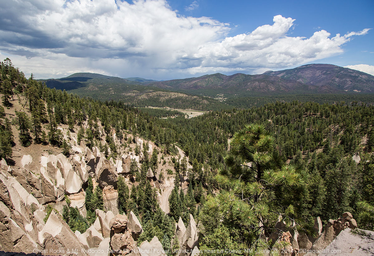 |
| Looking down at Ghost Rocks |
I then took NM-126 west past the turn to Fenton Lake to the Fish Hatchery. I'd found interesting dragonflies here before, but only saw the Four-spotted Skimmer and lots of damselflies. I did also get a nice shot of a Song Sparrow.
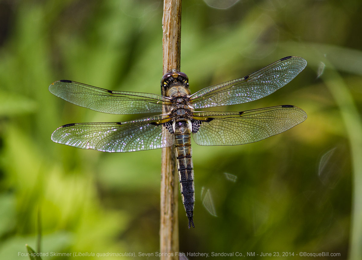 |
| Four-spotted Skimmer |
 |
| Song Sparrow |
Continuing on NM-126 I ran into a couple miles of white dust of the consistency of talcum powder. It was so deep that I shifted into FWD just for stability as it was actually slippery! This was surprising as the road was perfectly fine last August. I guess it really is dry this year (glad to report the Jemez has received a couple of good rains in early July since my trip.) I then hit a delay for road construction. I was going to stop to check for dragonflies where Rio de las Vacas crossed 126, but that clearing is just where the construction company was parking their heavy equipment. Sigh.
I continued on the the town of Cuba. I stopped there at El Bruno's for either a late lunch or early dinner and had one of the best green chile cheese burgers, evar ;-) With the large portion of fries, I couldn't finish it so took half along for later. Gotta love having a fridge in the camper. (Spoiler: it was better cold that most other burgers are, hot.)
Just northwest of Cuba I took NM-96 north, then east, to connect to north US-84 and hence to US-64.
Tres Pedras
I'd never been on 64 between 84 and 285 before. It is a lovely area, but all of it until well after you go over the pass is private. There was a spectacular rock mountain to the north which I learned is named the Brazos Cliffs. I stopped at the overlook just past the pass to try to get a photo. The light wasn't very good and I waited a while to see if the clouds would change and sun would shine on the cliffs, but it never happened.
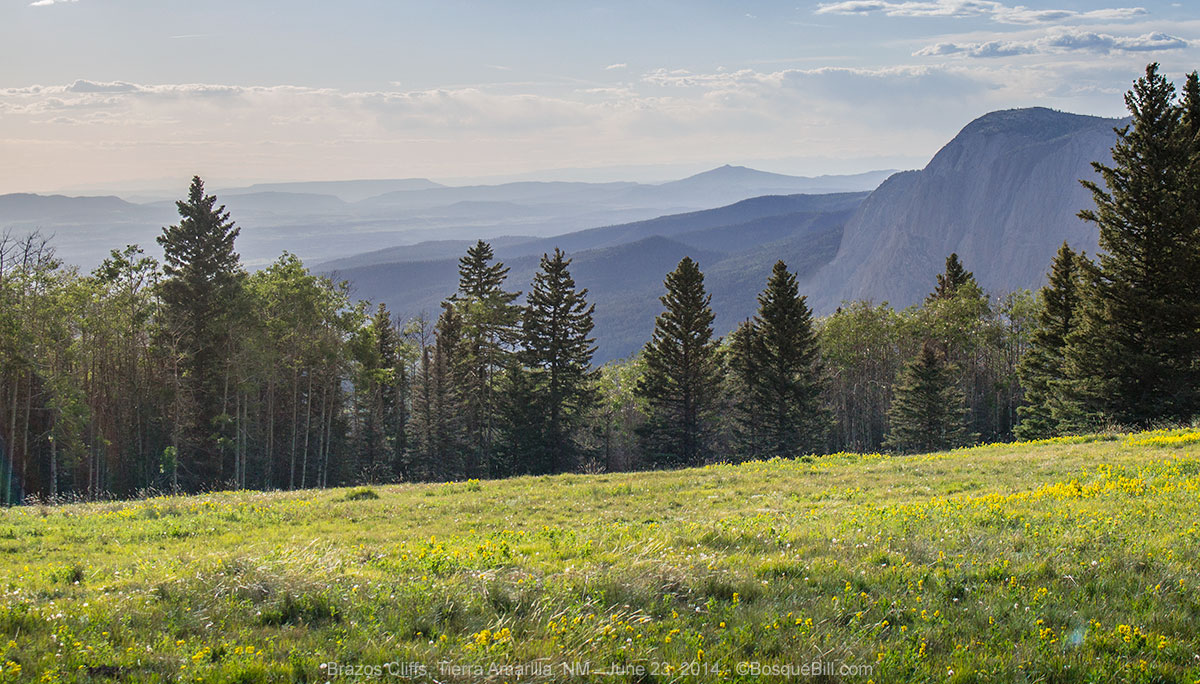 |
| Brazos Cliffs |
Once I entered Carson National Forest I turned off to try to find dispersed camping, but the forest road on the map was closed. I tried a smaller road on the other side which was a bit rough. I found a couple of potential spots, but the mosquitoes were thick. I did get this interesting photo of a lone pronghorn shedding it's winter coat.
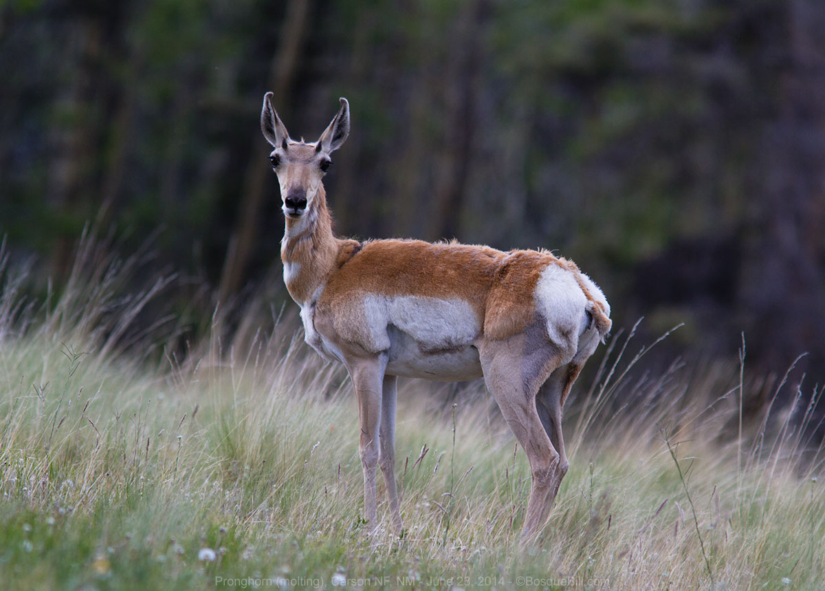 |
| Pronghorn in molt |
As there was no immediate prospect for bug-free dispersed camping and it was getting late, I turned into the National Forest campground at Hopewell Lake. As in most areas I've noticed that older forest camps have become day-use only and new camping areas have been built to be more ecologically sustainable and physically larger to accomodate the trend toward larger camp trailers and vehicles. Such was the case at Hopewell Lake where camping is no longer permitted at the scenic lakeside sites. The new campground had the advantage, at least, of being mosquito free.
I didn't realize until the following day, many miles away, that this was the first campsite I've utilized in my FWC camper where I forgot to take a photo of my camper in the site. Perhaps because of my late arrival. Oh, well, it was bound to happen and this was a pretty ordinary site, after all.
Tuesday, June 24
After breakfast I took the trail from my campsite down the hill to Hopewell Lake. It's a nice looking lake and I had fun chatting with the folks fishing and the family cooking breakfast lakeside. There were wildflowers to admire, as well.
 |
| Blue Flax |
 |
| The north end of Hopewell Lake |
I spoke with the fisherman who had the blue, inflatable pontoon boat in the photo below; he said there were enormous trout, some even 24" in length out in the middle of the lake. Of course that could be a fish story.
 |
| The south end of Hopewell Lake. |
 |
| Blossoms of the shrub that was all around the lake. |
After returning to camp and packing up I kept on 64 with the goal of heading north on US-285 and then west on FR-87, an interesting road I traveled last year. I had asked the camp host about FR-133 that heads north from 64 up to the same area, but her description of the roughness of the road convinced me to take the pavement around.
Taos Plateau
I love driving west on FR-87. The first 15 miles, or so, are the northwest-most part of the
Taos Plateau Volcanic Field. It is the largest volcanic field within the Rio Grande rift, but you wouldn't necessarily realize that looking at the grass and shrub covered praire. The first 5 miles are BLM, then you enter Carson NF. Incidentally, the largest section of the field, east of US-285 is now part of the
Rio Grande del Norte National Monument, established in March 2013 which runs from the Colorado border to just north of US-64.
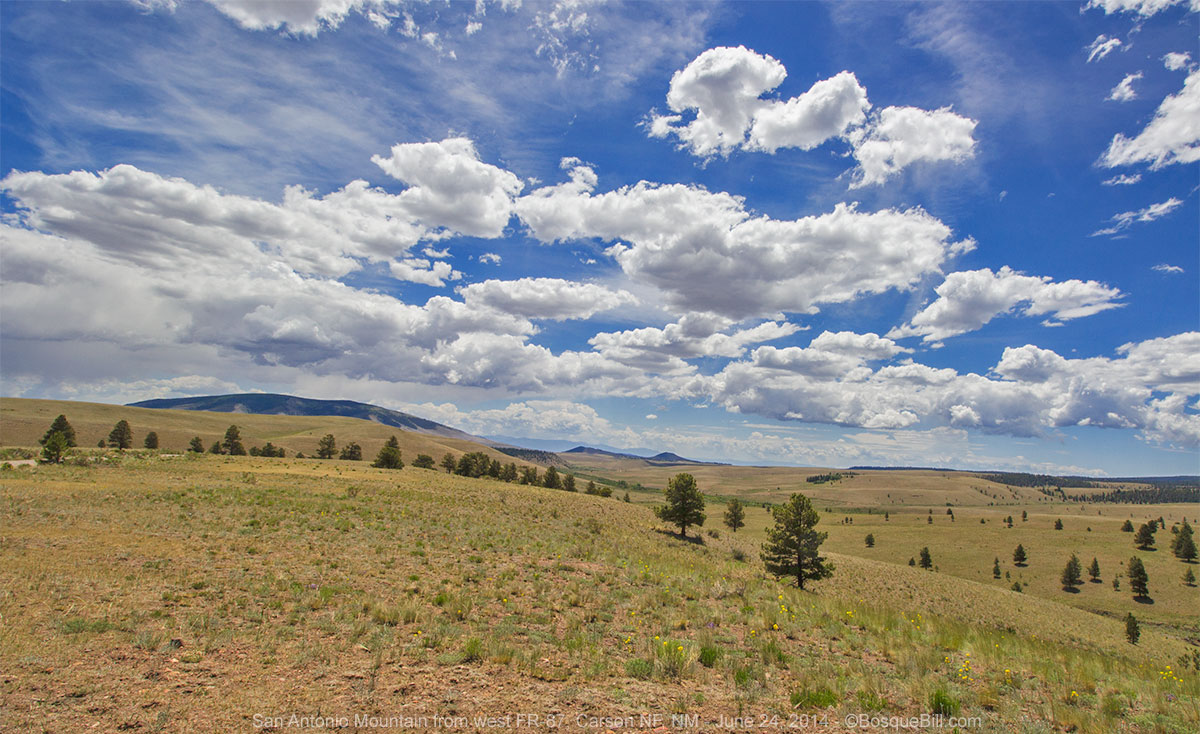
San Antonio Mountain looks like a small, round hill, but is a volcano with a height of 10,908 feet.
 |
| San Antonio Mountain from FR-87 near US-285 |
I stopped where 87 crosses Rio San Antonio creek to look for dragonflies. I only saw a few damselflies and some lovely wildflowers, but it is a pretty stream.
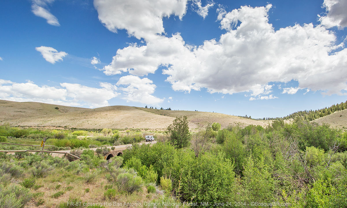 |
| Where 87 crosses the Rio San Antonio. |
 |
| Toad Flax on the side of the cut above the Rio San Antonio |
 |
| Rio San Antonio |
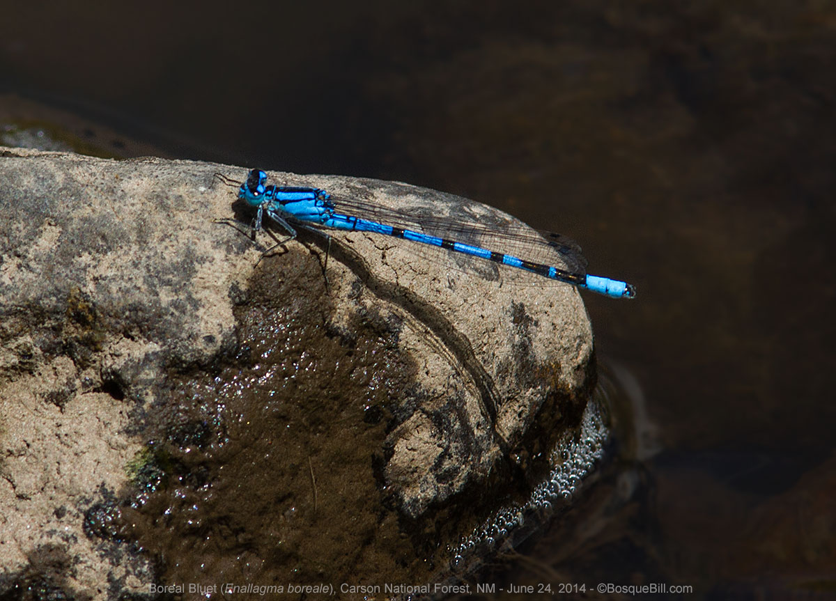 |
| Boreal Bluet on the Rio San Antonio |
Tusas Mountains
I continued up 87. It quickly climbs up into the foothills of the Tusas Mountains leaving the plateau behind. There are gorgeous views from up here.
 |
| Looking back (east) toward San Antonio Mountain and the plateau. |
 |
| Paintbrush near my feet where I took the photo just above this one. |
At the "top" of 87 you can go left, continuing on 87 to Lagunitas or right, following 87A, to Rio de los Piños. Last year I went right, this year I wanted to look at Lagunitas to see if the campground was worth spending the night, then head back the way I did last year. There was some pretty country on 87 and some rough road, too.
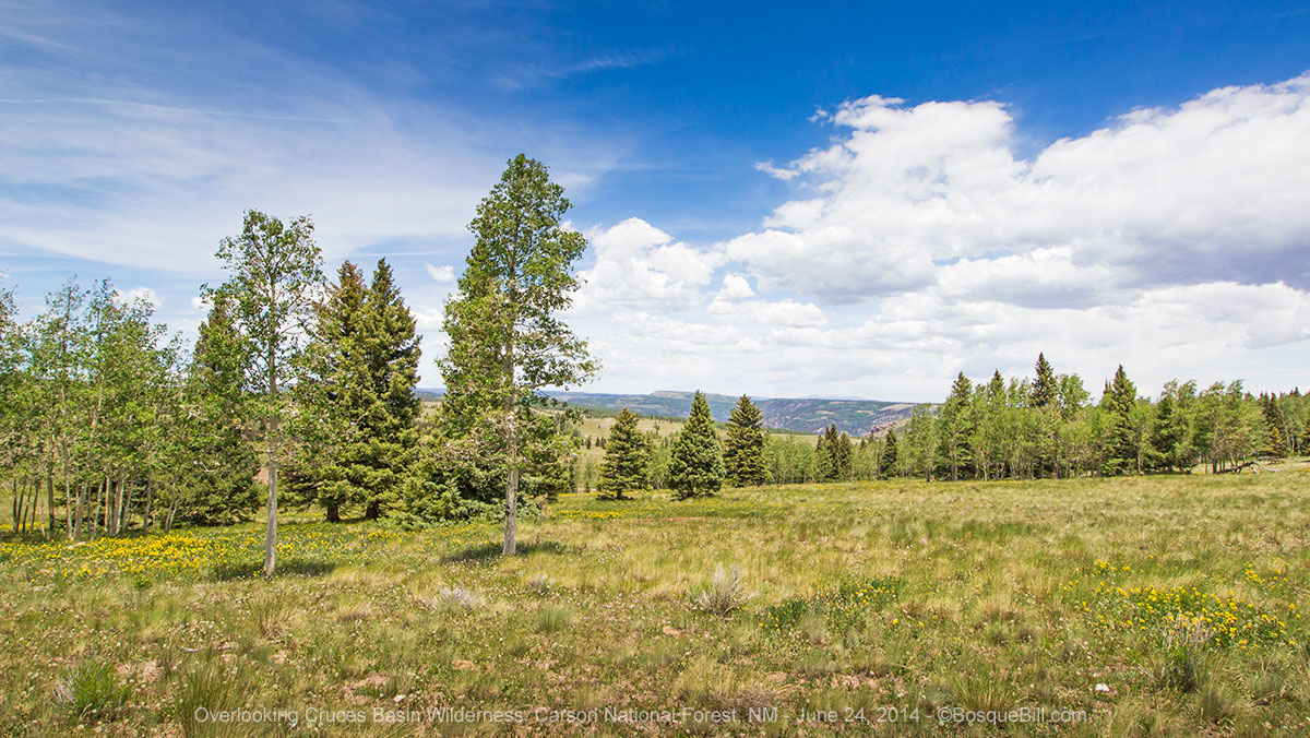 |
| Looking over the Cruces Basin Wilderness from the junction of 87 and 87A |
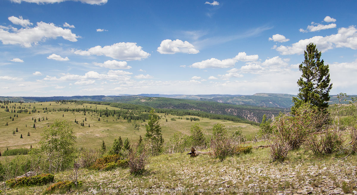 |
| Olguin Mesa seen from FR-87 |
The campgrounds at the lakes at Lagunitas are of the old style, though it looks like they are trying to refurbish the lower campground. Seems they brought down quite a number of full grown trees, but then stopped without taking them away or doing anything else to the sites.
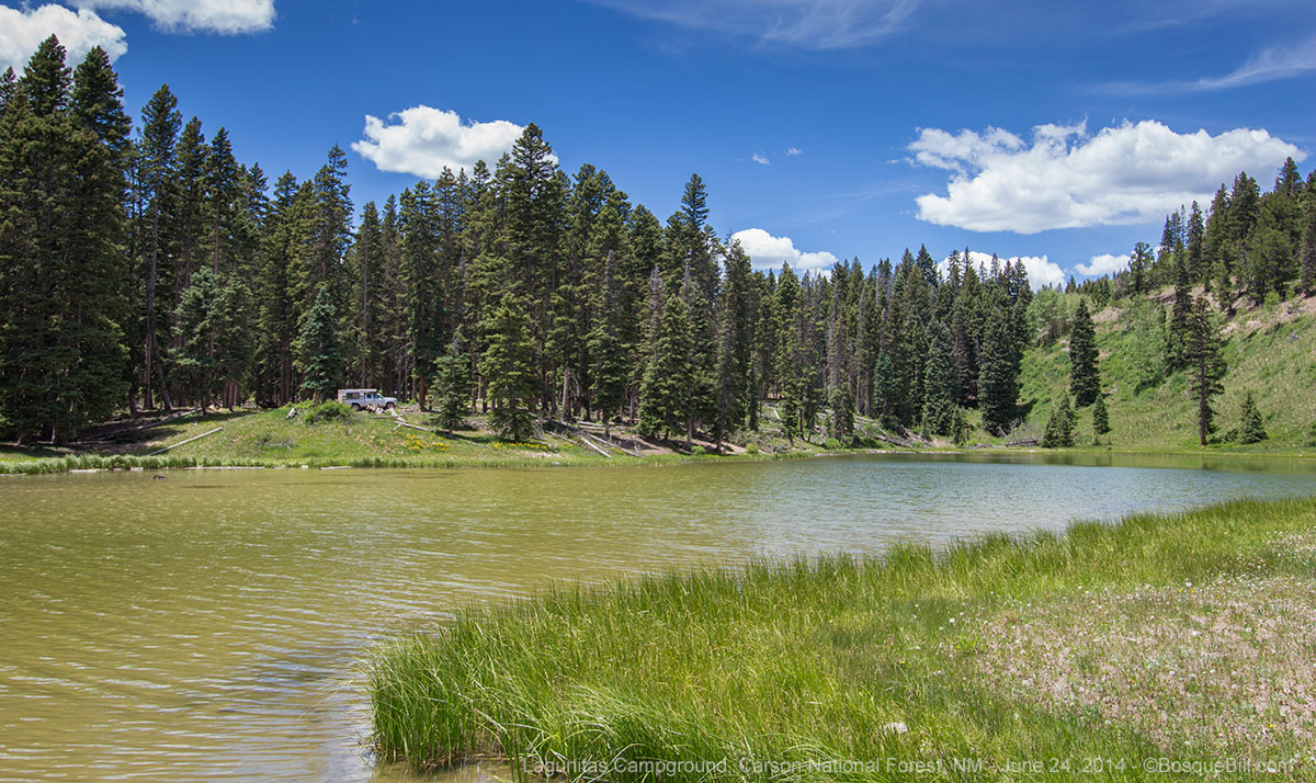 |
| Lower Lagunitas Campground and one of the little lakes. |
Strange and it didn't make it inviting for me to stay, so I headed back, then continued on on 87A.
 |
Golden Banner growing alongside the road.
I simply poked my camera out my window. |
Last year when I camped at Rio de los Piños, it was just me and one couple way down the road. This year there were folks in nearly every site. That doesn't make it "crowded" like most campgrounds as most sites are placed along the road at far enough intervals that you are out of eyesight and hearing of other campers. I didn't get as pretty of a site this year, but did find one with lots of shade for the very warm afternoon.
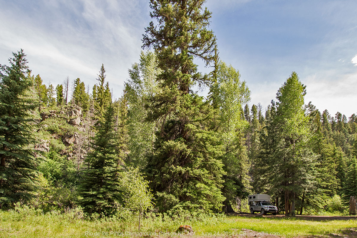 |
| My campsite next to the river. |
It is a beautiful area with the river running along rocky cliffs. I enjoyed my early evening walk and took a few photos.
 |
| River and canyon walls |
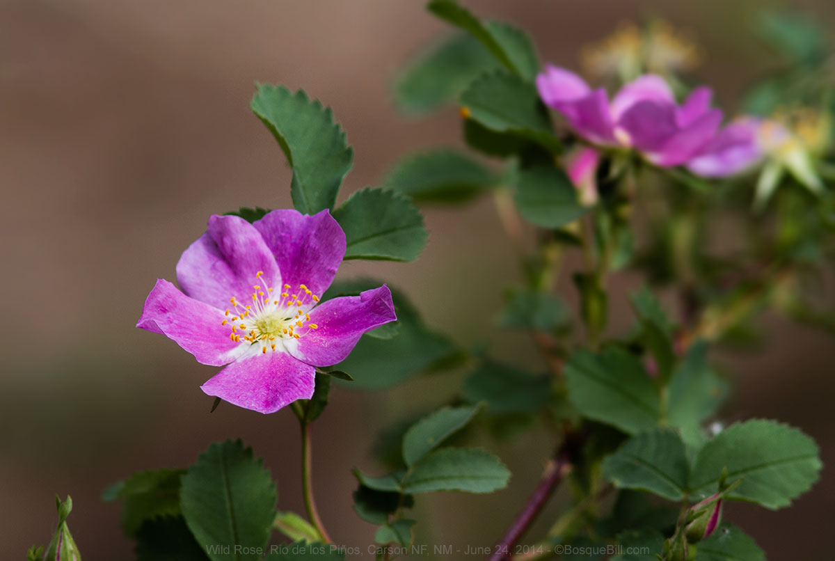 |
| Wild Rose |
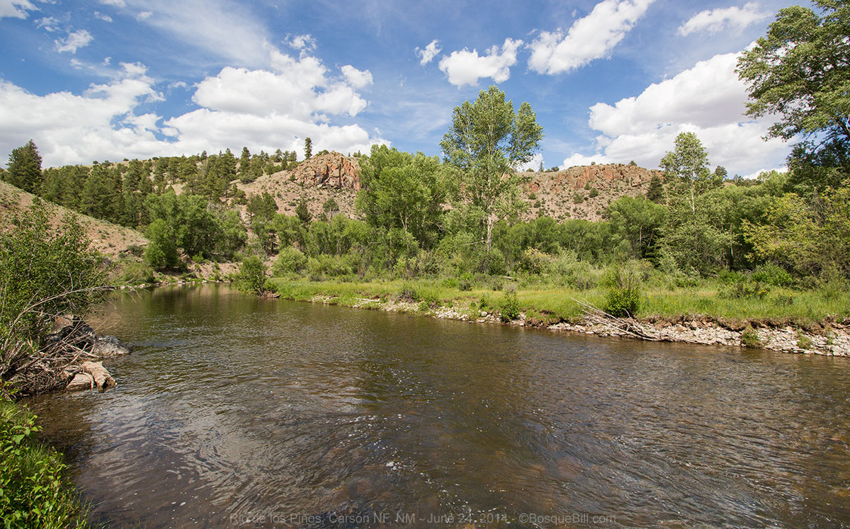 |
| Bend in the river |
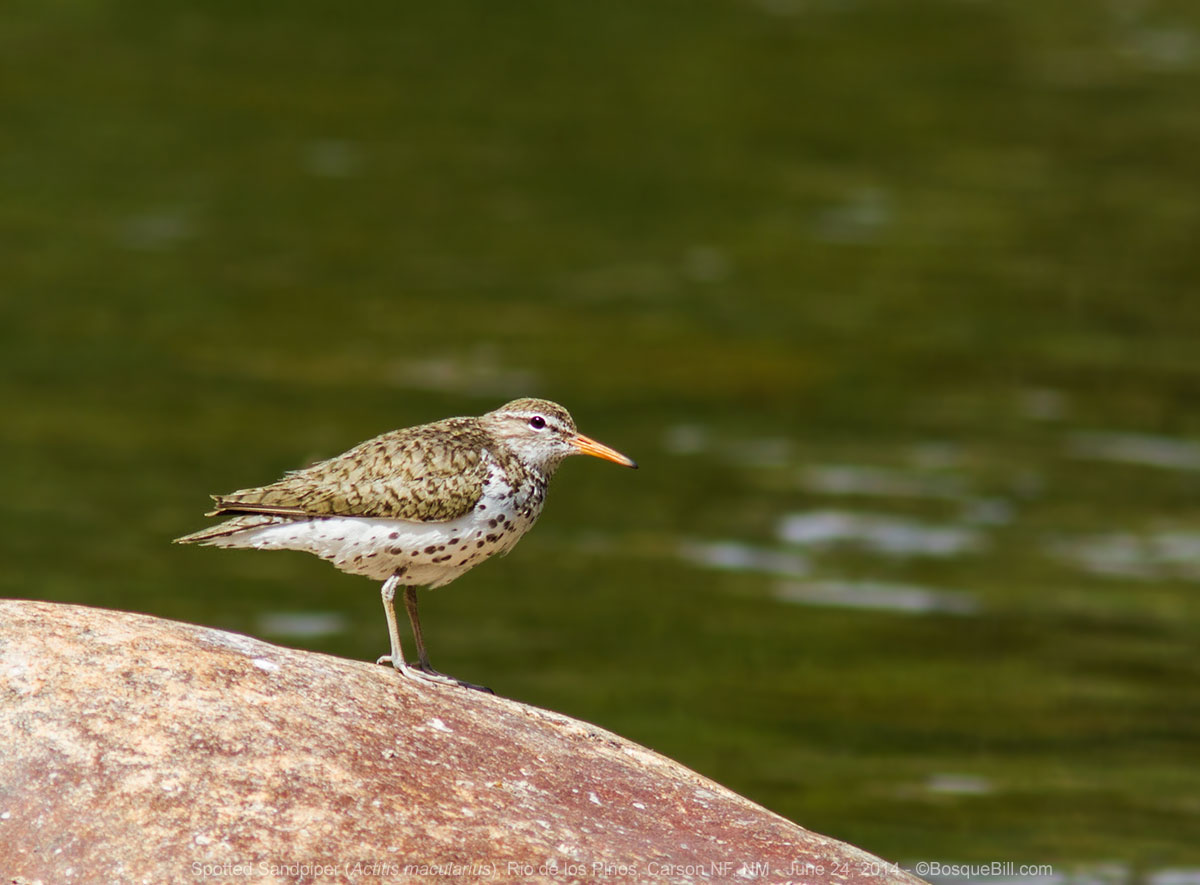 |
| Spotted Sandpiper |
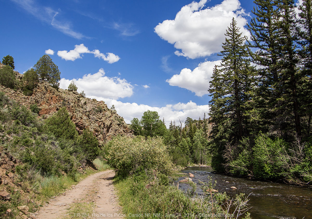 |
| FR-284 runs along side the river |
Wednesday morning
After a short morning walk, I left the campground on Los Piños Road that leads north to Colorado.
The next section of my trip in Colorado will be covered in the next post.
Thursday, continued.
I returned to New Mexico from Colorado on a hot Interstate-25 late in the afternoon.
I tried to find the family New Mexican restaurant I'd had recommended to me in Raton, but was mistaken on where it was and couldn't remember the name. So I just gassed up and continued down the freeway. I turned east at Springer onto US-56, then south on NM-39 to Mill's Canyon Road where I turned back west. I was amused to find this windmill smack-dab in the middle of the road.
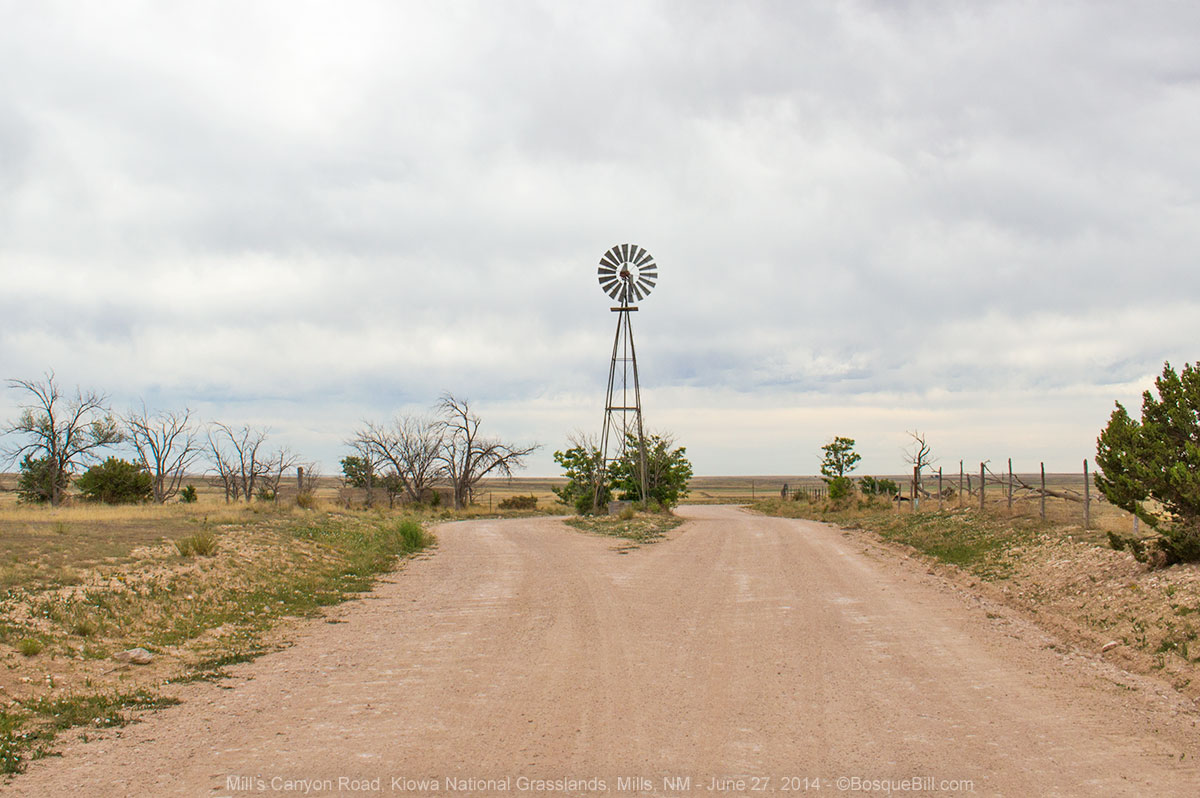 |
| Windmill in the middle of Mill's Canyon Road |
There are two campgrounds at this western unit of the Kiowa National Grasslands. The Rim Campground is, as its name implies, on the rim of Mill's Canyon and includes two covered horse corrals. As the hot wind was blowing across the rolling prairie, I decided to drive down the high-clearance vehicles only, primitive road. I was not optimistic about my chances for star photos as high clouds had been evident for hours.
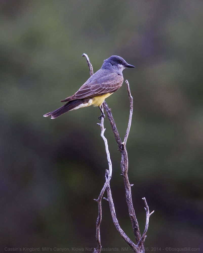 |
| There were several Kingbirds in the Rim Campground. |
I had expected
Mill's Canyon to be a small, unimpressive feature, like some of the canyons I'd seen on the high plains of the Texas panhandle. But no, the narrow road switchbacks down the rock canyon wall 1000 feet to the bottom where the Canadian River flows. Along the river are ruins of a ranch with orchard, and hotel and stage stop.
 |
| The old orchard along the Canadian River |
The campground was fairly new, though just basic with vault toilet and level gravel parking for campers, metal fire pits, and tables. There is evidence of much dispersed camping in the area, but the mosquitoes chased me back to the no-fee, developed campground. Plus, if the clouds did clear, the wide gravel area would be a good, safe place to set up my tripod and camera.
 |
| My campsite |
The clouds didn't clear entirely that night, but there were areas where I could see the stars. I think there was still a lot of high altitude moisture as the stars weren't very bright even though there was no moon. I worked around them best I could. I was also surprised there there were one or two lightning bugs in the canyon.
 |
| The Milky Way shining down into Mill's Canyon |
Friday
Before I left Mill's Canyon I stopped to look over the ruins of the old Mill's ranch. Interesting, but not particularly photogenic. As I was climbing the road up out of the canyon I spotted a bear crossing the road ahead; that was cool.
 |
| Looking across the grasslands on my way back to the highway. |
Once I was back at the highway, I drove south to Roy, then west on NM-120 toward Wagon Mound and the freeway. About seven miles west of Roy the highway descends into the Canadian River Canyon before climbing right back up the other side.
I was heading home, but decided to head over to Mora first as the thought of the brisket enchiladas made New Mexico style with blue corn tortillas at Rene's Diner was too enticing to pass up. And I could check the Mora River for dragonflies.
The enchiladas were every bit as good as I'd remembered from last year. There weren't very many dragonflies, but I did get photos of one of my favorites, a Pale Snaketail.
 |
| Pale Snaketail in the Mora River |
Thus, I headed down NM-518 to Las Vegas where I picked up I-25 that took me back to the Albuquerque area.
My next post will cover those parts of Colorado I skipped above. Thanks for reading.