
In Search of Autumn Color
 |
| Map showing the complete journey, all three parts of the narrative. |
Part 2 of 3: October 4th to the 7th
After exploring the San Juan Mountains, Ohio Creek and Kebler Pass Road, I decided to head west to Grand Mesa. From there I would go northeast along the Colorado River, then southeast to visit Maroon Bells for the first time since my youth, cross Independence Pass, and... well, I didn't know where I'd go from there.
Saturday, October 4th (continued)
The west end of Kebler Pass Road terminates at CO-133. If one follows the highway north, it will cross McClure Pass and then drop down to Carbondale and finally come to CO-82, between Glenwood Springs and Aspen. I did want to go up that way, but first wanted to check out Grand Mesa National Forest, where I'd heard there were large stands of aspen. Instead of driving down through the arid areas on 133, where I'd been earlier in the season, I thought I'd go north a bit on 133 and then explore up FR-265, cutting though a bit of White River National Forest to reach Grand Mesa.
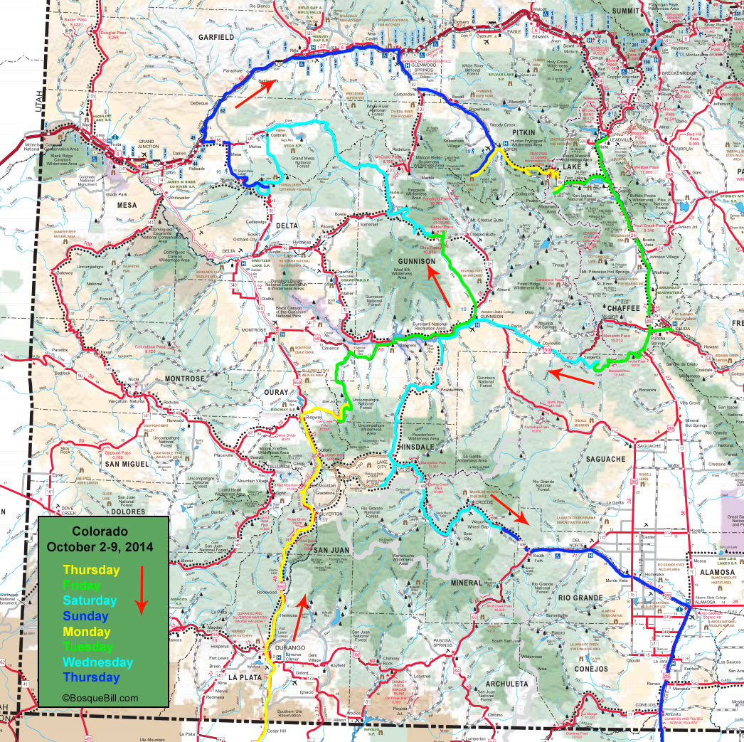
Buzzard Divide
 |
| Buzzard Divide Road where it begins to climb up into the aspen zone. |
Buzzard Divide Road is the name my navigation app gave to FR-265, which is evocative, though I never did see Buzzard Divide or find it on a map or even see any buzzards. The road is tricky to follow at first as there are a number of junctions and road signs are scarce. Traffic was very scarce, too. The road winds through ranch country for a while and then begins to climb, though there is still open grazing. There were lots of aspen once the road gained some elevation and some great views.
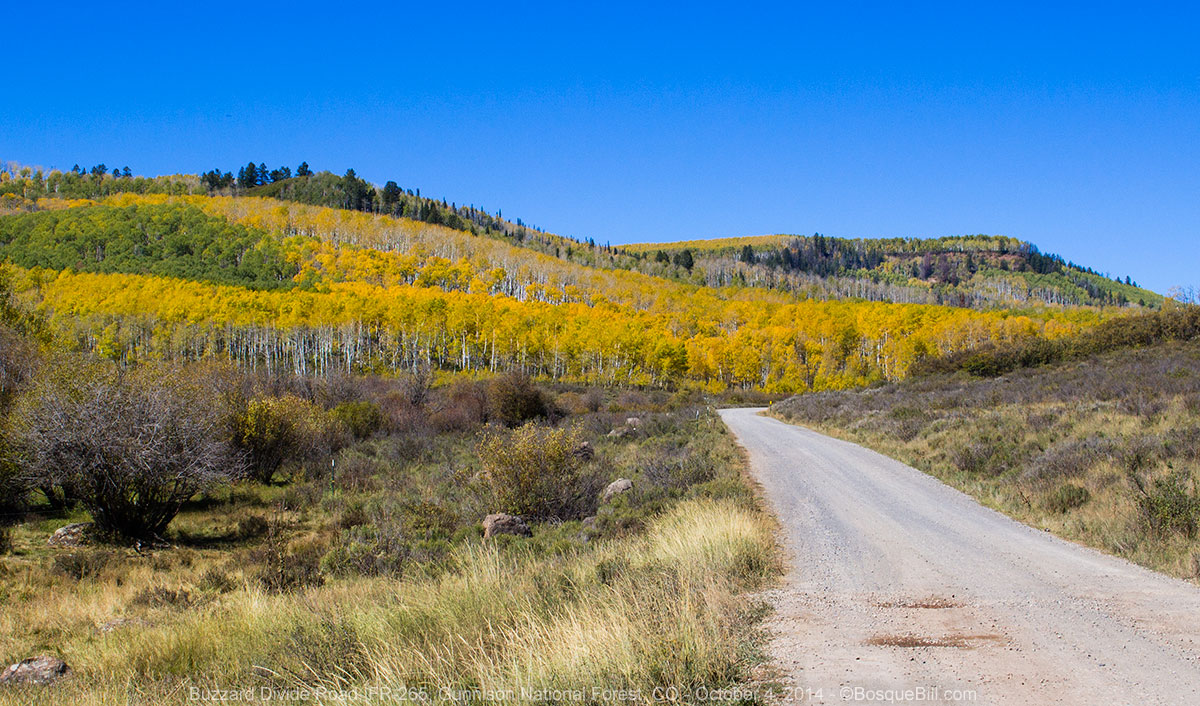
 |
| A two-image panorama overlooking a beautiful valley with mountain peaks in the background. |
I took a short spur at Muddy Flats to find a grassy meadow to stop and have lunch, and learned there is an oil well up that road – I'm glad I was there on a Sunday.
Returning to the “main” route and continuing on I began to see a few hunter campsites, but the area remained lightly used. I crossed from White River NF to Grand Mesa NF, though still was not on Grand Mesa proper. The terrain opened back up into ranch country. There were a couple of junctions and route changes to place me on CO-330 on the route to the town Cullbran. There was also more evidence of oil or gas wells. I lost most of the elevation gain by the time I reached Cullbran.
I wasn't sure which road I wanted to take to get up onto Grand Mesa, so stopped at the gas station/c-store on the highway at Cullbran for advice and directions. The young woman said I could either continue on the highway to the “desert” then take the main road up, or I could go through town via dirt roads into the mountains. I elected the later course, though I had to stop for directions again before I got out of town as the route is unmarked with lots of turns, and the initial instructions I received were less than clear.
Grand Mesa
Once the road began climbing up toward Grand Mesa there were a few aspen changing color, but not very many. Once on top, it was impossible to know one was on a mesa top, as it was all firs and spruce, streams and lakes, and a winding dirt road between the hills. It is a very nice area, however, I saw no aspen up there of any color. I drove south, then west on FR-121 passing many campgrounds, lakes, and side roads where dispersed camping appears to be available.
 |
| One of the many lakes on Grand Mesa |
I drove all the way to the Visitor Center at the junction with the aforementioned highway, CO-62. The VC was not only closed, but completely empty; at least the restroom was open. I had hoped to ask a ranger where the heck all the aspen were that I'd been told were on Grand Mesa. I did ask a fellow visitor who was gazing at a map and he said there were lots of aspen just down the hill toward Delta on 62.
I headed down 62 and after a few miles there were indeed lots of aspen. There were also amazing views off the drop-off side of the mesa toward Delta and Montrose. However, with the haze and sun, I took no photos. The highway winds all the way down to the dry, arid area below and I didn't really want to do that. What I wanted was to find more aspen and a nice place to camp.
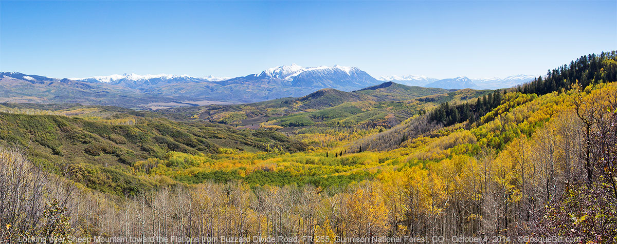
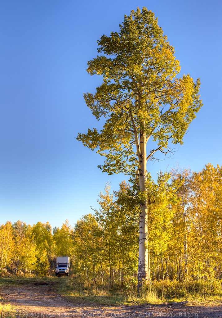
 |
| My campsite nestled among the aspen. |
I noticed on the map a small road with lots of switch-backs that seemed to be in about the right area to climb up the mesa side through the large aspen grove. I found this road, which turned out to be Old Grand Mesa Road, and it did indeed meander up though acres of aspen. I found a short turn off at one of the curves near the top that led to a dispersed campsite. I set up there and walked around before evening set in. I followed a game trail for a while and heard water. Following the sound I came to a small spring; it was a delight to find, but sadly not photogenic. There was an ancient, for aspen, tree near my campsite. Someone had put up a sign to commemorate the tree, but I forgot to read it.
 |
| An amazing mother aspen nearby my campsite. |
Sunday, October 5th
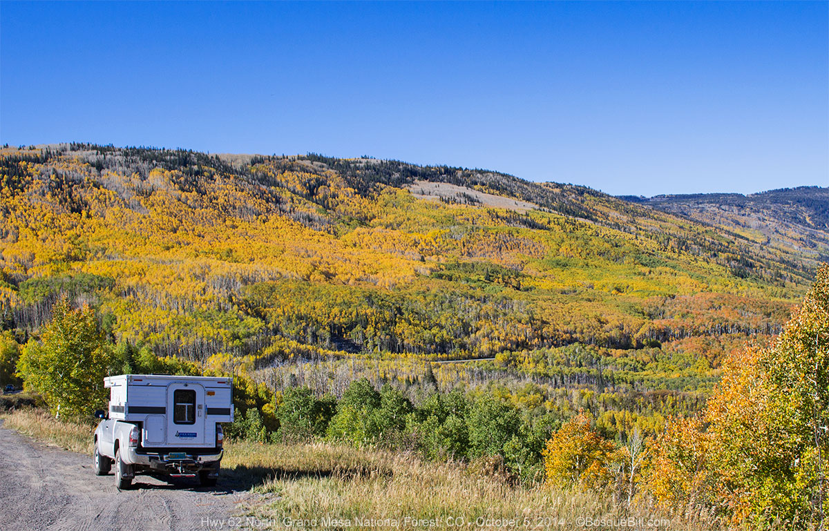
After breaking camp, I drove the short ways to the top of Grand Mesa, past a few small lakes and back to CO-62. This time I turned north on the highway toward I-70. As the highway began to drop off the mesa top, there was an enormous aspen field. Unfortunately, they had all lost their leaves.
 |
| A highway overlook at the edge of Grand Mesa. Most of the aspen here have lost their leaves. Note the view of arid canyon lands in the distance wherein runs the Colorado River. |
A bit lower and I began to see some aspen still with leaves and there were a couple of places to pull off and admire amazing views.
 |
| Aspen along the highway crossing the lower shoulder of Grand Mesa |
Lower and lower I drove until I was out of the forest and into the very dramatic, steep canyon of Plateau Creek. After several miles of winding curves the highway came out at the freeway.
I turned northeast on I-70 and had to remember how to drive at speed. My intention was to turn off the freeway at Glenwood Springs toward Aspen and Independence Pass. It had been over 40 years since I'd seen the beauty of Maroon Bells and I hoped I'd be able to see that this trip. The freeway here runs along the Colorado River, which makes it a bit more scenic than in other stretches.
Glenwood Springs is an interesting place, a combination of tourist attraction and small town funk, like many towns in this part of the state. I stopped at the 19th Street Diner along the main drag, CO-82 to Aspen. It was lunch time, but I had a hankering for breakfast. I ordered eggs with sausage patties, hash browns, and toast and it was delicious.
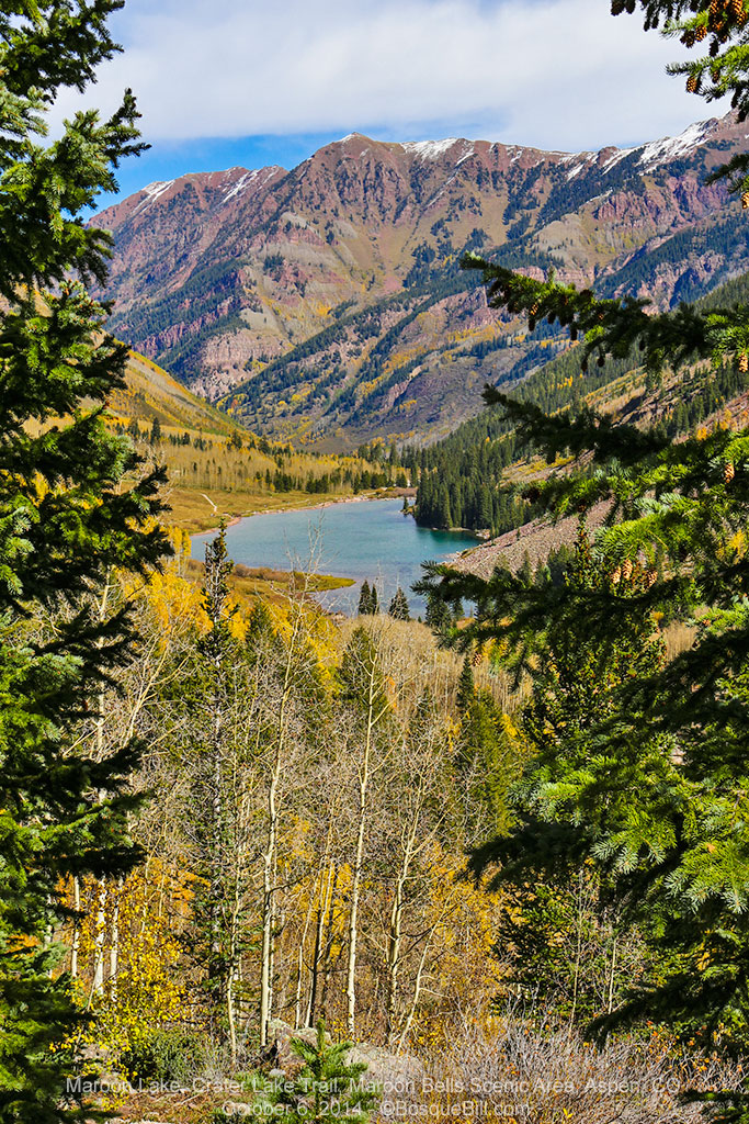
Maroon Bells
I called my buddy Chris to let him know I was still in pursuit of autumn aspen and that I was on my way to Maroon Bells. He mentioned that due to the popularity of the site, visitors had to park just outside of town and ride shuttle buses into the area. This was news to me, not having done my research beforehand, but I soldiered on. I had seen the entrance gate to this special fee area on the map, and had also noticed there were a couple of campgrounds past the gate on the way to Maroon Lake. My new plan was to ask at the entrance if there were campsites available and if so, did that allow me to drive to the lake.
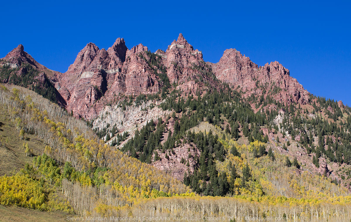 |
| Sievers Mountain (I believe) which is on the "other" side of Maroon Lake. |
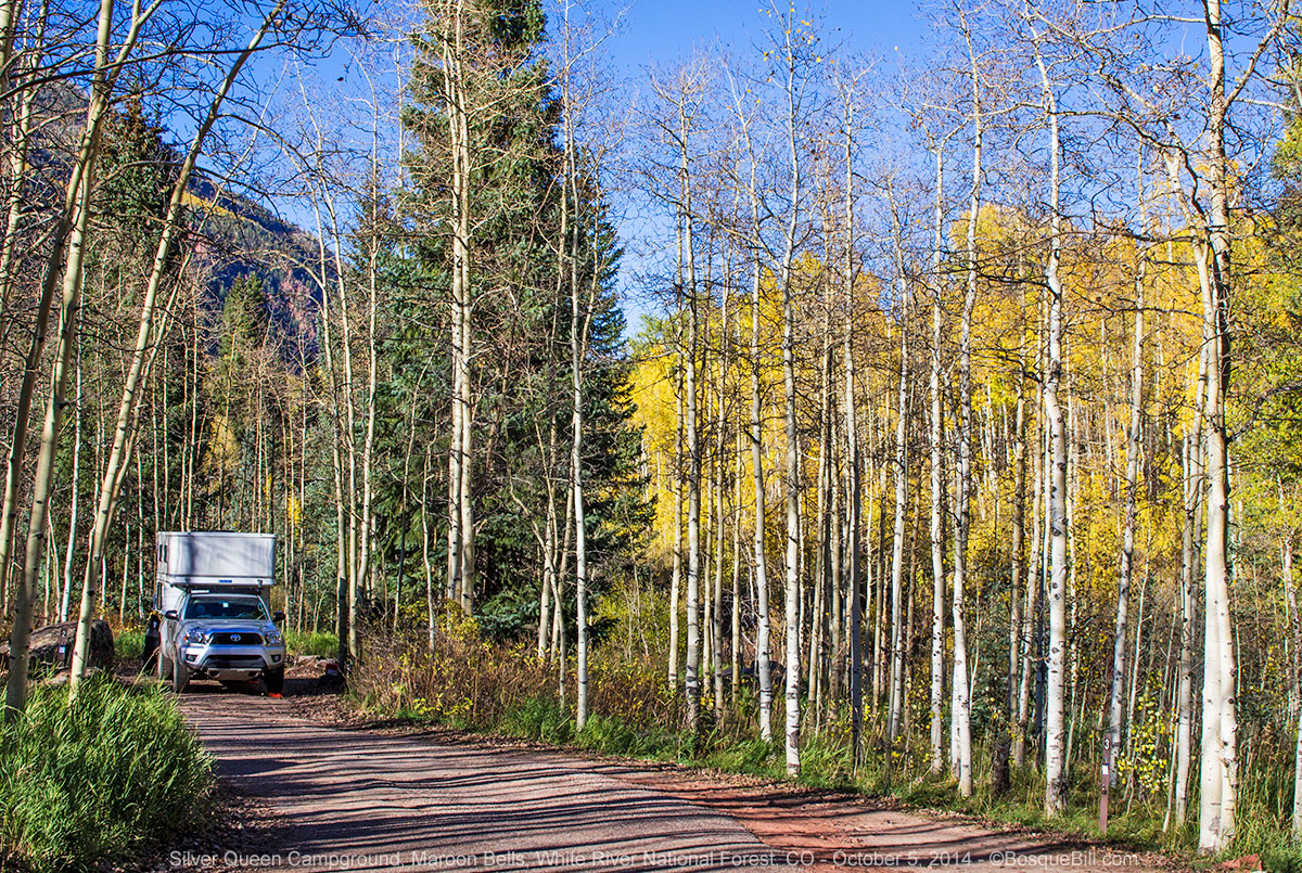
Turns out there were and it did. Excellent. I was assigned a lovely spot at the Silver Queen campground, where I attached my permit to the post. I then drove up to the lake to take photos. The light wasn't perfect, but it is indeed a gorgeous spot. I then drove back down the paved road, stopping as the mood hit me and the afternoon light hit the hillside and those aspen that were still showing color. It was all fabulously beautiful in the late afternoon sun.
 |
| The aspen along here were mostly green or yellow |
 |
| Maroon Creek |
Spent a pleasant evening in the quiet campground, only about 4 of the ~8 sites were taken. I had a very nice conversation with the couple with a camping trailer “next door.”
 |
| My campsite, #2 at Silver Queen NFS Campground |
Monday, October 6th
It was another 27º morning and in the shade of the campsite it didn't warm quickly, so I took my time before breaking camp. I drove up to Maroon Lake. It turns out the shuttle busses run every day in summer, but only Friday - Sunday after Labor Day. Since this was Monday, the parking lot was already full when I got there at 10:15. I was directed to the lead position of a long RV parking slot by a ranger.
 |
| Maroon Bells reflected in Maroon Lake |
Maroon Bells was gorgeous with the sun brightly shining on the peaks and the snow aligning with the rock strata. Breathtaking!
My friendly campground neighbor the night before had recommended the hike to Crater Lake, so I set out. This is a steep, rocky hike – definitely not a walk. I had a bottle of water and too much camera gear, though I was wearing my good hiking boots. About 2/3rds of the way to the lake I realized I should have packed a lunch as the climb was taking much longer than I'd estimated. The round trip was supposed to be just less that 4 miles. I stopped and dug into my camera bag hoping I'd left an energy bar in there somewhere. I was rewarded with a Cliff bar that was only slightly old and hard.
 |
| This chickadee was so close to me that I had to cut off his tail. |
There was a rocky area to cross before getting to Crater Lake. It looked like some sort of upheaval to me as it seemed too far from the mountain walls to be an avalanche spoil. I heard a “cheap” and spotted a Pika on a big rock. I took several photos, but it was much farther away than the one I saw at Ophir Pass in July. Turns out there were lots of Pika in that rocky area which made me happy to note.
 |
| American Pika, one of many seen along the trail in the high rocky areas |
By the time I made it to Crater Lake the weather was changing. The fleece jacket I'd removed on my way up the mountain helped to cut the wind. High clouds were starting to move in and the wind on the water kept the lake from reflecting the mountain peaks. It is a magnificent place, too big even for my widest wide-angle lens.
 |
| Crater Lake and Maroon Bells |
The hike back was less enjoyable due to my low energy state; it had been way too many hours since breakfast. I had to keep reminding myself to pick my feet up and not kick the rocks. At least it was mostly downhill in this direction, as one of my fellow travelers had remarked.
 |
| Cute chipmunk seen along the trail |
 |
| A view of Maroon Lake looking down from the Crater Lake trail. |
On my drive out, before I left the forest, I stopped to picnic and enjoy the last views of the beautiful canyon vista. In Aspen I stopped at the ranger station for advice on camping for that night. It turns out all the campgrounds in the Aspen Ranger District had closed on September 15th, except those at Maroon Bells. Apparently that's when the contracts with the concessionaires completes. In these modern times the NFS contracts for campground hosts and maintenance most places. I asked about the status of campgrounds on the other side of Independence Pass, but he didn't know as that was a different district. The ranger told me that there were dispersed campsites along Lincoln Creek Road on this side of the pass, so I thought I'd try there. I restocked perishables at City Market before leaving Aspen.
Independence Pass
Again, it had been over forty years since I'd been on this road and hadn't recalled just how narrow the highway is as it climbs toward the pass. I understand the prohibition on long vehicles, now. I was very scenic, however.
I found the turn-off to Lincoln Creek Road. The ranger mentioned it was a bit rough, but that some folks had been in there the previous week with their Subaru with no trouble, though they had to drive slowly. I passed the (closed) campground I'd visited all those years ago. My only memory of the place was that it had been mid-July and my dog's water bowl froze solid during the night. The road was terrible, covered with nasty pot-holes. 5 m.p.h. would be way too fast on that “road.” The sign said there were 22 campsites in the first 6 miles. The first two were occupied, the next ones were nowhere near level enough for a camper. The canyon was narrow, steep and dark, not at all inviting. After two miles I retreated, slowly, got back to the highway and headed toward the pass.
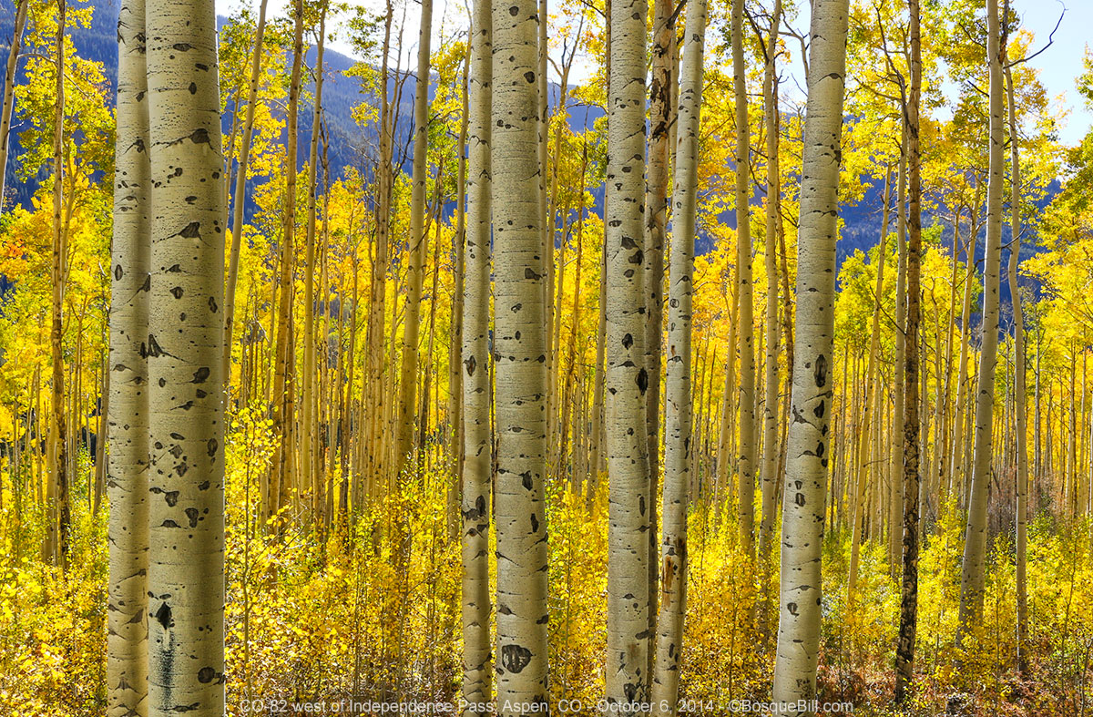 |
| A backlit aspen grove along the highway up to Independence Pass |
 |
| Obligatory photo of the sign at the pass |
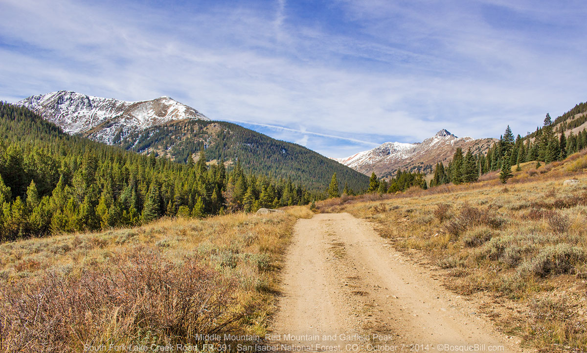
My backup plan was to explore Forest Road 391, about five miles beyond Independence Pass and I was guessing that any of the campgrounds would be closed. I found the turn-off to the road on the south side of the highway. There was a sign announcing that the first 1.6 miles of the road was on private land, no trespassing. The road was rough, but not nearly as bad as Lincoln Creek. It follows the South Fork of Lake Creek and not far from the highway is the trailhead for La Plata Peak, one of Colorado's fourteeners.
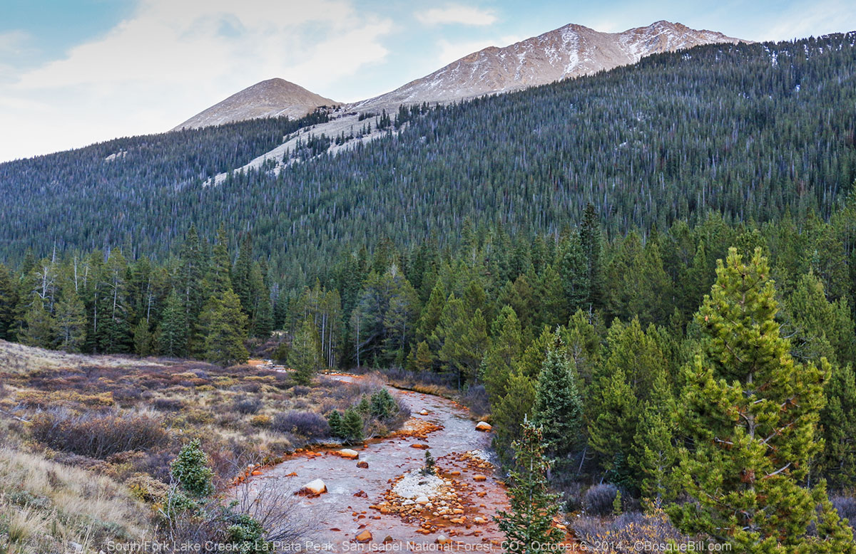 |
| South Fork of Lake Creek with La Plata Peak in the background, a fourteener. |
After about a mile, the road enters a wider valley and is quite lovely. I found a nice camping spot just after the 1.6 miles, according to my odometer, but thought I'd explore just a little farther along. After a bit I came to the sign I was entering San Isabel National Forest, which was closer to two miles from the highway by my reckoning. Nonetheless, within fifty feet was an even better campsite near the creek, under some tall trees, so I backed in to claim it as my own.
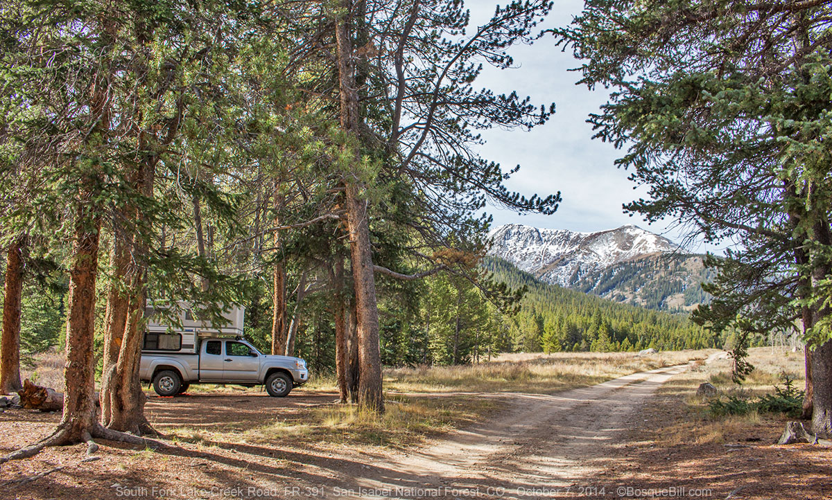 |
| My campsite along South Fork Lake Creek Road |
 |
| This squirrel wasn't real pleased that I camped in his territory, but he allowed me to stay. |
All this time I'd seen no sign of anyone else on the road, but as I maneuvered my truck level, I saw a couple walking down the road toward me. As they got near I said “hello” and asked if they were camping up the road. No, they'd started out to climb La Plata, but never saw the sign for the trailhead. Oh, well, they said that they had a nice walk; they were parked in the lot by the highway. After they continued on, my only companions were the Gray Jays and the squirrel.
Tuesday, October 7th
During the hour or so it took me to break fast and gather myself to pack up, two separate pickup trucks drove past and on up the road. Hunters? Fishermen? Don't know. After breaking camp, I continued up South Fork Lake Creek Road until I came to the junction with FR-381. This is about half as far as the road goes, according to my map, and it forks again farther along. It was interesting to me, too, as the peaks I was seeing ahead were the far sides of those Collegiate Peaks I'd admired and photographed when I was at Taylor Park, earlier this summer. There didn't seem to be any autumn color up that way, however.
 |
| South Fork Lake Creek Road (a uncharacteristically smooth stretch) south of my campsite. |
Twin Lakes - Leadville
I returned to the highway and set off east toward Twin Lakes. As I passed the campgrounds I'd seen on my maps, they were indeed closed. There wasn't much activity at Twin Lakes and the visitor center was closed – another summer destination, I guess. There was not much in the way of aspen, either, though I took a couple of photos.
 |
| Twin Lakes |
When I reached US-24, just past Twin Lakes, I decided to detour north to Leadville as another place I hadn't seen in over 40 years and to visit the ranger station there for a map and information. I stopped for lunch at the Golden Burro Cafe in Leadville. It was not bad, but really not too much to recommend it other than being about the only restaurant open in town.
I had to ask directions to the ranger station, as it had moved to a new facility at the south edge of town. I'd obviously driven by it without noticing. I bought the map for San Isabel National Forest and enquired about various side roads south along US-24 and the prospect for autumn color. I left with ideas, but no set plan.
This concludes Part 2 of this 3 part journey.
No comments:
Post a Comment
Thank you for taking the time to comment. I really appreciate it!