I spent 6 days exploring southeastern Utah. This included two national parks I'd never visited, Canyonlands and Arches. It would also take me back to Muley Point and to discover a few new areas between those destinations.
I will divide the trip into probably three parts to aid digestion.
Muley Point and Johns Canyon Road
Remember to click on a photo to see a larger version or to view them all in a slideshow.
Sunday, May 4, 2014
From central New Mexico I drove up US-550, through Cuba to US-64 West to Farmington. At Shiprock Garmin tried to route me way north then west then south. Took me a while to figure out what was happening. A default preference I'd never changed was to avoid unpaved roads when calculating a route and Moki Dugway is definitely not paved. Once I reset that, it happily directed me on US-160 toward US-191. Then up across the San Juan River and onto Utah State Route 261.
Moki Dugway
Coming up to the shear cliff, you can't see the road cut. Seems impossible the road goes up there, but it does. This is Moki Dugway - dug right into the side of the bluff. It was almost exactly a year ago when I came down this way.
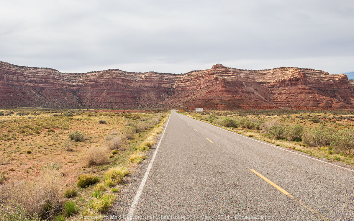 |
| Seems like the highway runs right into the bluff, but somehow finds its way up to the top. |
 |
| Here's the photo from last year of Moki Dugway. |
Muley Point
Turn left at the top, just before the pavement returns, to head out to Muley Point. When I was there last spring admiring the spectacular view, the fellow I was talking to said "actually this isn't the official point, that's farther down the road, but I like this spot much better." So this time I drove to the end of the road. The point is very cool, but he was right. I returned to the area of that first vista and found a fantastic site to set up. My porch was solid sandstone with a view of the San Juan gorge with Monument Valley on the other side. This area is part of Glen Canyon NRA with rules on dispersed camping very similar to those of the BLM. So camping here is free, no facilities what so ever, so pack out your trash.
 |
| Camp set up and my chair on the back porch. |
I was concerned about the wind, being so close to the cliff edge, but the breeze was light to moderate so I didn't worry. There had been high clouds all day, so there was only a small patch of sunset and no stars to view.
 |
| Piñon silhouette in the sunset. |
I settled in for the night. About ten o'clock the wind started up - hard. It was not a gusty wind as I'd experienced in the camper before, but brutal hard staccato bursts. Sailors will understand high rolling waves are not nearly as hard on your boat as a severe chop, and that is what this was. I'd never worried about wind in the camper before, but this was different. At one point I briefly entertained the notion of lowering the roof, but realized if one of the strong gusts caught me in mid-procedure, it could rip the roof right off. Though this went on for hours with me not sleeping, it finally, slowly lessened until it was again only a breeze by dawn. The camper suffered no ill effects from the wind.
Monday, May 5th.
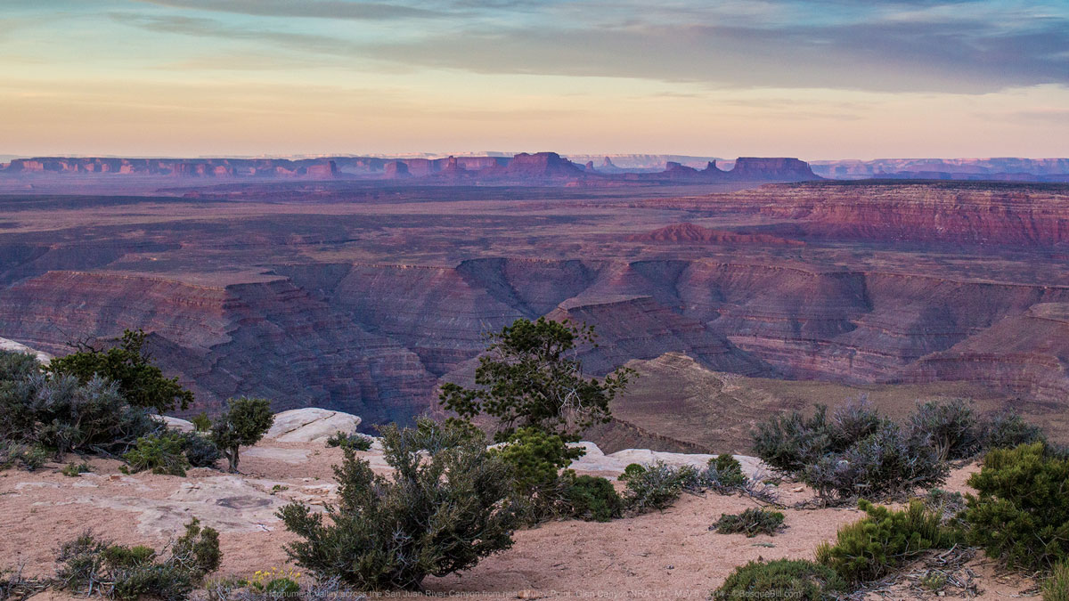 |
| Monument Valley across the San Juan River Canyon |
And what a beautiful view to greet me as I arose. Unfortunately, it was still cloudy, so no sharp morning light to illuminate Monument Valley across the canyon. I took photos anyway and have done my best in Photoshop to try to capture a feel of the view.
 |
| What an amazing camping spot! |
 |
| Tiny flowers growing from the rocky soil. |
 |
| Looking down from the edge of the bluff you can see the Johns Canyon Road along the canyon rim. |
I had seen the road below the bluff last year and the same fellow I mentioned above said he'd driven it the previous day. I asked how it was and he replied that it was fairly easy. That planted the bug. Every time I saw, the more I wanted to drive it.
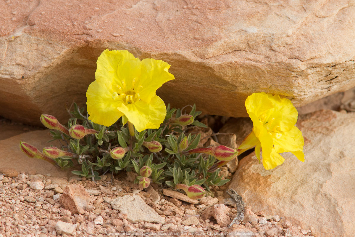 |
| More pretty yellow flowers thriving among the rocks. |
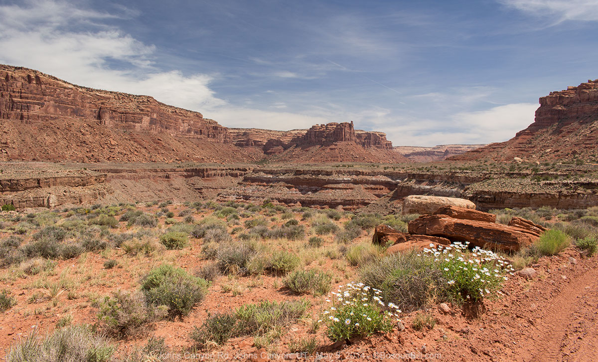
Johns Canyon Road
So, I changed my itinerary. Instead of continuing up SR-261 to check out some ancient ruins on SR-95, I drove back down Moki Dugway to the turnoff to Goose Necks State Park. Within a mile Johns Canyon Road peels off across the prairie toward the bluffs upon which I'd camped the night before.
 |
| Johns Canyon Road headed toward the bluffs. |
Driving up this road really brought home to me the fact that the canyon of the San Juan River and the bluff upon which sits Muley Point are two distinct geological features which happen to coincide. When looking out from the point, you think you are looking across just a canyon, but that is not entirely accurate.
I'll tell the rest of the story of Johns Canyon Road via the captions on the photos.
 |
| The road now approaches the bluff with the canyon just to the left. |
 |
| Looking out of the driver's side window at a branch canyon of the San Juan River. |
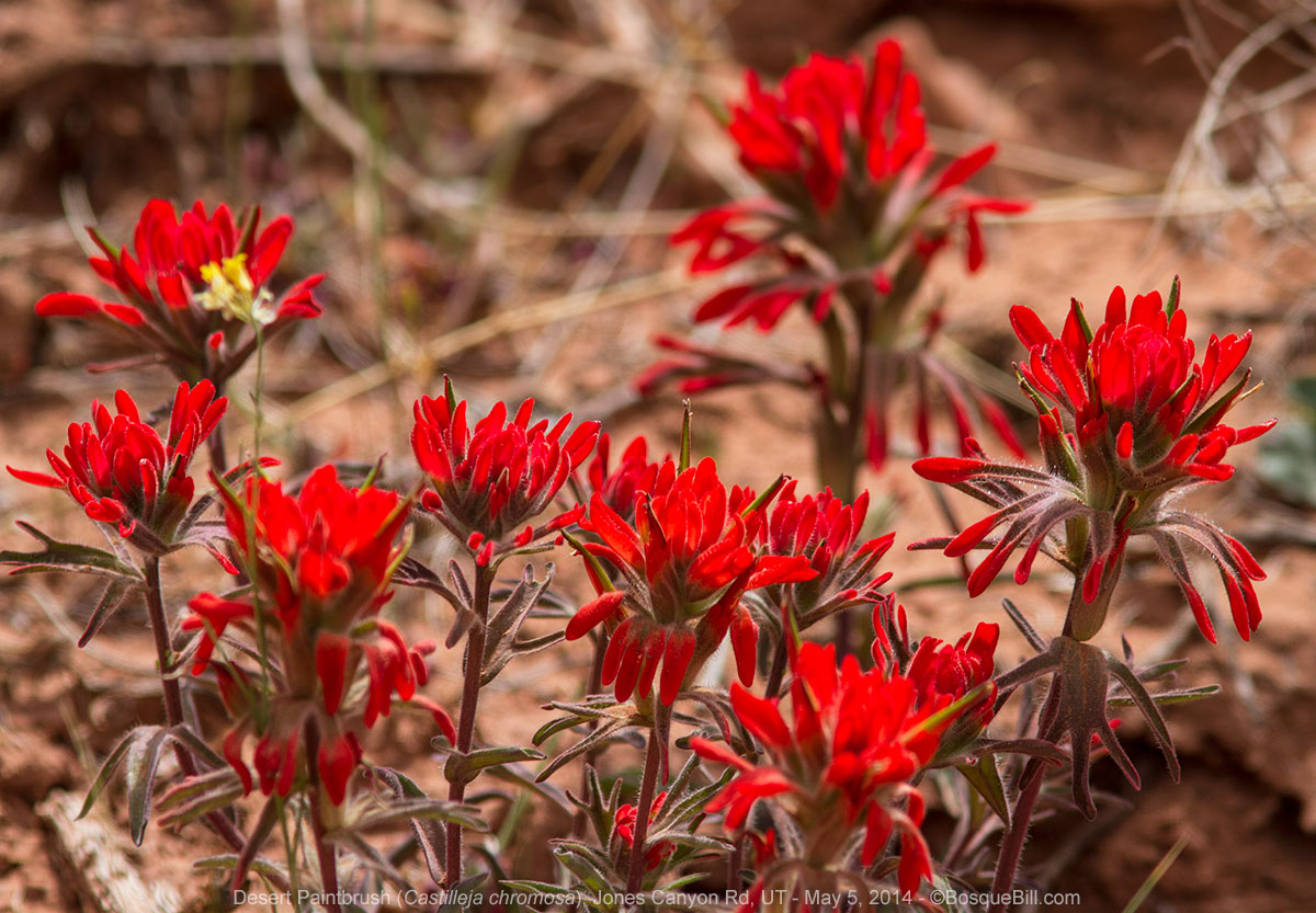 |
| Wildflowers were blooming all along the road. |
 |
| Here you can see the road around a bend of the canyon rim. |
 |
| More flowers with more bluffs across the canyon on the south rim. |
 |
| This is actually the second gate you pass through. Remember to leave gates as you find them. |
 |
To get a feeling of scale: see the rock sitting on the ground, lower center?
That is the same one you can see through the gate in the photo above.
If you look carefully, you can see a full-sized pick-up truck stopped to close the gate in this photo.
Look for it about a quarter of the way from the right edge of the photo.
You may need to enlarge the photo to see the little silver speck. |
 |
| After driving around several points, the road now turns north into Johns Canyon. |
 |
| I needed a fast shutter speed to "freeze" these blossoms in the breeze. |
 |
This is where I turned around after having lunch and taking a walk down the creek.
The road continues farther up Johns Canyon, then south along the other side - for the adventurous. |
 |
| Cactus blooming right in the middle of a Mormon Tea shrub. |
 |
This is the bluff on which I camped the night before.
Do you see the large square boulder exactly in the center of the photo along the bluff edge?
Keep this in mind as you look at the next photo. |
 |
| This is that boulder from the previous photo using my telephoto lens. Notice the two people? |
 |
| I snapped this as I closed the first gate on my way out of the canyon. |
Once out of the canyon and back onto the highway, I drove west on US-191 through Bluff, then north through Blanding to stop at the BLM office in Monticello for information on dispersed camping on BLM lands in the Needles District. I also filled the gas tank before leaving town. FYI, if you ever go up this way, gasoline is much less expensive in Blanding than in Montecello or Moab.
Thus ends Part 1.


Very nice Bill! We are looking forward to your next installments. We can sense your thrill at visiting such a special place. Thank you!
ReplyDeleteSki, thanks for taking the time to comment. Part 2 is now up.
DeleteThanks for sharing your photos and story...very nice. It's inspiring to those of us who cannot get there....yet!
ReplyDeleteThanks for your comment, Jim. Lots of interesting places around there and I feel like I've only scratched the surface.
DeleteHeaded to there next week, been there many times but like you I have never done Johns Cny. Also never camped at Muley point and going to do this time to. Pray to the wind gods for no wind, want to be there for the full moon. Can't think of a better campsite with a full moon...
ReplyDeleteThanks for leaving a comment, Tuna. I hope you have great weather and fun explorations!
ReplyDelete